Newton Abbot
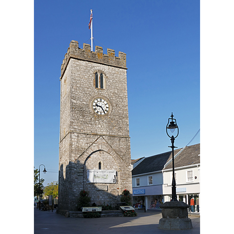
Image copyright © Alan Hunt, 2015
CC-BY-SA-2.0
Results: 2 records
view of church exterior - tower - east side
Scene Description: Source caption: "The former tower of St Leonard's Chapel now stands alone after the chapel was demolished in 1836. On 5th November 1688 the first proclamation declaring William of Orange king was made by the Reverend John Raynall from the pedestal with the lamp post on it." -- the east wall of the tower still shows the contour of the 15thC(?) nave on it.
Copyright Statement: Image copyright © Alan Hunt, 2015
Image Source: edited detail of a digital photograph taken 2 October 2015 by Alan Hunt [www.geograph.org.uk/photo/4687584] [accessed 13 August 2019]
Copyright Instructions: CC-BY-SA-2.0
view of church exterior - tower - west side
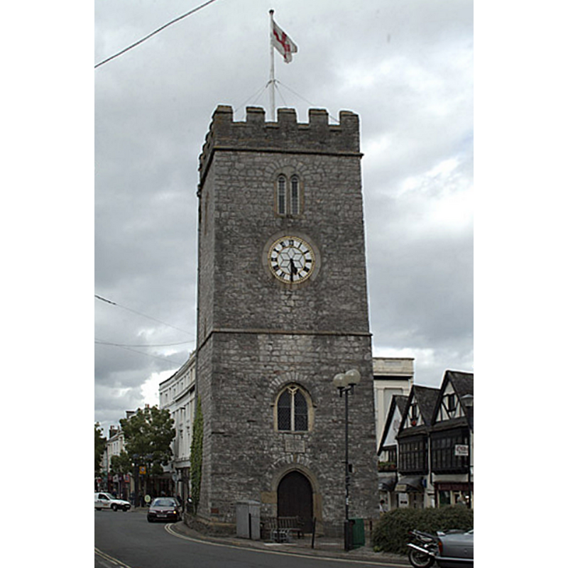
Scene Description: Source caption: "St Leonards Tower, Newton Abbot. This local landmark dates back to the Cromwell era when William of Orange arrived in South Devon."
Copyright Statement: Image copyright © Mike Crowe, 2005
Image Source: edited detail of a digital photograph taken 4 June 2005 by Mike Crowe [www.geograph.org.uk/photo/15316] [accessed 13 August 2019[
Copyright Instructions: CC-BY-SA-2.0
INFORMATION
Font ID: 14275NEW
Object Type: Baptismal Font1?
Font Century and Period/Style: 12th century / 15th century, Medieval
Church / Chapel Name: Parish Church of St. Leonard
Font Location in Church: [cf. FontNotes]
Church Patron Saint(s): St. Leonard
Church Address: 19A Bank St, Newton Abbot TQ12 2JL, UK
Site Location: Devon, South West, England, United Kingdom
Directions to Site: Located off (S) the A382-B3195 confluence, 10-12 km NNW of Torquay
Ecclesiastic Region: Diocese of Exeter
Additional Comments: e-mailed the clerk of the Benefice at Wolborough to see if they can help (4 March 2009] [no reply] -- disappeared font? (the one from the early-13thC and 15thC church here)
Font Notes:
Click to view
No individual entry for Newton Abbot found in the Domesday survey. The entry for Newton Abbot in Murray's Handbook for travellers […] (1865) notes: "The font, of Norman date, has a bowl of a fine red gritstone (Roborough stone), boldly and most effectively ornamented." [NB: it is not clear which font Murray was referring to, as the original church of St. Leonard is reported to have been demolished in 1836 [cf. Pevsner (1952: 211). There is a Norman font at Wolborough St. Mary's [cf. Index entry], which now serves south and west Newton Abbot areas [cf. www.ogwol.org.uk/stmary.htm [accessed 4 March 2009] -- to be resolved]. The entry for the remaining tower of St Leonard's in Historic England [Listing NGR: SX8579871202] notes: "Tower of a C15 church of which the rest was demolished in 1836 [...] The north-east side bears traces of the roof line of the former nave". [NB: the original church is said to date to the early-13th century, first documented 1350]. The entry for this church in Historic England [Listing NGR: SX8568271128] describes what sounds like a Perpendicular font in it: "The south chapel has an octagonal font with quatrefoil panels to the top, trefoil-headed panels to the shaft and rounded moulding to the base."
COORDINATES
UTM: 30U 456553 5597718
Latitude & Longitude (Decimal): 50.5298, -3.613
Latitude & Longitude (DMS): 50° 31′ 47.28″ N, 3° 36′ 46.8″ W
MEDIUM AND MEASUREMENTS
Material: stone, gritstone (Roborough stone)
REFERENCES
- Murray, John, A handbook for travellers in Devon and Cornwall, London: John Murray, 1865, p. 58 / [http://books.google.ca/books?id=V_YGAAAAQAAJ&pg=PA58&lpg=PA58&dq=%22roborough+stone%22&source=bl&ots=2ZhOkO8ZIn&sig=RriwKcw-zwLPfFdGUaHE7WccPgU&hl=en&ei=QRWkSZHXMYjTnQe2ud2pBQ&sa=X&oi=book_result&resnum=7&ct=result#PPR5,M1] [accessed 24 February 2009]