Montacute
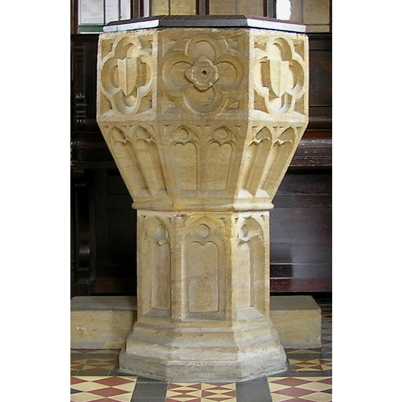
Image copyright © Tony Ethridge, 2009
Standing permission
Results: 9 records
view of font and cover
Copyright Statement: Image copyright © Tony Ethridge, 2009
Image Source: detail of a digital photograph taken 8 March 2007 by Tony Ethridge
Copyright Instructions: Standing permission
symbol - shield - blank - in a quatrefoil
Scene Description: several -- [cf. Font notes]
Copyright Statement: Image copyright © Tony Ethridge, 2009
Image Source: detail of a digital photograph taken 8 March 2007 by Tony Ethridge
Copyright Instructions: Standing permission
design element - motifs - floral - in a quatrefoil
Scene Description: [cf. Font notes]
Copyright Statement: Image copyright © Tony Ethridge, 2009
Image Source: detail of a digital photograph taken 8 March 2007 by Tony Ethridge
Copyright Instructions: Standing permission
design element - architectural - window - trefoiled - 16
Scene Description: [cf. Font notes]
Copyright Statement: Image copyright © Tony Ethridge, 2009
Image Source: detail of a digital photograph taken 8 March 2007 by Tony Ethridge
Copyright Instructions: Standing permission
design element - architectural - arch or window - trefoiled - 8
Scene Description: [cf. Font notes]
Copyright Statement: Image copyright © Tony Ethridge, 2009
Image Source: detail of a digital photograph taken 8 March 2007 by Tony Ethridge
Copyright Instructions: Standing permission
view of church exterior - south view
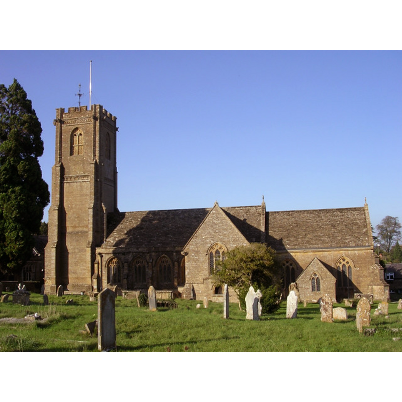
Scene Description: Source caption: "The parish church in Montacute began as a Norman chapel in the churchyard of the Cluniac priory. It still has a Norman chancel arch, though the church was enlarged later in the Middle Ages and almost entirely rebuilt in Victorian times. Within are the tombs of the Phelips family, owners of Montacute House."
Copyright Statement: Image copyright © Jim Champion, 2005
Image Source: digital photograph taken 27 October 2005 by Jim Champion [www.geograph.org.uk/photo/71112] [accessed 12 February 2018]
Copyright Instructions: CC-BY-SA-2.0
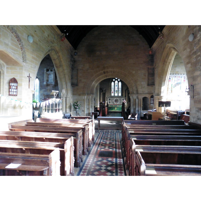
view of church interior - nave - looking east
Copyright Statement: Image copyright © Roger Confort, 2017
Image Source: digital photograph taken 1 November 2017 by Roger Cornfoot [www.geograph.org.uk/photo/5587720] [accessed 12 February 2018]
Copyright Instructions: CC-BY-SA-2.0
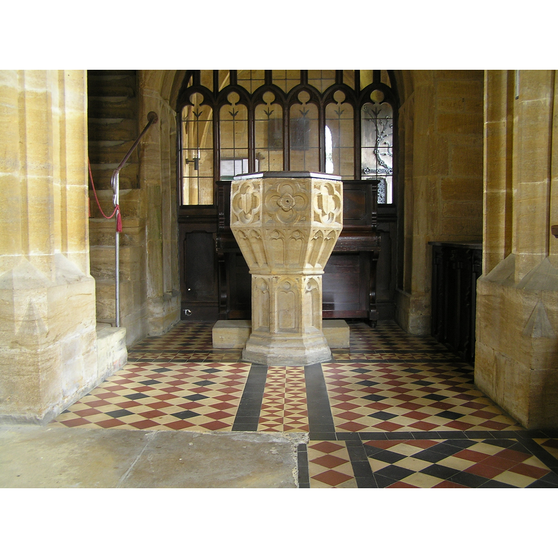
view of font and cover in context
Copyright Statement: Image copyright © Tony Ethridge, 2009
Image Source: digital photograph taken 8 March 2007 by Tony Ethridge
Copyright Instructions: Standing permission
design element - motifs - moulding
Scene Description: [cf. Font notes]
Copyright Statement: Image copyright © Tony Ethridge, 2009
Image Source: detail of a digital photograph taken 8 March 2007 by Tony Ethridge
Copyright Instructions: Standing permission
INFORMATION
Font ID: 14257MON
Object Type: Baptismal Font1
Font Century and Period/Style: 15th century, Perpendicular
Church / Chapel Name: Parish Church of St. Catherine
Font Location in Church: Inside the church
Church Patron Saint(s): St. Catherine of Alexandria [aka Katherine, Katharine]
Church Notes: church here ca. 1100, dedicated to St Peter; chapel dedicated to St Catherine added ca. 1200; Norman chancel arch ca. 1170; church modified 13th, 15th and 19thC
Church Address: Middle St, Montacute TA15 6UZ, UK -- Tel.: +44 1935 822329
Site Location: Somerset, South West, England, United Kingdom
Directions to Site: Located off (SW) the A3088, S of Tintinhull, 6-7 km W of Yeovil
Ecclesiastic Region: Diocese of Bath & Wells
Historical Region: Hundred of Tintinhull
Additional Comments: disappeared font? (the one from the earlier church here)
Font Notes:
Click to view
No individual entry for Montacute found in the Domesday survey. The Handbook for travellers… (1869) notes a font of the Perpendicular period in this church: "The font has a solid stone cover, which is raised by means of a pulley and chain." Described in Pevsner (1958) as Perpendicular. The entry for this church in Historic England [IoE Number: 436778] reports: "font in lobby between porch and transept possibly C15, octagonal with panelled bowl, underbowl and shaft". The web site for the Parish Church of Montacute [https://stcatherinesmontacute.wordpress.com/st-catherines-the-church-building/] [accessed 12 February 2018] notes: "to the south, in the churchyard, is the 15c pulpit base, often mistaken for a font", and describes the font itself: "The 15th century font, similar in design to the redundant pulpit base". The entry for this parish in the Victoria County History (Somerset, vol. 3, 1974) notes: "Exemption from payment of secular dues for ½ hide of land in Montacute in 854 may be an indication that the abbey of Glastonbury, the owners, had established a church there. [...] No church is mentioned in Domesday, though the later story of the Invention of the Holy Cross refers to a priest and a sexton. [...] A church, dedicated to St. Peter, had certainly been established by c. 1102, when it became the church of the newly-founded Cluniac priory there [...] The monastic church, c. 1155 dedicated to Saint Peter and Saint Paul, [...] is the only one mentioned in a charter no later than 1166 [...] Between 1174 and 1180 a chapel dedicated to St. Catherine in the monks' burial place, was confirmed to the priory [...] It subsequently became the parish church [...] The only recognizable features which survive from the first church, built perhaps c. 1170, are the Norman chancel arch, one of the brackets supporting the present organ loft, and the re-set voussoirs of an enriched arch in the north wall of the nave [...] in 1969 the lobby was used as a baptistry and contained the 15thcentury font." The font consists of an octagonal basin the sides of which are decorated with large quatrefoil panels that inscribe, alternately, blank shields and rosettes; the underbowl chamfer has pairs of trefoil arches or windows; the octagonal stem has single trefoil arches or windows that match those of the underbowl; the lower base is moulded. The cover that is now [March 2007] on the font is a flat octagonal one made of wood.
Credit and Acknowledgements: We are grateful to Tony Ethridge, of Somerset Villages, for his photograph of this font
COORDINATES
UTM: 30U 519825 5644272
Latitude & Longitude (Decimal): 50.949722, -2.717778
Latitude & Longitude (DMS): 50° 56′ 59″ N, 2° 43′ 4″ W
MEDIUM AND MEASUREMENTS
Material: stone
Font Shape: octagonal, mounted
Basin Interior Shape: round
Basin Exterior Shape: octagonal
LID INFORMATION
Material: stone
Apparatus: yes; pulley system
Notes: [cf. FontNotes]
REFERENCES
- Victoria County History [online], University of London, 1993-. URL: https://www.british-history.ac.uk.
- Chevalier, C., "Piscine baptismale à immersion du VIe siècle à Civray-sur-Cher", XIII (1860), Mémoires de la Société Archéologique de Touraine, 1860, pp. 217-225; p. 244
- Murray, John, A handbook for travellers in Wiltshire, Dorsetshire, and Somersetshire, London: John Murray, 1869, p. 379