Chislehampton nr. Oxford / Chiselhampton
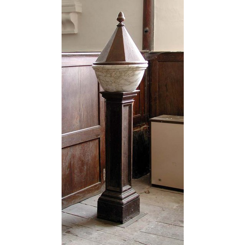
Image copyright © John Salmon, 2004
CC-BY-SA-3.0
Results: 5 records
view of font and cover
Scene Description: the modern font and cover inside the modern church
Copyright Statement: Image copyright © John Salmon, 2004
Image Source: digital photograph taken 12 June 2004 by John Salmon [www.geograph.org.uk/photo/1623899] [accessed 30 October 2013]
Copyright Instructions: CC-BY-SA-3.0
view of church exterior - southeast view
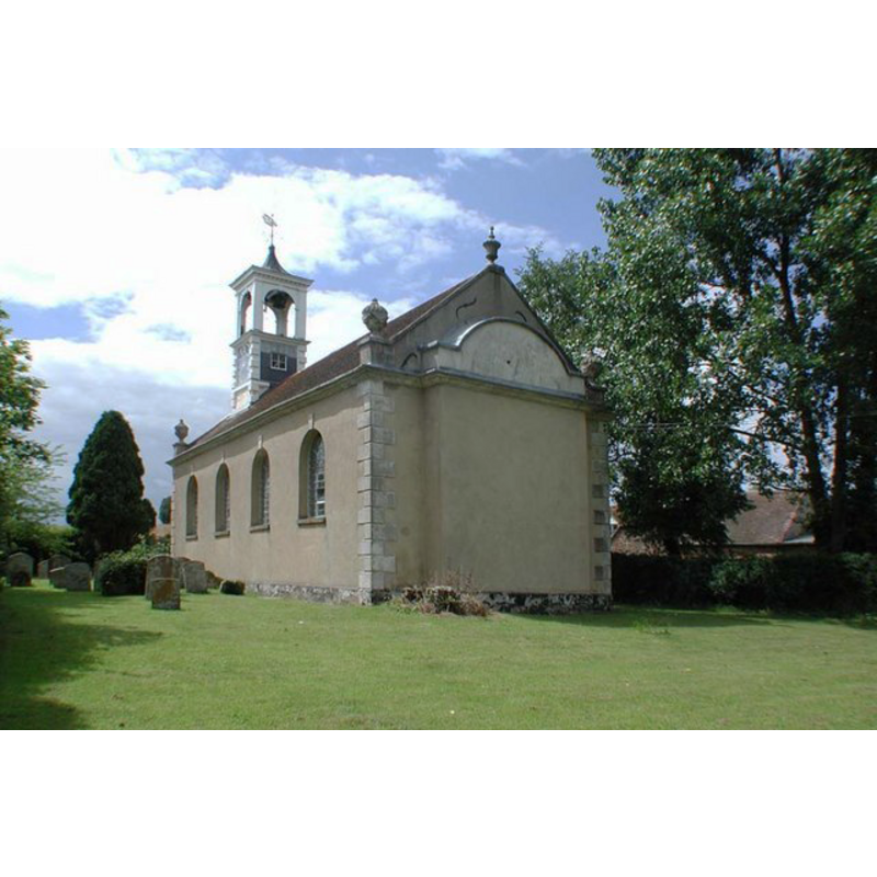
Scene Description: the modern church
Copyright Statement: Image copyright © John Salmon, 2004
Image Source: digital photograph taken 12 June 2004 by John Salmon [www.geograph.org.uk/photo/1623894] [accessed 30 October 2013]
Copyright Instructions: CC-BY-SA-3.0
view of church exterior - west end
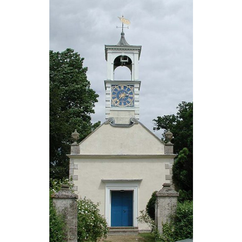
Scene Description: the modern church
Copyright Statement: Image copyright © John Salmon, 2004
Image Source: digital photograph taken 12 June 2004 by John Salmon [www.geograph.org.uk/photo/1623893] [accessed 30 October 2013]
Copyright Instructions: CC-BY-SA-3.0
view of church interior - nave - looking east
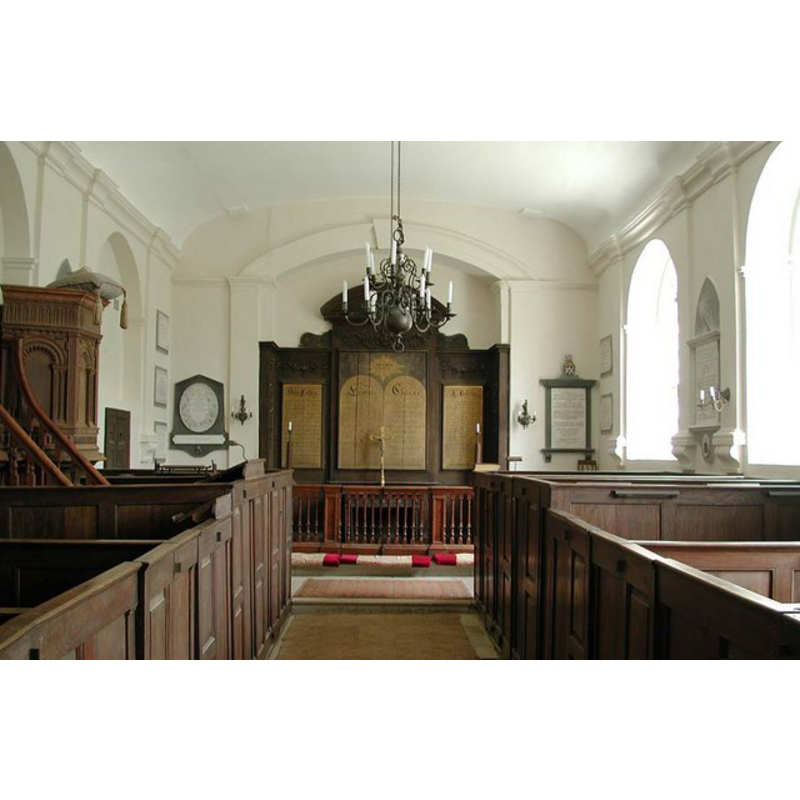
Scene Description: the modern church
Copyright Statement: Image copyright © John Salmon, 2004
Image Source: digital photograph taken 12 June 2004 by John Salmon [www.geograph.org.uk/photo/1623896] [accessed 30 October 2013]
Copyright Instructions: CC-BY-SA-3.0
view of church interior - plan

Scene Description: showing the location of the modern the font in the 18th-century church
Copyright Statement: Image copyright © University of London & History of Parliament Trust, 2008
Image Source: plan [www.british-history.ac.uk/report.aspx?compid=63764] [accessed 17 January 2009]
Copyright Instructions: PERMISSION NOT AVAILABLE -- IMAGE NOT FOR PUBLIC USE
INFORMATION
Font ID: 14210CHI
Object Type: Baptismal Font1
Font Date: ca. 1146?
Font Century and Period/Style: 12th century (mid?), Late Norman
Church / Chapel Name: Parish Church of St. Katherine [medieval: Chapel of St. Mary]
Font Location in Church: [cf. FontNotes]
Church Patron Saint(s): St. Catherine of Alexandria [aka Katherine] [medieval chapel dedicated to St. Mary]
Church Notes: originally (?) a medieval chapelry of Dorchester, confirmed 1146 -- Chiselhampton St Katherine is a tiny Georgian church now cared for by the Churches Conservation Trust
Church Address: Chislehampton, Oxford, Oxfordshire, OX44 7XF, UK
Site Location: Oxfordshire, South East, England, United Kingdom
Directions to Site: Located 9 km SE of Oxford
Ecclesiastic Region: Diocese of Oxford
Historical Region: Hundred of Dorchester
Additional Comments: disappeared font? from the medieval church?
Font Notes:
Click to view
There is no individual entry for Chislehampton in the Domesday survey [http://opendomesday.org/place/SU5999/chislehampton/] [accessed 25 October 2017]. The Victoria County History (Oxford, vol. 7, 1962) notes: "Chislehampton church in the Middle Ages was a chapelry of Dorchester [...] The present church at Chislehampton, dedicated to St. Katherine, is a small 18th-century structure of stone [...] The new building replaced a medieval chapel dedicated to St. Mary, which was first mentioned in 1146 [...] Seventeenth-century presentments (1623–1706) record that the chapel was in a good state of repair, [...] but in 1763 when Peers petitioned the peculiar court of Dorchester for permission to pull it down he described it as being in 'so ruinous and decayed a condition that the inhabitants cannot assemble for worship without manifest hazard (to) their lives.' [...] The new church was erected out of the old materials about 200 yards west of the original church and had a churchyard attached; previously burials had taken place at Stadhampton. (fn. 241) It was consecrated by the Bishop of Oxford in 1763 [...] The font is contemporary with the church building and a space on the opposite side of the aisle has been left where the christening party might stand." [NB: we have no information on a possible font in the medieval chapel]. Noted in Sherwood & Pevsner (1974): "Very rustic font; a plain marble pudding basin on a wooden base".
COORDINATES
UTM: 30U 628232 5728076
Latitude & Longitude (Decimal): 51.688982, -1.144856
Latitude & Longitude (DMS): 51° 41′ 20.33″ N, 1° 8′ 41.48″ W
REFERENCES
- Victoria County History [online], University of London, 1993-. URL: https://www.british-history.ac.uk.
- Pevsner, Nikolaus, Oxfordshire, Harmondsworth: Penguin Books, 1974, p. 542