Bix / Bix Brand
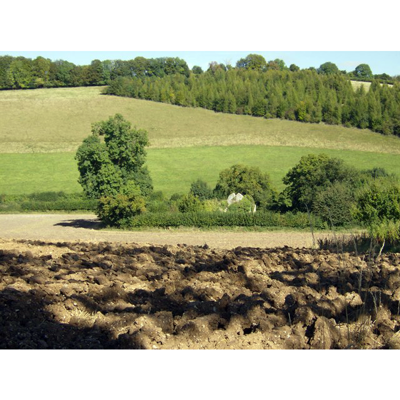
Image copyright © Graham Horn, 2007
CC-BY-SA-2.0
Results: 3 records
view of church exterior in context
Scene Description: Source caption: "St James Church, Bix Bottom. Seen in its context. The former parish church now lies in ruins in isolation, surrounded by its churchyard but with a variety of fields and farming types surrounding it."
Copyright Statement: Image copyright © Graham Horn, 2007
Image Source: digital photograph taken 15 September 2007 by Graham Horn [www.geograph.org.uk/photo/557775] [accessed 10 January 2018]
Copyright Instructions: CC-BY-SA-2.0
view of church exterior
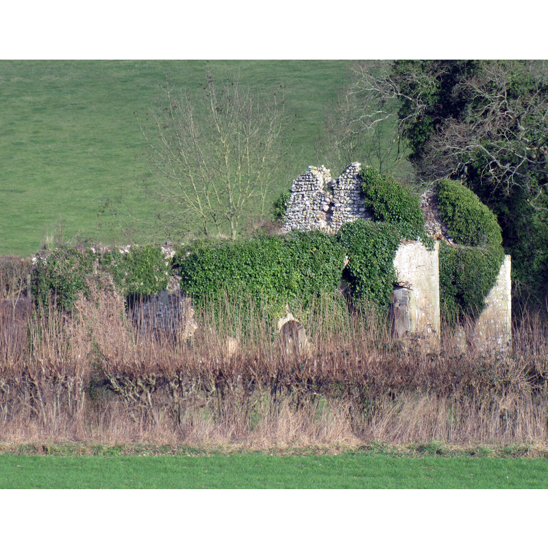
Scene Description: at the time the ruins were not safe and totally over-run by vegetation
Copyright Statement: Image copyright © UKgeofan, 2012
Image Source: digital photograph taken 15 January 2012 by UKgeofan [https://commons.wikimedia.org/wiki/File:Bix_Old_Church.JPG] [accessed 10 January 2018]
Copyright Instructions: CC-BY-SA-3.0
view of church exterior - northeast view
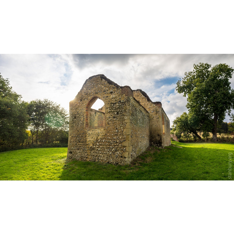
Scene Description: Source caption: "Bix Old Church. Bix Bottom, near Nettlebed; formerly St James; abandoned in the late C19. The restoration and making-safe work has been completed in the last couple of years."
Copyright Statement: Image copyright © Howard Stanbury, 2016
Image Source: digital photograph taken 23 October 2016 by Howard Stanbury [www.flickr.com/photos/stanbury/29891670693] [accessed 10 January 2018]
Copyright Instructions: CC-BY-SA-3.0
INFORMATION
Font ID: 14202BIX
Object Type: Baptismal Font1
Font Century and Period/Style: 12th century, Late Norman
Church / Chapel Name: Parish Church of St. James [old church now in ruins]
Font Location in Church: [cf. FontNotes]
Church Patron Saint(s): St. James
Church Address: Old Church ruins, Bix, Oxfordshire, UK
Site Location: Oxfordshire, South East, England, United Kingdom
Directions to Site: Located off the A4130, NW of Henley-on-Thame. The old church is in a field, about 1.5 km N of the new church
Ecclesiastic Region: Diocese of Oxford
Historical Region: Hundred of Binfield
Additional Comments: disused font / abandoned font / damaged font
Font Notes:
Click to view
There are two entries for Bix [variant spelling] in the Domesday survey [http://opendomesday.org/place/SU7285/bix/] [accessed 10 January 2018], neither of which mentions priest or church in it. A paper by E.A. Greening Lamborn (1936) [http://oxoniensia.org/volumes/1936/lamborn.pdf] [accessed 10 January 2018] notes: "The desecrated church of St. James, Bix Brand [...], lies isolated in a combe [,,,] The church was unroofed and abandoned in 1875. The tiles and font and some pieces of early sixteenth century glass, with the registers1, and a memorial tablet to the Rev. Henry Heathcote, B.D., twenty years rector, who died in September, 1822, were removed to the new church [...] The font from the old church lies derelict in the new churchyard. It is of the tub-shaped Norman form, and has lost its lead and its rim." Sherwood & Pevsner (1974) mention both churches but not the font. The Victoria County History (Oxon., vol. 16, 2011) notes: "The now-ruined church of Bix Brand is a two-cell Romanesque structure with late medieval alterations and later rebuilding [...] The date of initial construction is difficult to determine, but the character of the masonry and other features make the early 12th century seem most likely [...] By 2006 it was in very poor repair [...] Only two grave slabs were left in the churchyard, which had formerly been used as an animal pen." [NB: the new church, at Bix Common, is 19th-century].
COORDINATES
UTM: 30U 641814 5715974
Latitude & Longitude (Decimal): 51.57697, -0.9534
Latitude & Longitude (DMS): 51° 34′ 37.09″ N, 0° 57′ 12.24″ W
MEDIUM AND MEASUREMENTS
Material: stone
Font Shape: tub-shaped
Basin Interior Shape: round
Basin Exterior Shape: round
REFERENCES
- Victoria County History [online], University of London, 1993-. URL: https://www.british-history.ac.uk.
- Lamborn, Edward Arnold Greening, "The churches of Bix", [s.d.]