Southam nr. Cheltenham / Surham
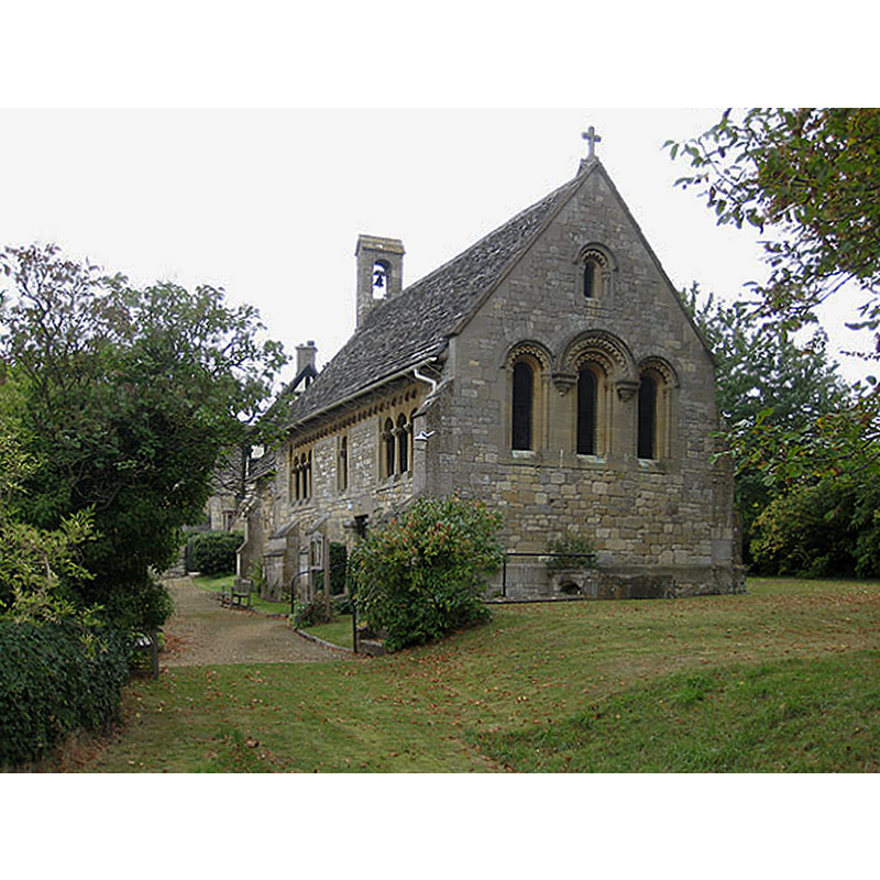
Image copyright © Pauline E, 2009
CC-BY-SA-2.0
Results: 1 records
view of church exterior - southeast view
Scene Description: Source caption: "Church of the Ascension, Southam. A fine Norman church which was disused following the Reformation in 1536-39. It was restored in the early 1860s. There is neither tower nor spire, just a simple bellcote with single bell. There are remains of a monastery nearby."
Copyright Statement: Image copyright © Pauline E, 2009
Image Source: digital photograph taken 28 september 2009 by Pauline E [www.geograph.org.uk/photo/1508456] [accessed 9 February 2015]
Copyright Instructions: CC-BY-SA-2.0
INFORMATION
Font ID: 14191SOU
Object Type: Baptismal Font1?
Font Century and Period/Style: 11th century, Pre-Conquest? / Norman
Church / Chapel Name: Parish Church of the Ascension
Font Location in Church: [cf. FontNotes]
Church Patron Saint(s): Jesus Christ
Church Address: 20 Ratcliff Lawns, Southam, Gloucestershire GL52 3PB, UK
Site Location: Gloucestershire, South West, England, United Kingdom
Directions to Site: Located 5 km NE of Cheltenham
Ecclesiastic Region: Diocese of Gloucester
Historical Region: Hundred of Tibblestone [in Domesday]
Additional Comments: disappeared font? (the one of the Domesday-time church here)
Font Notes:
Click to view
There is an entry for this Southam [variant spelling] in Folio 165r of the Domesday survey [http://domesdaymap.co.uk/place/SO9725/southam/] [accessed 9 February 2015]; it mentions a priest among several of the lords of this place in 1086, and reports church lands as well without the specific mention of a church in it, though there probably was one there. English Heritage [Listing NGR: SO9701925579] (1987) reports: "Anglican chapel. C12, restored mid-late C19 in neo-Norman style by Edward Earl of Ellenborough 1861 in memory of his first wife Octavia, died 1819. The early church appears to have been of rubble construction with large squared and dressed quoins, Cl9 rebuilding on coursed squared and dressed limestone. [...] Octagonal white marble font with ornate lotus flower decoration in relief". [NB: we have no information on the font of the Domesday-time church here].
COORDINATES
UTM: 30U 565163 5753455
Latitude & Longitude (Decimal): 51.928004, -2.052308
Latitude & Longitude (DMS): 51° 55′ 40.81″ N, 2° 3′ 8.31″ W