Redmarley d'Abitot / Hrydmearlea / Redmarlega / Redmarley d'Abitôt / Redmerley Dapetot / Reode moere leage / Ridmarlege / Ridmerlege / Ridmerleye / Rudmerleg / Ryde mereleage / Rydmarly / Rydmer lege

Image copyright © John Wilkes, 2009
Standing permission
Results: 3 records
view of font and cover
Scene Description: the modern font
Copyright Statement: Image copyright © John Wilkes, 2009
Image Source: digital photograph by John Wilkes [www.allthecotswolds.com]
Copyright Instructions: Standing permission
view of church exterior - south view
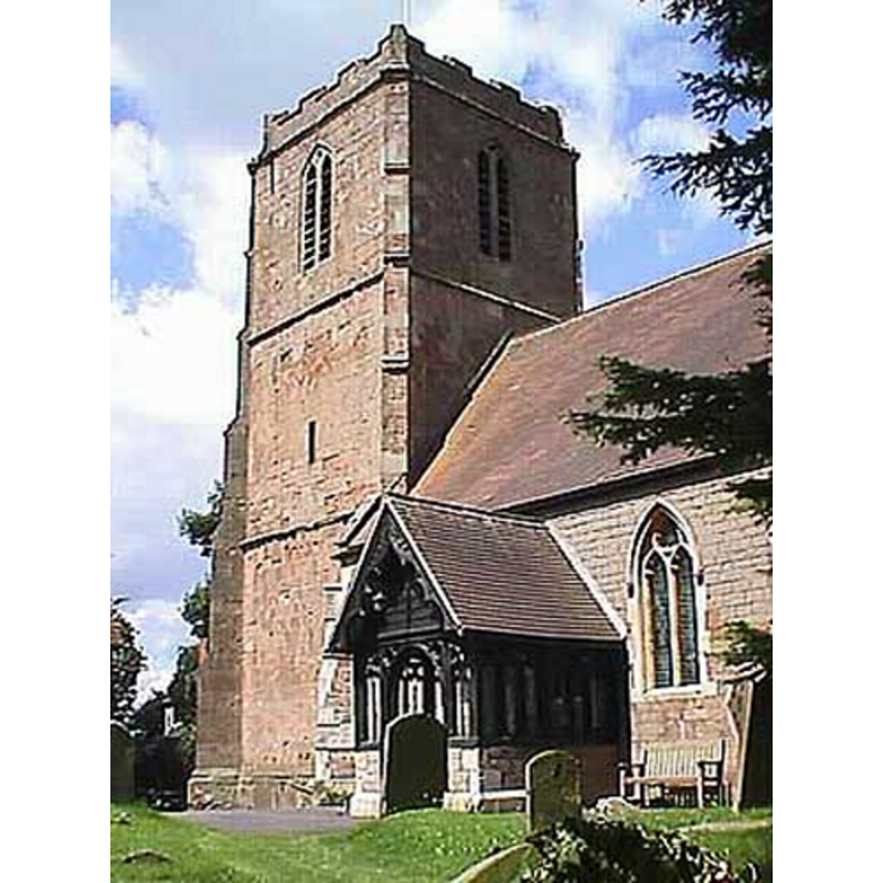
Copyright Statement: Image copyright © John Wilkes, 2009
Image Source: digital photograph by John Wilkes [www.allthecotswolds.com]
Copyright Instructions: Standing permission
view of church interior - nave - looking east
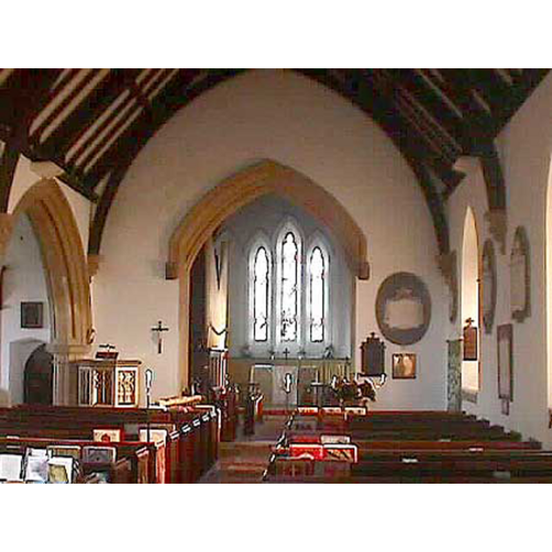
Copyright Statement: Image copyright © John Wilkes, 2009
Image Source: digital photograph by John Wilkes [www.allthecotswolds.com]
Copyright Instructions: Standing permission
INFORMATION
Font ID: 14190RED
Object Type: Baptismal Font1?
Font Century and Period/Style: 13th century (late?), Medieval
Church / Chapel Name: Parish Church of St. Bartholomew
Church Patron Saint(s): St. Bartholomew
Church Address: The Causeway, Redmarley d'Abitot, Gloucestershire, GL19 3HS, UK
Site Location: Gloucestershire, South West, England, United Kingdom
Directions to Site: Located in the SW-most part of the county, bordering with Worcester [of which county it was part until 1931]
Ecclesiastic Region: Diocese of Gloucester
Historical Region: Hundred of Oswalslow -- formerly in Worcestershire
Additional Comments: disappeared font?
Font Notes:
Click to view
There is an entry for Redmarley [d'Abitot] [variant spelling] in the Domesday survey [http://domesdaymap.co.uk/place/SO7531/redmarley-dabitot/] [accessed 29 September 2014]; it mentions neither cleric nor church in it. Miller (1890) writes: "The church was rebuilt, excepting the tower, 1855 [...] the font is modern", and gives "Ade de Hernwynton ... 1305" as the first recorded rector of the old church. The Victoria County History (Gloucester, vol. 3, 1913) notes: "The first mention of the church of Redmarley occurs in 1290, when the Bishop of Worcester dedicated three altars there. [...] The timber south porch and the octagonal stone font are both modern"; the VCH (ibid.) further notes that the baptismal register starts in 1542. English Heritage [Listing NGR: SO7522731302] (1954) reports an "Octagonal stone font with blind tracery, on stem". Noted in Verey & Brooks (1999-2002): "By Niblett the octagonal stone font" [i.e., Francis Niblett, responsible for the 1855-18856 renovation of this church]. [NB: we have no information on the original font from the medieval church]
Credit and Acknowledgements: We are grateful to John Wilkes, of www.allthecotswolds.com, for his photographs of church and modern font
COORDINATES
UTM: 30U 543826 5758932
Latitude & Longitude (Decimal): 51.979336, -2.361901
Latitude & Longitude (DMS): 51° 58′ 45.61″ N, 2° 21′ 42.85″ W
REFERENCES
- Victoria County History [online], University of London, 1993-. URL: https://www.british-history.ac.uk.
- Miller, George [Revd.], The Parishes of the Diocese of Worcester, Birmingham: Hall & English, 1890, vol. 2: 129-130
- Verey, David, Gloucestershire, London: Penguin Books, 1999-2002, vol. 2: 650