Newland nr. Monmouth
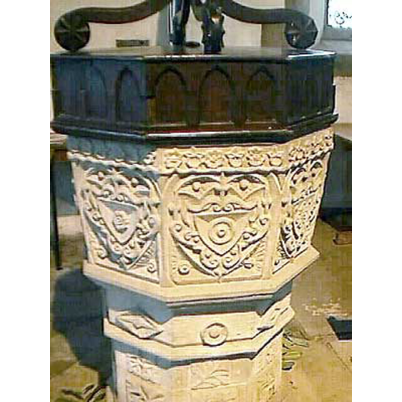
Image copyright © John Wilkes, 2009
Standing permission
Results: 3 records
view of font and cover
Scene Description: the 1661 font
Copyright Statement: Image copyright © John Wilkes, 2009
Image Source: digital photograph by John Wilkes [www.allthecotswolds.com]
Copyright Instructions: Standing permission
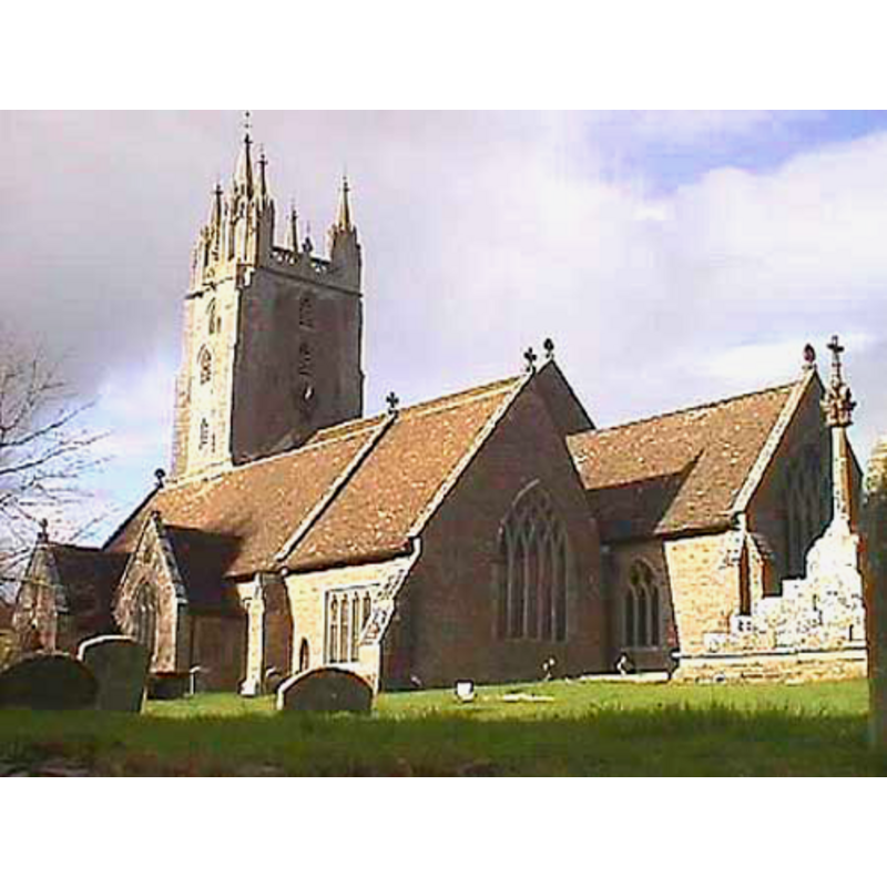
view of church exterior - southeast view
Copyright Statement: Image copyright © John Wilkes, 2009
Image Source: digital photograph by John Wilkes [www.allthecotswolds.com]
Copyright Instructions: Standing permission
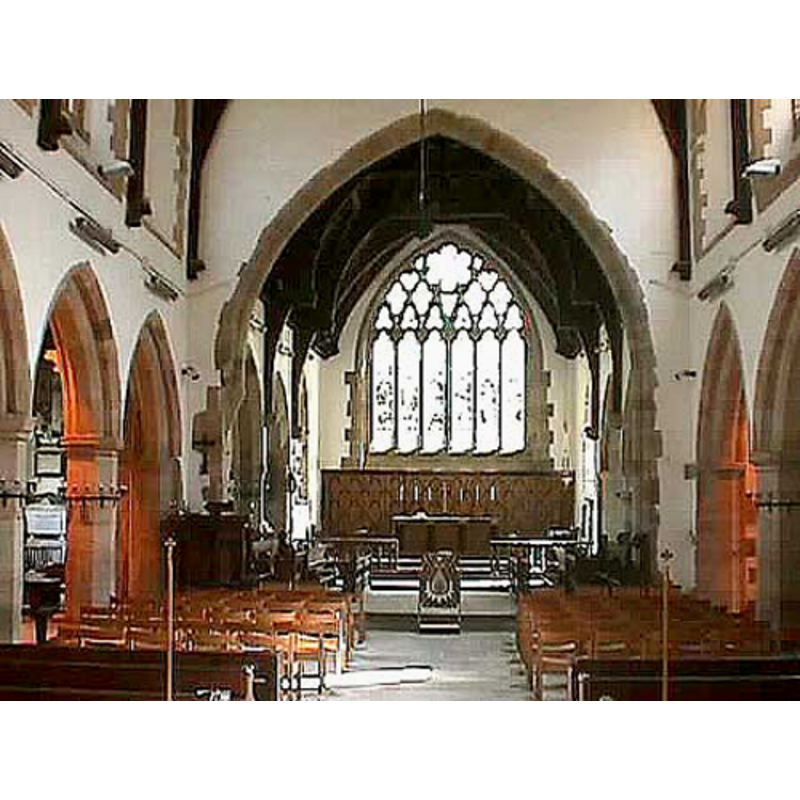
view of church interior - nave - looking east
Copyright Statement: Image copyright © John Wilkes, 2009
Image Source: digital photograph by John Wilkes [www.allthecotswolds.com]
Copyright Instructions: Standing permission
INFORMATION
Font ID: 14185NEW
Object Type: Baptismal Font1
Font Date: 1661
Font Century and Period/Style: 17th century(mid), Stuart
Workshop/Group/Artisan: heraldic font
Church / Chapel Name: Parish Church of All Saints [new church]
Font Location in Church: Inside the church
Church Patron Saint(s): All Saints
Church Notes: church originaly founded here ca. 1215
Church Address: Almshouse Road, Newland, Gloucestershire, GL16 8NL, UK
Site Location: Gloucestershire, South West, England, United Kingdom
Directions to Site: Located 6 km SE of Monmouth, in the Forest of Dean
Ecclesiastic Region: Diocese of Gloucester
Historical Region: hundred of Bledsloe and Hundred of St. Briavels
Additional Comments: disappeared font? (the one from the early-13thC church here)
Font Notes:
Click to view
No individual entry for this Newland found in the Domesday survey. Miller (1890) reports this as "a chapelty of Great Malvern. The old church, a timber building of considerable interest, was taken down in 1864, when the new church and almshouses were built"; no font mentioned in Miller. The entry for this parish in the Victoria County History (Gloucester, vol. 5, 1996) notes: "A new church to serve the assarted lands that became Newland parish was founded shortly before 1216. Robert de Wakering held it as rector in 1219 by appointment of King John and was said to have recently built the church. [...] There are no obvious remains of the original, early 13th-century church [...] The font is dated 1661 and has an octagonal bowl and base of stone, its panels decorated with shields and other devices in a rustic style." A font here is noted in Verey & Brooks (1999-2002): "Font. Date 1661. Octagonal, with rather naïve local carving, but full of character. Shields in cartouches and, on the shaft, plain leaves and elementary geometrical motifs. Matching cover."
Credit and Acknowledgements: We are grateful to John Wilkes, of www.allthecotswolds.com, for his photographs of church and font
COORDINATES
UTM: 30U 524090 5736690
Latitude & Longitude (Decimal): 51.78056, -2.650796
Latitude & Longitude (DMS): 51° 46′ 50.02″ N, 2° 39′ 2.87″ W
MEDIUM AND MEASUREMENTS
Material: stone
Font Shape: octagonal, mounted
Basin Interior Shape: round
Basin Exterior Shape: octagonal
LID INFORMATION
Date: 17th-century?
Material: wood
Notes: [cf. FontNotes]
REFERENCES
- Victoria County History [online], University of London, 1993-. URL: https://www.british-history.ac.uk.
- Miller, George [Revd.], The Parishes of the Diocese of Worcester, Birmingham: Hall & English, 1890, vol. 2: 315-316
- Verey, David, Gloucestershire, London: Penguin Books, 1999-2002, vol. 2: 609