Moulsford / Moleford / Molesford / Molisford / Mollesford / Moulsford / Muleford / Mulseford

Image copyright © Bill Nicholls, 2015
CC-BY-SA-2.0
Results: 5 records
view of font and cover in context
Scene Description: the modern font; the hanging bell rope on the left shows that the font is located in the tower space
Copyright Statement: Image copyright © Bill Nicholls, 2015
Image Source: digital photograph taken 7 February 2015 by Bill Nicholls [www.geograph.org.uk/photo/4360144] [accessed 4 May 2015]
Copyright Instructions: CC-BY-SA-2.0
view of church exterior - south view
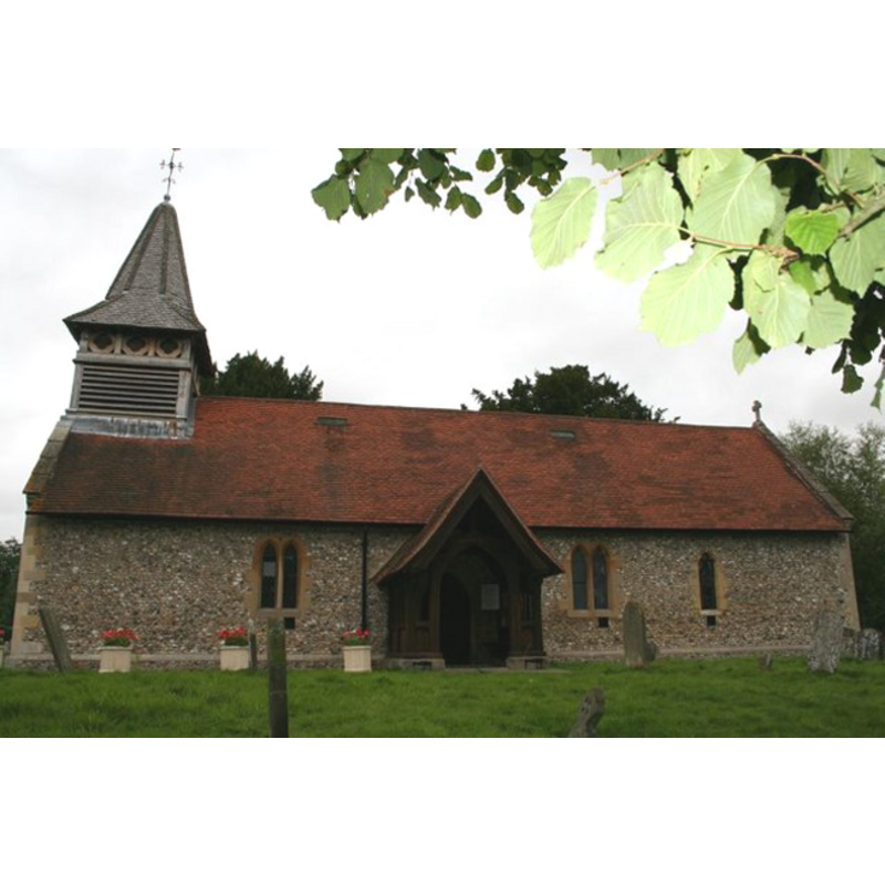
Copyright Statement: Image copyright © Bill Nicholls, 2008
Image Source: digital photograph taken on 25 August 2008 by Bill Nicholls [http://www.geograph.org.uk/search.php?i=4807500] [accessed 4 January 2009]
Copyright Instructions: CC-BY-SA-2.0
view of church exterior - northwest end
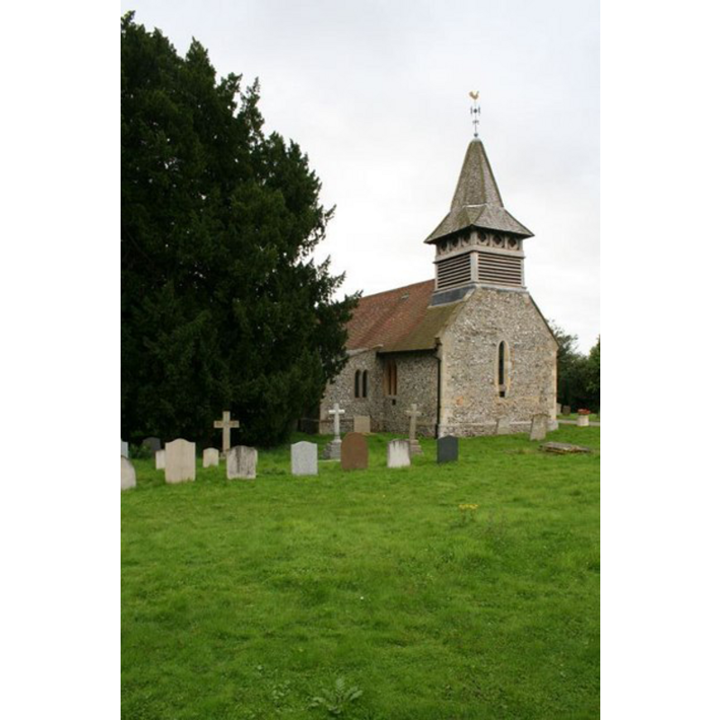
Copyright Statement: Image copyright © Bill Nicholls, 2008
Image Source: digital photograph taken on 25 August 2008 by Bill Nicholls [http://www.geograph.org.uk/search.php?i=4807500] [accessed 4 January 2009]
Copyright Instructions: CC-BY-SA-2.0
view of church interior - nave - looking west
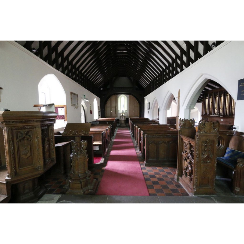
Scene Description: the modern font is visible at the far end
Copyright Statement: Image copyright © Bill Nicholls, 2015
Image Source: digital photograph taken 7 February 2015 by Bill Nicholls [www.geograph.org.uk/photo/4361375] [accessed 4 May 2015]
Copyright Instructions: CC-BY-SA-2.0
view of church interior - nave - looking east
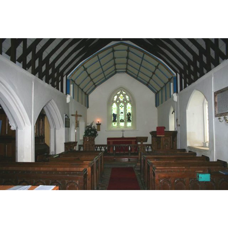
Copyright Statement: Image copyright © Bill Nicholls, 2008
Image Source: digital photograph taken on 25 August 2008 by Bill Nicholls [http://www.geograph.org.uk/search.php?i=4807500] [accessed 4 January 2009]
Copyright Instructions: CC-BY-SA-2.0
INFORMATION
Font ID: 14177MOU
Object Type: Baptismal Font1?
Font Century and Period/Style: 13th - 14th century, Early English? / Decorated?
Church / Chapel Name: Parish Church of St. John the Baptist
Font Location in Church: [cf. FontNotes]
Church Patron Saint(s): St. John the Baptist
Church Address: Reading Road, Moulsford, Oxfordshire OX10 9HU, UK
Site Location: Oxfordshire, South East, England, United Kingdom
Directions to Site: Located on the A329, 5 km NNW of Goring, 6-7 km SSW of Wallingford
Ecclesiastic Region: Diocese of Oxford
Historical Region: formerly in Berkshire -- Hundred of Moreton
Additional Comments: disappeared font? (the present font is modern)
Font Notes:
Click to view
A font here is described in 'Church notes...' (1887) in the context of some "notes [that] were taken between 1835 and 1840": "Font a rude octagonal bowl, resting on two steps, early English or Decorated". The Victoria County History (Berkshire, vol. 3, 1923) informs: "In 1846 the old church was taken down and the present building erected on the old foundations [...] In the west wall is a small lancet window of original 13th-century date", but there is no mention of the font, but the VCH notes that baptisms at the old church are recorded since 1772. [NB: an architectural feasibility study by John Radice, architect, [http://www.radice.org.uk/churches/stjohn.htm -- undated -- accessed 4 January 2009] shows three possible options for renovation, the second of which involves relocating the font -- the modern font is located in the space beneath the tower, curiously, on an existing tombstone]. [NB: we have no information on the whereabouts of the medieval font].
COORDINATES
UTM: 30U 628399 5712985
Latitude & Longitude (Decimal): 51.553323, -1.147979
Latitude & Longitude (DMS): 51° 33′ 11.96″ N, 1° 8′ 52.72″ W
MEDIUM AND MEASUREMENTS
Material: stone
Font Shape: octagonal, mounted
Basin Interior Shape: round
Basin Exterior Shape: octagonal
REFERENCES
- "Church notes, chiefly in Berks, Wilts, and Oxford, with a few in Somerset and Gloucestershire", 44, Archaeological Journal, 1887, pp. 43-50; 185-193; 291-303; 397-402; p. 299
- Victoria County History [online], University of London, 1993-. URL: https://www.british-history.ac.uk.