Lillingstone Dayrell / Lelinchestane / Lillingeston Parva / Lillingston Dayerel / Lullingestan / Lyllingstan
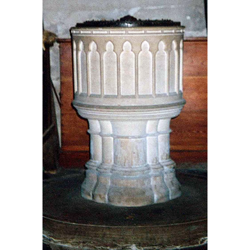
Image copyright © Cliff & Monica Robinson, 2016
No known copyright restriction / Fair Dealing
Results: 3 records
view of font and cover
Scene Description: the modern font [cf. FontNotes]
Copyright Statement: Image copyright © Cliff & Monica Robinson, 2016
Image Source: digital photograph taken by Cliff & Monica Robinson, in the St. Nicholas Center [www.stnicholascenter.org/galleries/gazetteer/1388/5/] [accessed 18 Janjuary 2016]
Copyright Instructions: No known copyright restriction / Fair Dealing
view of church exterior - north view
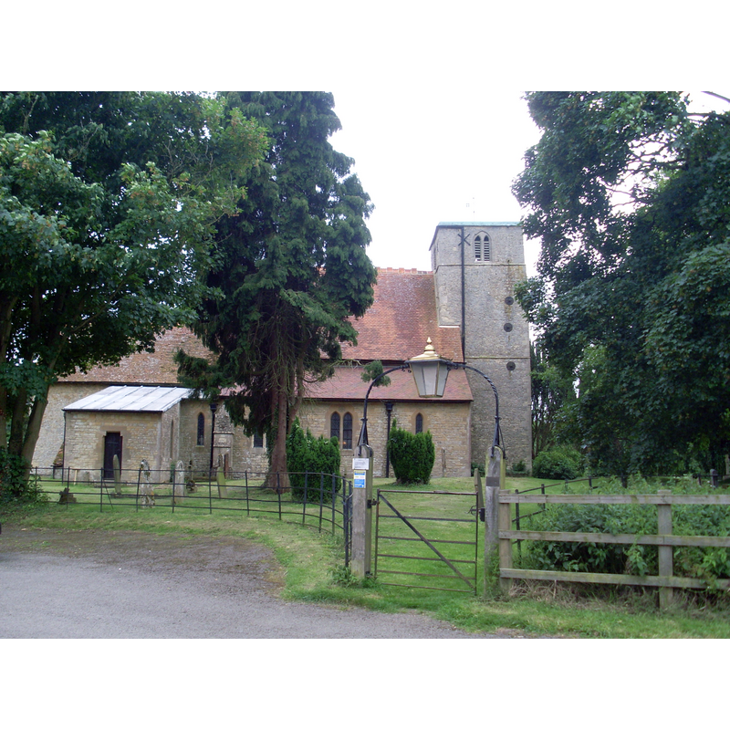
Scene Description: Source capton: "St Nicholas Church, Lillingstone Dayrell. Situated down a track off the A413 Main Road, this Parish Church is dedicated to St Nicholas of Myra. It is of grey stone with 11th-century nave and 13th-century tower and chancel. The Church was extended, restored and given expensive woodwork, tiles and stained glass by G.E.Street in the 1860s"
Copyright Statement: Image copyright © David Hillas, 2009
Image Source: digital photograph taken 20 June 2009 by David Hillas [www.geograph.org.uk/photo/2114053] [accessed 18 January 2016]
Copyright Instructions: CC-BY-SA-2.0
view of church exterior - south view
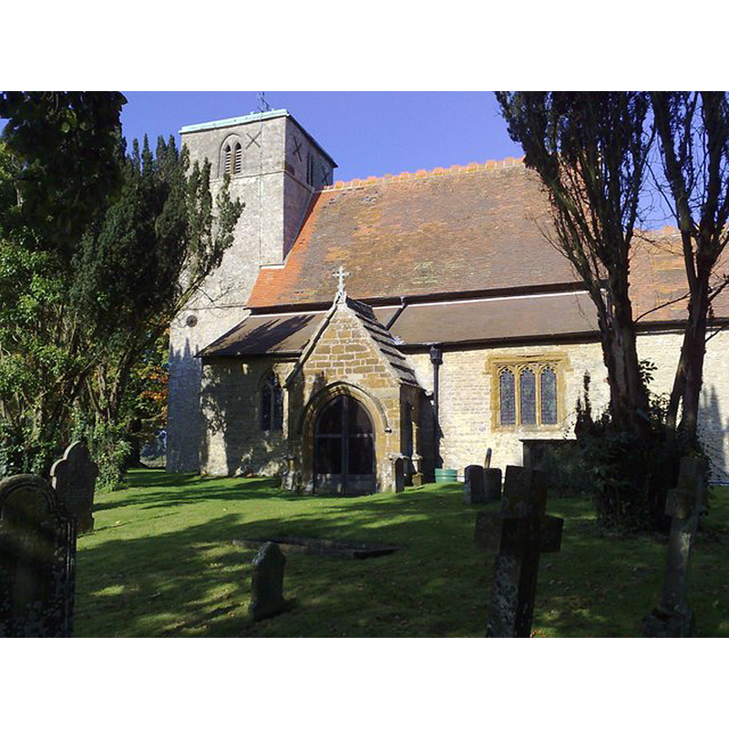
Copyright Statement: Image copyright © mick finn, 2008
Image Source: digital photograph taken 12 October 2008 by mick finn [www.geograph.org.uk/photo/1003148] [accessed 18 January 2016]
Copyright Instructions: CC-BY-SA-2.0
INFORMATION
Font ID: 14165LIL
Object Type: Baptismal Font1?
Font Century and Period/Style: 11th century (late?), Norman
Church / Chapel Name: Parish Church of St. Nicholas of Myra
Font Location in Church: [cf. FontNotes]
Church Patron Saint(s): St. Nicholas of Myra
Church Address: Lillingstone Dayrell, Buckinghamshire MK18 5AS, UK
Site Location: Buckinghamshire, South East, England, United Kingdom
Directions to Site: Located off the A413, 8 km N of Buckingham, by the Nhants. border
Ecclesiastic Region: Diocese of Oxford
Historical Region: Hundred of Stotfold [in Domesday] -- Hundred of Buckingham
Additional Comments: disappeared font? (the one from the late-11thC church here)
Font Notes:
Click to view
There is an entry for Lillingstone [Dayrell] in the Domesday survey [http://opendomesday.org/place/SP7039/lillingstone-dayrell/] [accessed 18 January 2016], but it mentions neither cleric nor church in it. Sheahan (1862) notes a small font in this Early English church. The Victoria County History (Buckingham, vol. 4, 1927) notes: "The east and west walls of the nave, with the chancel and tower arches, are the only survivals of a late 11th-century aisleless church with a western tower [...] The font and fittings are modern". [NB: Sheahan's font may have been an earlier one, since he saw the church before the 1868 renovation by G.E. Street in which the furnishings were replaced]
COORDINATES
UTM: 30U 638966 5768773
Latitude & Longitude (Decimal): 52.052113, -0.973295
Latitude & Longitude (DMS): 52° 3′ 7.61″ N, 0° 58′ 23.86″ W
REFERENCES
- Victoria County History [online], University of London, 1993-. URL: https://www.british-history.ac.uk.
- Sheahan, James Joseph, History and topography of Buckinghamshire, comprising a general survey of the county, preceded by an epitome of the early history of Great Britain, London; Pontefract: Longman, Green, Longman, and Roberts; William Edward Bonas [...], 1862, p. 285