Lillingstone Lovell / Great Lyllingstone / Lelluygestan Lillingestan / Lillingston Lovell / Lillingstone Lowell / Liwingstane / Lylenstone / Lyllingstone Dansey / Lyllingstone Lovell
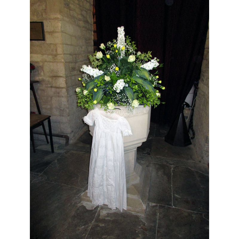
Image copyright © eltpics, 2016
No known copyright restriction / Fair Dealing
Results: 2 records
view of font in context
Scene Description: the modern font [cf. FontNotes]
Copyright Statement: Image copyright © eltpics, 2016
Image Source: digital photograph taken by eltpics [https://farm8.staticflickr.com/7778/18305040431_c1d28717ab_b.jpg] [accessed 18 January 2016]
Copyright Instructions: No known copyright restriction / Fair Dealing
view of church exterior - southeast view
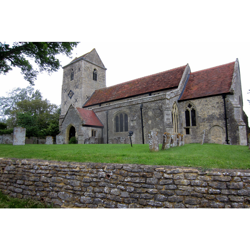
Copyright Statement: Image copyright © Philip Jeffrey, 2012
Image Source: digital photograph taken 5 June 2012 by Philip Jeffrey [www.geograph.org.uk/photo/2980002] [accessed 18 January 2016]
Copyright Instructions: CC-BY-SA-2.0
INFORMATION
Font ID: 14162LIL
Object Type: Baptismal Font1?
Font Century and Period/Style: 12th - 13th century, Transitional
Church / Chapel Name: Parish Church of St. Mary the Virgin
Font Location in Church: [cf. FontNotes]
Church Patron Saint(s): St. Mary the Virgin
Church Address: Church Lane, Lillingstone Lovell, Buckinghamshire MK18 5BB, UK
Site Location: Buckinghamshire, South East, England, United Kingdom
Directions to Site: Located off (E) the A413, 8 km N of Buckingham, by the Nhants. Border
Ecclesiastic Region: Diocese of Oxford
Historical Region: Hundred of Kirtlington [in Domesday] -- Undred of Buckingham -- formerly? / partly in Oxfordhsire?
Additional Comments: disappeared font? (the one from the pre-1200 church here)
Font Notes:
Click to view
There are two entries for Lillingstone [Lovell] [variant spelling] in the Domesday survey [http://opendomesday.org/place/SP7140/lillingstone-lovell/] [accessed 18 January 2016], neither of which mentions cleric or church in it. Sheahan (1862) remarks that the tower of the church dates from Henry III's reign [1216-1272], whereas the rest of the church is later, of the 14th century; Sheahan (ibid.) does not mention a font in it but notes that the "church was entirely repaired in 1777, with foreign oak". The Ecclesiastical and Architectural Topography of England: Oxfordshire (1850) and the Victoria County History (Buckingham, vol. 4, 1927) note the date of this church in the Early English period, but they both report the font as modern, thereby indicating the old font had disappeared before 1850. The VCH (ibid.) further adds that by the late-12th century half of the advowson of the church was held by Sybil Dangerville, which puts the original church here before 1200 [NB: we have no information on the whereabouts of the old font].
COORDINATES
UTM: 30U 639656 5769483
Latitude & Longitude (Decimal): 52.058316, -0.962943
Latitude & Longitude (DMS): 52° 3′ 29.94″ N, 0° 57′ 46.6″ W
REFERENCES
- Victoria County History [online], University of London, 1993-. URL: https://www.british-history.ac.uk.
- Parker, John Henry, The Ecclesiastical and architectural topography of England: Oxfordshire, Oxford, London: Published under the sanction of the Central Commitee of the Archaeological Institute of Great Britain and Ireland [by] John Henry Parker, 1850, [unpaged -- entry 48]