Adwell / Aduelle
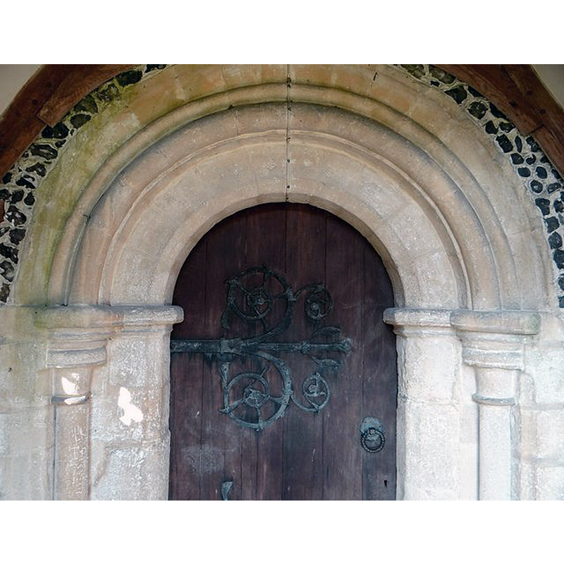
Image copyright © Sheepdog Rex, 2017
No known copyright restriction / Fair dealing
Results: 6 records
view of church exterior - south portal - detail
Scene Description: the south portal, originally from the medieval church demolished in 1865
Copyright Statement: Image copyright © Sheepdog Rex, 2017
Image Source: digital photograph originally by Sheepdog Rex [in Flickr?], used in https://i.pinimg.com/736x/df/1d/6c/df1d6c55828b1085367668f1855a5fc7--no-contact-noblesse.jpg [accessed 31 October 2017]
Copyright Instructions: No known copyright restriction / Fair dealing
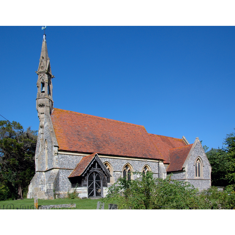
view of church exterior - southwest end
![Source caption: "Porch and bell-turret of St Mary's parish church, Adwell, Oxfordshire." [NB: unfortunately the south portal, which was retained from the medieval church, is not visible here]](/static-50478a99ec6f36a15d6234548c59f63da52304e5/compressed/1171031007_compressed.png)
Scene Description: Source caption: "Porch and bell-turret of St Mary's parish church, Adwell, Oxfordshire." [NB: unfortunately the south portal, which was retained from the medieval church, is not visible here]
Copyright Statement: Image copyright © Herry Lawford, 2011
Image Source: digital photograph taken 18 June 2011 by Herry Lawford [https://commons.wikimedia.org/wiki/File:Adwell_House,_Oxfordshire-5846398356.jpg] [accessed 31 October 2017]
Copyright Instructions: CC-BY-2.0
view of church exterior - southwest view
Copyright Statement: Image copyright © Motacilla, 2012
Image Source: digital photograph taken 5 September 2012 by Motacilla [https://commons.wikimedia.org/wiki/File:Adwell_StMary.jpg] [accessed 31 October 2017]
Copyright Instructions: CC-BY-SA-3.0
view of church exterior in context - southwest view
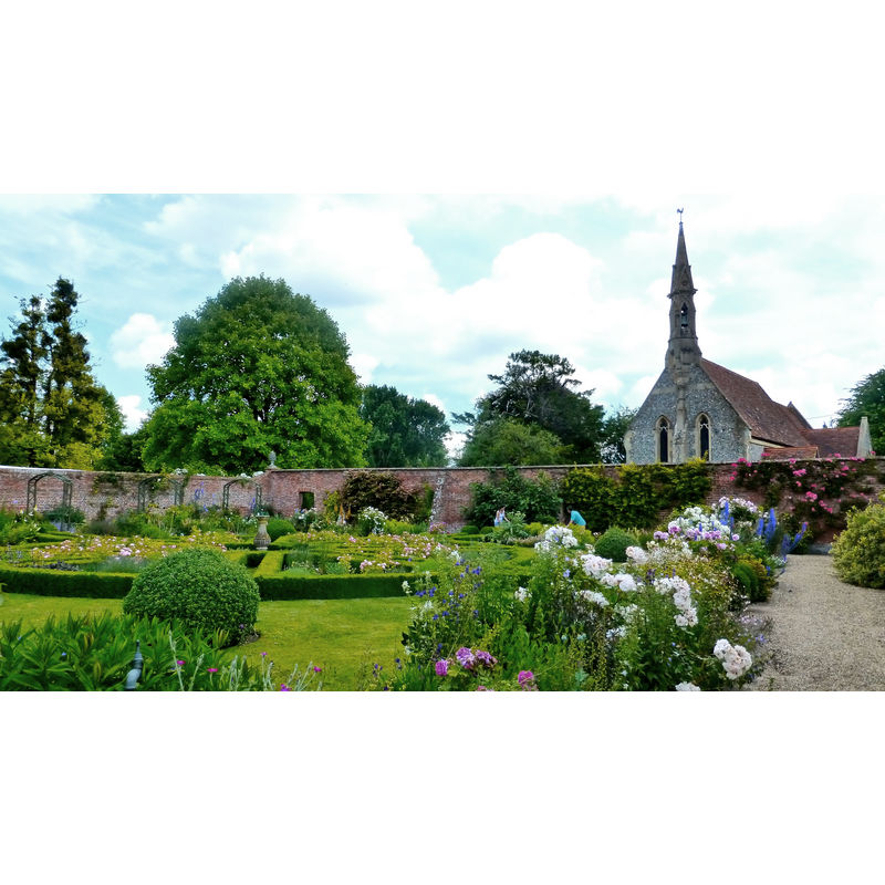
Scene Description: Source caption: "Walled garden of Adwell House, Oxfordshire, with St Mary's parish church behind the wall".
Copyright Statement: Image copyright © Herry Lawford, 2014
Image Source: digital photograph taken 22 June 2014 by Herry Lawford [https://commons.wikimedia.org/wiki/File:Adwell_House,_Oxfordshire-14484296501.jpg] [accessed 31 October 2017]
Copyright Instructions: CC-BY-2.0
view of church interior - nave - looking west
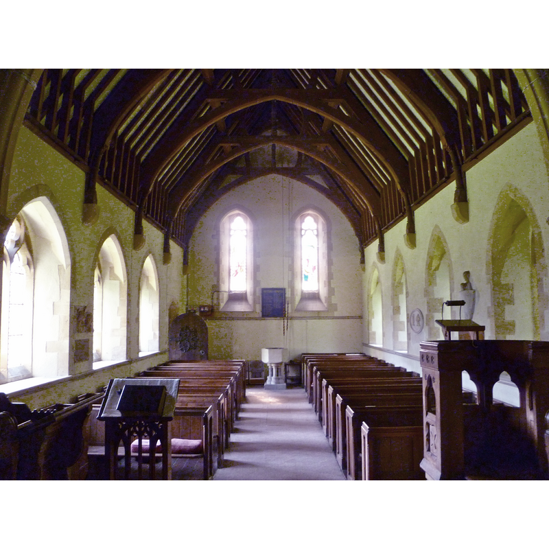
Scene Description: the mid-19thC font at the west end
Copyright Statement: Image copyright © Herry Lawford, 2011
Image Source: digital photograph taken 18 June 2011 by Herry Lawford [https://commons.wikimedia.org/wiki/File:Adwell_House,_Oxfordshire-5845858263.jpg] [accessed 31 October 2017]
Copyright Instructions: CC-BY-2.0
view of church interior - chancel
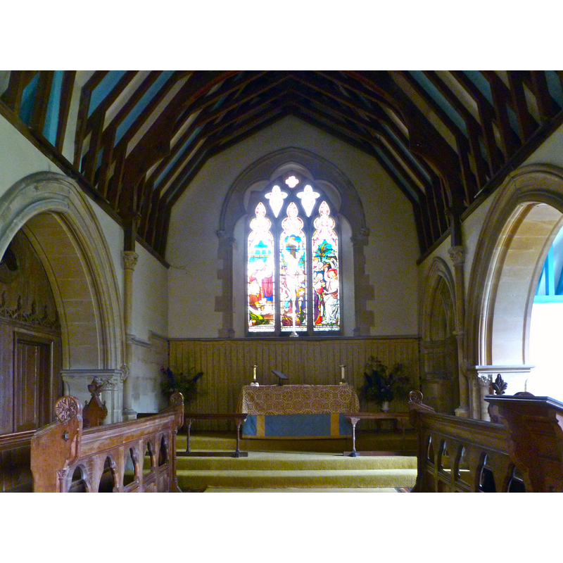
Copyright Statement: Image copyright © Herry Lawford, 2011
Image Source: digital photograph taken 18 June 2011 by Herry Lawford [https://commons.wikimedia.org/wiki/File:Adwell_House,_Oxfordshire-5846404618.jpg] [accessed 31 October 2017]
Copyright Instructions: CC-BY-2.0
INFORMATION
Font ID: 14157ADW
Object Type: Baptismal Font1?
Font Century and Period/Style: 12th century (early?), Norman
Church / Chapel Name: Parish Church of St. Mary
Font Location in Church: [cf. FontNotes]
Church Patron Saint(s): St. Mary the Virgin
Church Notes: late-12thC church demolished 1865; new church designed by Arthur Blomfield in early-Decorated style keeping the south doorway of the old church
Church Address: Adwell, Oxfordshire, OX9 7DQ, UK
Site Location: Oxfordshire, South East, England, United Kingdom
Directions to Site: Located off (S) the M40, just SE of Tetsworth, 5 km SSW of Thame, 26 km from Oxford
Ecclesiastic Region: Diocese of Oxford
Historical Region: Hundred of Lewknor
Additional Comments: disappeared font? (the one from the Norman church here)
Font Notes:
Click to view
There is an entry for Adwell [variant spelling] in the Domesday survey [http://opendomesday.org/place/SU6999/adwell/] [accessed 31 October 2017], but it mentions neither priest nor church in it. There is no font mentioned in The Ecclesiastical and Architectural Topography of England: Oxfordshire (1850), which probably is an indication that the original font from the early Norman church, of which only the nave remained at that time, had already disappeared. The entry for this parish in the Victoria County History (Oxon., vol. 8, 1964) notes: "It is likely that Miles Crispin built and endowed the church after the Conquest, [...] although there is no documentary evidence for its existence before 1254. [...] The earliest part of the medieval church building dates from the Norman period [...] The archdeacon's orders of 1759 reveal some neglect. [...] Banks of rubbish against the church walls and on either side of the porch were ordered to be moved. A new door was to be made, the pavement of church and chancel were to be newly laid, the roof of the chancel was to be made good, the font was to have a new cover, and the floor of the reading desk was to be repaired." There are no specifics on the font in the VCH entry. The present [June 2011] font is modern, a plain octagonal basin on a columnar support, probably introduced in Blomfield re-building of the 1860s.
COORDINATES
UTM: 30U 638621 5728453
Latitude & Longitude (Decimal): 51.6899, -0.9945
Latitude & Longitude (DMS): 51° 41′ 23.64″ N, 0° 59′ 40.2″ W
REFERENCES
- Parker, John Henry, The Ecclesiastical and architectural topography of England: Oxfordshire, Oxford, London: Published under the sanction of the Central Commitee of the Archaeological Institute of Great Britain and Ireland [by] John Henry Parker, 1850, [unpaged -- entry 1] / [http://books.google.ca/books?id=maikb1i3wSUC&pg=PT144&lpg=PT144&dq=longcot+church+font&source=web&ots=p3k5tJJE6J&sig=KYjkm8H5wOoAuH7BvnLp7JqMPus&hl=en&sa=X&oi=book_result&resnum=6&ct=result#PPA17,M1] [accessed 31 December 2008]