Ibstone / Ebestan / Hibestanes / Ipstone / Ybestan / Ybestane / Ykkerton / Ypestan
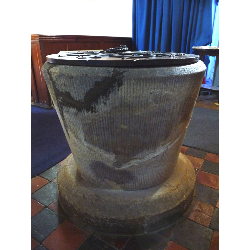
Image copyright © John Ward, 2009
Standing permission
Results: 2 records
view of font and cover
Scene Description: the striated pattern on the sides is probably part of the modern re-cutting
Copyright Statement: Image copyright © John Ward, 2009
Image Source: digital photograph taken 18 March 2009 by John Ward
Copyright Instructions: Standing permission
view of church exterior - southwest view
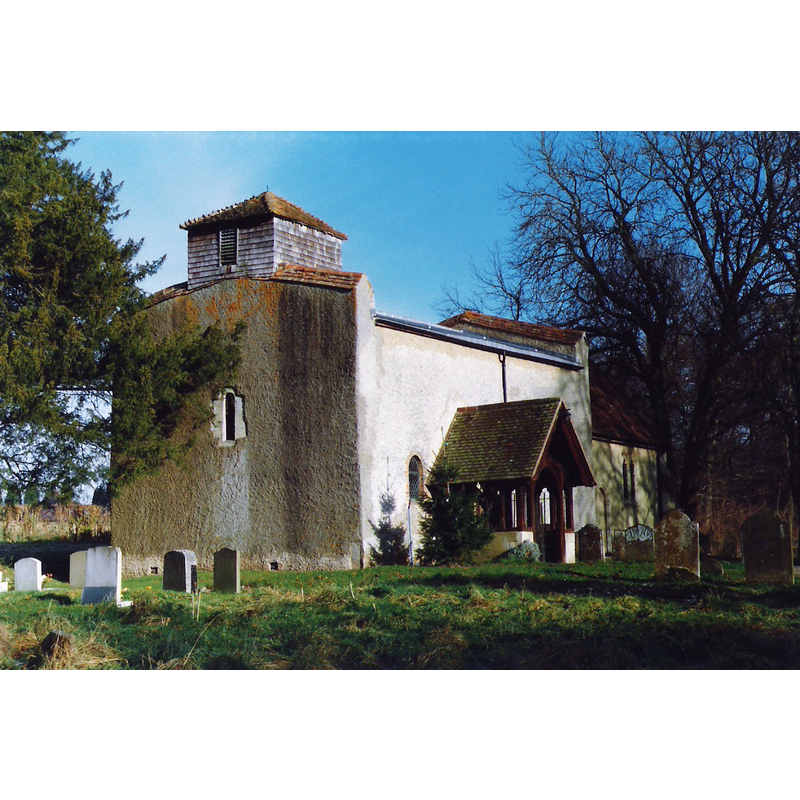
Scene Description: Source caption: "The church of St Nicholas, Ibstone dates back to the 12th century and now stands apart from the village it serves."
Copyright Statement: Image copyright © john shortland, 2010
Image Source: digital photograph taken December 1987 by john shortland [www.geograph.org.uk/photo/1690427] [accessed 16 October 2015]
Copyright Instructions: CC-BY-SA-2.0
INFORMATION
Font ID: 14154IPS
Object Type: Baptismal Font1
Font Century and Period/Style: 12th century [re-cut?], Medieval [altered]
Church / Chapel Name: Parish Church of St. Nicholas
Font Location in Church: [cf. FontNotes]
Church Patron Saint(s): St. Nicholas of Myra
Church Address: Ibstone, Buckinghamshire, HP14 3YD, UK
Site Location: Buckinghamshire, South East, England, United Kingdom
Directions to Site: Located off (S) the M40-A4020, 3 km S of Stokenchurch, 11 km WNW of Marlow [NB: the village is partly in Buckinghamshire, with the county line going through one of the rooms of the manor house]
Ecclesiastic Region: Diocese of Oxford
Historical Region: Hundred of Pyrton [in Domesday] -- Hundred of Desborough
Additional Comments: re-cut font / damaged font
Font Notes:
Click to view
There are three entries for Ibestone [variant spelling] in the Domesday survey [http://opendomesday.org/place/SU7593/ibstone/] [accessed 16 October 2015], none of which mentions cleric or church in it. There is no mention of a font in this church in the corresponding entry in The Ecclesiastical and Architectural Topography of England: Oxfordshire (1850). Sheahan (1862) notes the church, "a small ancient building", but not a font in it. The Victoria County History (Buckingham, vol. 3, 1925)) notes: "The nave dates from the early 12th century [...] The tub font is probably 12th-century work, though recut." The bucket-shaped basin has been repaired and re-tooled; stands on a squat circular base; the wooden cover is round and flat, with metal decoration and ring handle; appears modern, perhaps 19th-century.
Credit and Acknowledgements: We are grateful to John Ward, of Oxfordshire Churches [http://homepage.mac.com/john.ward/oxfordshirechurches], for his photograph of this font
COORDINATES
UTM: 30U 644698 5721360
Latitude & Longitude (Decimal): 51.624633, -0.909584
Latitude & Longitude (DMS): 51° 37′ 28.68″ N, 0° 54′ 34.5″ W
MEDIUM AND MEASUREMENTS
Material: stone
Font Shape: bucket-shaped, mounted
Basin Interior Shape: round
Basin Exterior Shape: round
LID INFORMATION
Date: 19th-century?
Material: wood, oak?
Apparatus: no
Notes: [cf. FontNotes]
REFERENCES
- Victoria County History [online], University of London, 1993-. URL: https://www.british-history.ac.uk.
- Sheahan, James Joseph, History and topography of Buckinghamshire, comprising a general survey of the county, preceded by an epitome of the early history of Great Britain, London; Pontefract: Longman, Green, Longman, and Roberts; William Edward Bonas [...], 1862, p. 892