Dauntsey / Dantesie / Dantsey
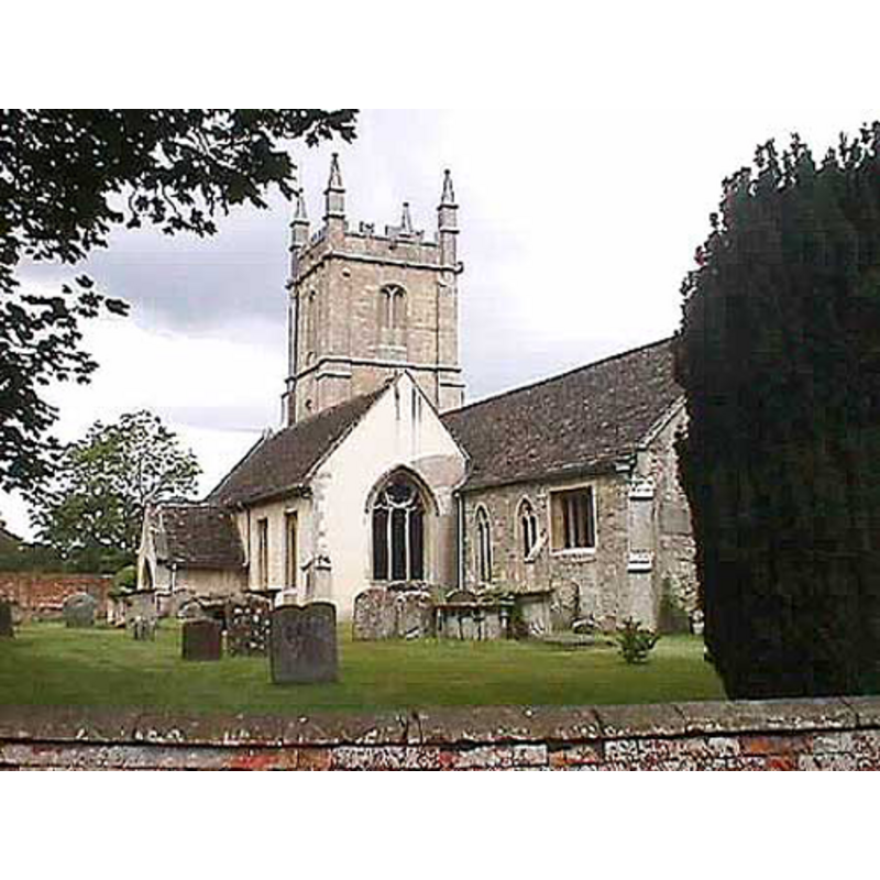
Image copyright © John Wilkes, 2008
Standing permission
Results: 4 records
view of church exterior - southeast view
Copyright Statement: Image copyright © John Wilkes, 2008
Image Source: digital photograph by John Wilkes [www.allthecotswolds.com]
Copyright Instructions: Standing permission
view of font in context
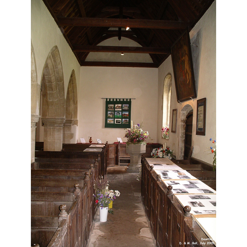
Scene Description: the modern font by the north door
Copyright Statement: Image copyright © Duncan & Mandy Ball, 2008
Image Source: digital photograph taken July 2005 by Duncan & Mandy Ball [http://www.oodwooc.co.uk/ph_daun_in.htm]
Copyright Instructions: Standing permission
view of font cover
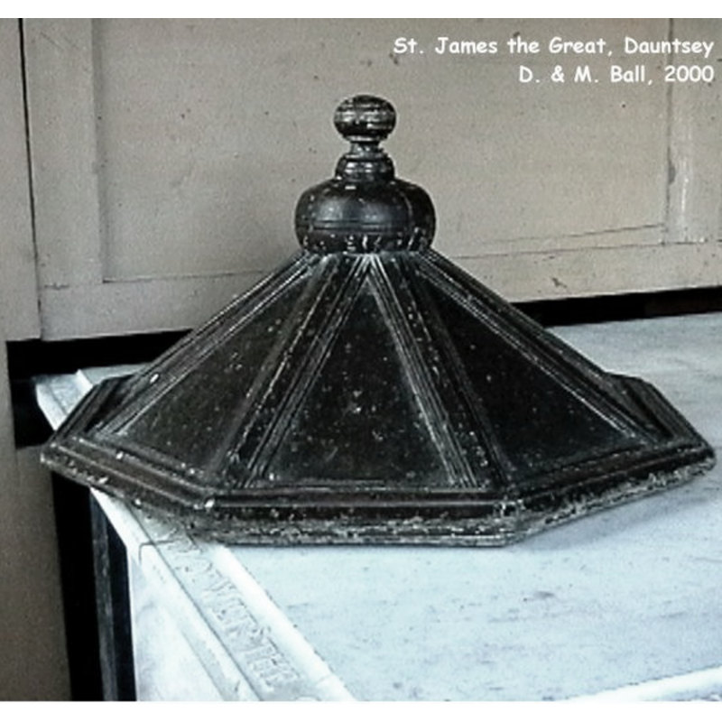
Copyright Statement: Image copyright © Duncan & Mandy Ball, 2008
Image Source: digital photograph taken in 2000 by Duncan & Mandy Ball [http://www.oodwooc.co.uk/ph_daun_in.htm]
Copyright Instructions: Standing permission
view of font
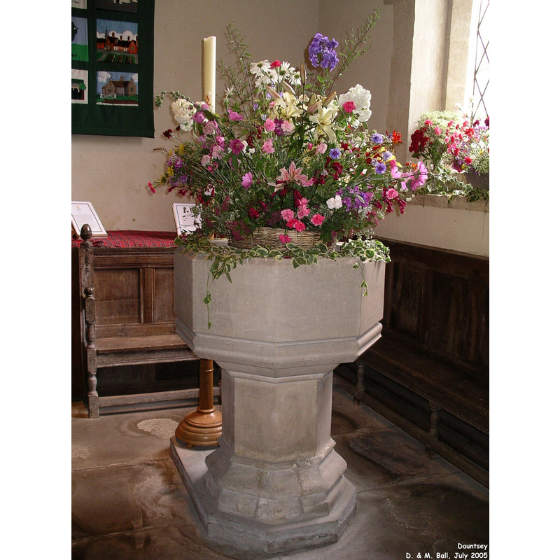
Scene Description: the modern font
Copyright Statement: Image copyright © Duncan & Mandy Ball, 2008
Image Source: digital photograph taken July 2005 by Duncan & Mandy Ball [http://www.oodwooc.co.uk/ph_daun_in.htm]
Copyright Instructions: Standing permission
INFORMATION
Font ID: 14135DAU
Object Type: Baptismal Font1
Font Century and Period/Style: 11th - 12th century, Pre-Conquest? / Norman?
Church / Chapel Name: Parish Church of St. James the Great
Font Location in Church: [cf. FontNotes]
Church Patron Saint(s): St. James the Greater [aka James the Great, James the Elder]
Church Notes: "church of ST. JAMES, so called in 1763" [cf. VCH entry in bib.] -- 14thC Doom board; one of only five in the country; above the rood screen [http://en.wikipedia.org/wiki/File:DauntseyDoomBoard.jpg] [accessed 14 Feb 2012]
Church Address: Church Lane, Dauntsey, Wiltshire, SN154HT, UK
Site Location: Wiltshire, South West, England, United Kingdom
Directions to Site: Located off (N) the M4, SE of Malmesbury, 11 km NE of Chippenham
Ecclesiastic Region: Diocese of Bristol
Historical Region: Hundred of Startley [in Domesday] -- Hundred of Malmesbury
Additional Comments: disappeared font? (the one from the 11th-12thC church here)
Font Notes:
Click to view
There is an entry for Dauntsey [variant spelling] in the Domesday survey [http://opendomesday.org/place/ST9782/dauntsey/] [accessed 22 May 2016], but it mentions neither cleric nor church in it. The Victoria County History (Wiltshire, vol. 14, 1991) notes: "The church at Dauntsey was claimed by Malmesbury abbey c. 1177. Since the abbey had already granted its Dauntsey estate in fee by 1086 and since the demesne of Dauntsey manor was later tithe free, it is possible that Dauntsey church was built before the Conquest and belonged to the abbey [...] The nave was apparently built or rebuilt in the 12th century [...] There are registers of baptisms, marriages, and burials from 1653." There is no mention of a font in the VCH entry for this parish. The present baptismal font, located in the north aisle, is a modern one, probably 19th-century; it consists of an octagonal basin with vertical sides raised on a plain octagonal pedestal and a moulded lower base. The wooden font cover, a low pyramid of octagonal shape, is older than the font, and must have belonged to an earlier vessel [NB: we have no information on the original baptismal font of the medieval church]
Credit and Acknowledgements: We are grateful to Duncan & Mandy Ball, of www.oodwooc.co.uk, and to John Wilkes, of www.allthecotswolds.com, for their photographs of church and font
COORDINATES
UTM: 30U 567154 5710377
Latitude & Longitude (Decimal): 51.540495, -2.031673
Latitude & Longitude (DMS): 51° 32′ 25.78″ N, 2° 1′ 54.02″ W
MEDIUM AND MEASUREMENTS
Material: stone
Font Shape: octagonal, mounted
Basin Interior Shape: round
Basin Exterior Shape: octagonal
LID INFORMATION
Material: wood
Apparatus: no
Notes: [cf. FontNotes]
REFERENCES
- Barral i Altet, Xavier, Belgique romane, et Grand-Duché de Luxembourg, La Pierre-qui-vire, Yonne: Zodiaque, 1989, [www.british-history.ac.uk/report.aspx?compid=116142] [accessed 14 February 2012]