Gloucester No. 3 / Glouuecestre / Glowecestre
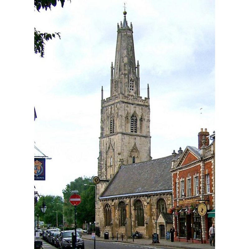
Image copyright © P.L. Chadwick, 2009
CC-BY-SA-3.0
Results: 1 records
view of church exterior - southeast view
Copyright Statement: Image copyright © P.L. Chadwick, 2009
Image Source: digital photograph taken 6 June 2009 by P.L. Chadwick [www.geograph.org.uk/photo/1432164] [accessed 22 June 2012]
Copyright Instructions: CC-BY-SA-3.0
INFORMATION
Font ID: 14106GLO
Object Type: Baptismal Font1
Font Century and Period/Style: 16th century, Tudor
Church / Chapel Name: Parish Church of St. Nicholas [aka St. Nicholas of the Bridge at Gloucester] [redundant]
Font Location in Church: Inside the church
Church Patron Saint(s): St. Nicholas of Myra
Church Notes: the church is redundant, and in the care of the Churches Conservation Trust since 1975
Church Address: Westgate Street, Gloucester GL1 2PG, UK
Site Location: Gloucestershire, South West, England, United Kingdom
Directions to Site: Located in lower Westgate St. Gloucester is located off (W) the A430, on Northgate St, 9-10 km WSW of Cheltenham and the M5
Ecclesiastic Region: Diocese of Gloucester
Historical Region: Hundred of Dudstone
Font Notes:
Click to view
There are five entries for Gloucester [variant spellings] in the Domesday survey [https://opendomesday.org/place/SO8318/gloucester/] [accessed 12 April 2020] none of which mentions priest or church in it. The Victoria County History (Gloucester, vol. 4, 1988) notes: "The church, in lower Westgate Street, had parochial rights by the end of the 12th century [...] and was described as a minster (monasterium) in the early 13th. [...] the church, which was closed in 1967, [...] was declared redundant in 1971 [...] The parish registers, which contain entries for the castle, survive from 1558." The VCH entry does not mention a font in this parish]. Noted in Verey & Brooks (1999-2002): "Font. Plain, octagonal, quite large; perhaps C16."
COORDINATES
UTM: 30U 551693 5746679
Latitude & Longitude (Decimal): 51.8685, -2.2492
Latitude & Longitude (DMS): 51° 52′ 6.6″ N, 2° 14′ 57.12″ W
MEDIUM AND MEASUREMENTS
Material: stone
Font Shape: octagonal, mounted
Basin Interior Shape: round
Basin Exterior Shape: octagonal
REFERENCES
- Victoria County History [online], University of London, 1993-. URL: https://www.british-history.ac.uk.
- Verey, David, Gloucestershire, London: Penguin Books, 1999-2002, vol. 2: 456