Shipton Moyne / Scipetone
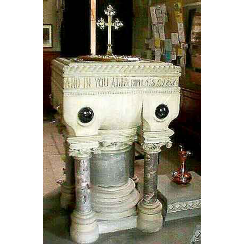
Image copyright © John Wilkes, 2008
Standing permission
Results: 2 records
view of font and cover
Scene Description: the 19th-century font
Copyright Statement: Image copyright © John Wilkes, 2008
Image Source: digital photograph by John Wilkes [www.allthecotswolds.com]
Copyright Instructions: Standing permission
view of church exterior - south view
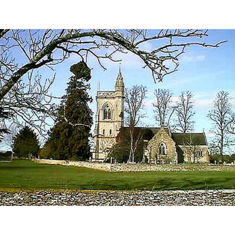
Copyright Statement: Image copyright © John Wilkes, 2008
Image Source: digital photograph by John Wilkes [www.allthecotswolds.com]
Copyright Instructions: Standing permission
INFORMATION
Font ID: 14069SHI
Object Type: Baptismal Font1?
Font Date: ca. 1211?
Font Century and Period/Style: 13th century (early?), Medieval
Church / Chapel Name: Parish Church of St. John the Baptist
Font Location in Church: [disappeared?]
Church Patron Saint(s): St. John the Baptist
Church Address: Church Ln, Shipton Moyne, Tetbury GL8 8PW, UK
Site Location: Gloucestershire, South West, England, United Kingdom
Directions to Site: Located off (SE) the A433, 5 km S of Tetbury, 5 km SW of Malmesbury
Ecclesiastic Region: Diocese of Gloucester
Historical Region: Hundred of Longtree
Additional Comments: disappeared font? (the one from the medieval church here)
Font Notes:
Click to view
There are three entries for Shipton [Moyne] [variant spelling] in the Domesday survey [https://opendomesday.org/place/ST8989/shipton-moyne/] [accessed 20 February 2019] none of which mentions cleri or church in it. The entry for this parish in the Victoria County History (Gloucester, vol. 11, 1976) informs: "The church at Shipton was recorded from 1211 […] The old octagonal font recorded in the church in 1843 was replaced, apparently at the rebuilding, by one in memory of Edward Dugdale Bucknall Estcourt (d. 1864)" [NB: the VCH entry gives "Trans. B.G.A.S. xliv. 184-5" as the source for the 1843 information, and indicates in a footnote that the source of the dedication of the modern font is an inscription on the font]. Only the later font is noted in Verey & Brooks (1999-2002): "typical 1860s, square, with much coloured marble" [NB: this text is followed by: "Nearby medieval stone fragments found during repairs to the N porch in 1984, one with Norman chevron"; but it not clear whether the authors made any association between font and fragments]. The entry for this church in Historic England [Listing NGR: ST8922189617] notes: "Anglican church. Mostly rebuilt, except for south aisle, in 1864-5 [...] Square stone font on central large and smaller corner columns with decorative lettering around top and large marble studs to each side."
Credit and Acknowledgements: We are grateful to John Wilkes, of www.allthecotswolds.com, for his photographs of church and new font
COORDINATES
UTM: 30U 558406 5717448
Latitude & Longitude (Decimal): 51.605042, -2.156619
Latitude & Longitude (DMS): 51° 36′ 18.15″ N, 2° 9′ 23.83″ W
MEDIUM AND MEASUREMENTS
Material: stone
Font Shape: octagonal
Basin Exterior Shape: octagonal
REFERENCES
- Victoria County History [online], University of London, 1993-. URL: https://www.british-history.ac.uk.
- Verey, David, Gloucestershire, London: Penguin Books, 1999-2002, vol. 1: 605