Rodborough
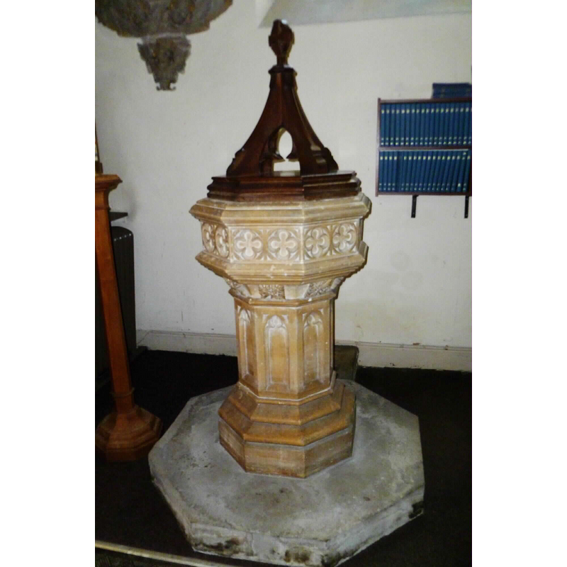
Image copyright © John Wilkes, 2008
Standing permission
Results: 3 records
view of font and cover
Scene Description: the 19th-century font and cover
Copyright Statement: Image copyright © John Wilkes, 2008
Image Source: digital photograph by John Wilkes [www.allthecotswolds.com]
Copyright Instructions: Standing permission
view of church exterior - south view
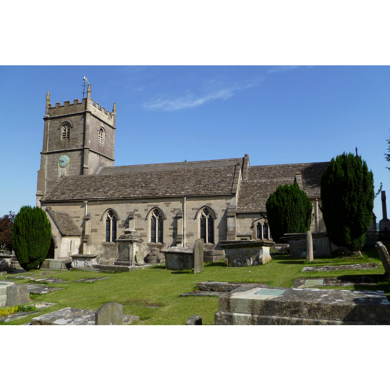
Copyright Statement: Image copyright © John Wilkes, 2008
Image Source: digital photograph by John Wilkes [www.allthecotswolds.com]
Copyright Instructions: Standing permission
view of church interior - nave - looking east
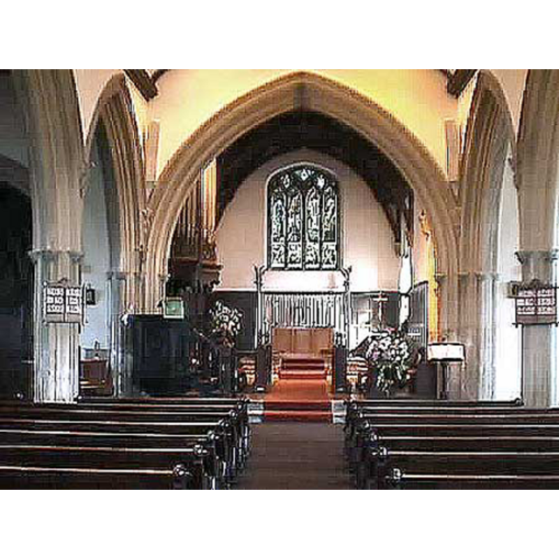
Copyright Statement: Image copyright © John Wilkes, 2008
Image Source: digital photograph by John Wilkes [www.allthecotswolds.com]
Copyright Instructions: Standing permission
INFORMATION
Font ID: 14065ROD
Object Type: Baptismal Font1?
Font Century and Period/Style: 16th century, Perpendicular
Church / Chapel Name: Parish Church of St. Mary Magdalene
Church Patron Saint(s): St. Mary Magdalene
Church Address: Church Pl, Rodborough, Stroud GL5 3NF, UK -- Tel.: +44 1453 752659
Site Location: Gloucestershire, South West, England, United Kingdom
Directions to Site: Located off (S) the A46, 2 km SW of Stroud, N of Nailsworth
Ecclesiastic Region: Diocese of Gloucester
Historical Region: Hundred of Longtree
Additional Comments: disappeared font? (the one from the ca. 1384 church here [even if not licensed for the sacraments until the 1550s))
Font Notes:
Click to view
No individual entry found for Rodborough in the Domesday survey. The entry for this parish in gthe Victoria County History (Gloucester, vol. 11, 1976) informs on the church itself: "Rodborough was originally part of the ecclesiastical parish of Minchinhampton. A church had been built by 1384, […] but it was not apparently consecrated or licensed for sacraments until the 1550s". Verey & Brooks (1999-2002) report a modern font here: "Font. Perp[endicular] style, probably of 1842." [NB: we do not have any information on the earlier font(s) of this church]
COORDINATES
UTM: 30U 553304 5732200
Latitude & Longitude (Decimal): 51.738175, -2.228041
Latitude & Longitude (DMS): 51° 44′ 17.43″ N, 2° 13′ 40.95″ W
LID INFORMATION
Date: 19th-century?
Material: wood, oak?
Apparatus: no
Notes: flat octagonal platform with four thick vertical scrolls, and encircled Greek cross finial
REFERENCES
- Victoria County History [online], University of London, 1993-. URL: https://www.british-history.ac.uk.
- Verey, David, Gloucestershire, London: Penguin Books, 1999-2002, vol. 1: 579