York No. 21, Marygate / Eboracum / Eburacum / Eburākon / Eoforwic / Everwic / Jórvík
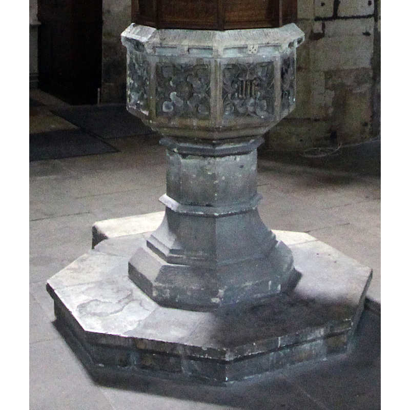
Image copyright © Beep boop beep, 2017
CC-BY-SA-4.0
Results: 11 records
view of font - southeast side
Copyright Statement: Image copyright © Beep boop beep, 2017
Image Source: edited detail of a digital photograph taken 19 July 2017 by Beep boop beep [https://commons.wikimedia.org/wiki/File:St_olaves_york_font.jpg] [accessed 27 August 2019]
Copyright Instructions: CC-BY-SA-4.0
symbol - anagram
Copyright Statement: Image copyright © Beep boop beep, 2017
Image Source: edited detail of a digital photograph taken 19 July 2017 by Beep boop beep [https://commons.wikimedia.org/wiki/File:St_olaves_york_font.jpg] [accessed 27 August 2019]
Copyright Instructions: CC-BY-SA-4.0
design element - motifs - quatrefoil
Copyright Statement: Image copyright © Beep boop beep, 2017
Image Source: edited detail of a digital photograph taken 19 July 2017 by Beep boop beep [https://commons.wikimedia.org/wiki/File:St_olaves_york_font.jpg] [accessed 27 August 2019]
Copyright Instructions: CC-BY-SA-4.0
design element - motifs - floral
Scene Description: below the upper rim
Copyright Statement: Image copyright © Beep boop beep, 2017
Image Source: edited detail of a digital photograph taken 19 July 2017 by Beep boop beep [https://commons.wikimedia.org/wiki/File:St_olaves_york_font.jpg] [accessed 27 August 2019]
Copyright Instructions: CC-BY-SA-4.0
design element - motifs - moulding
Scene Description: notice the protrusion on the left side
Copyright Statement: Image copyright © Beep boop beep, 2017
Image Source: edited detail of a digital photograph taken 19 July 2017 by Beep boop beep [https://commons.wikimedia.org/wiki/File:St_olaves_york_font.jpg] [accessed 27 August 2019]
Copyright Instructions: CC-BY-SA-4.0
design element - motifs - moulding - graded
Copyright Statement: Image copyright © Beep boop beep, 2017
Image Source: edited detail of a digital photograph taken 19 July 2017 by Beep boop beep [https://commons.wikimedia.org/wiki/File:St_olaves_york_font.jpg] [accessed 27 August 2019]
Copyright Instructions: CC-BY-SA-4.0
design element - motifs - moulding
Scene Description: several of them on the pedestal base
Copyright Statement: Image copyright © Beep boop beep, 2017
Image Source: edited detail of a digital photograph taken 19 July 2017 by Beep boop beep [https://commons.wikimedia.org/wiki/File:St_olaves_york_font.jpg] [accessed 27 August 2019]
Copyright Instructions: CC-BY-SA-4.0
view of church exterior - southwest end
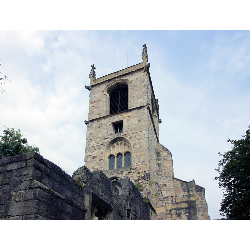
Copyright Statement: Image copyright © Beep boop beep, 2017
Image Source: digital photograph taken 19 July 2017 by Beep boop beep [https://commons.wikimedia.org/wiki/File:St_olaves_york_tower.jpg] [accessed 27 August 2019]
Copyright Instructions: CC-BY-SA-4.0
view of church exterior - northwest view
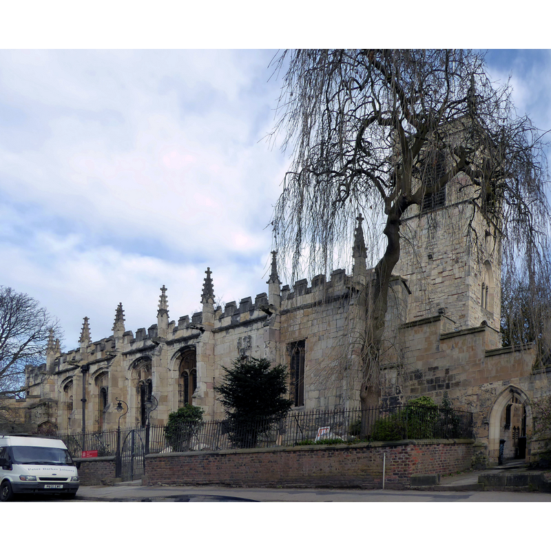
Copyright Statement: Image copyright © Paul Farmer, 2017
Image Source: edited detail of a digital photograph taken 21 March 2017 by Paul Farmer [www.geograph.org.uk/photo/5322961] [accessed 27 August 2019]
Copyright Instructions: CC-BY-SA-2.0
view of font and cover in context - southeast side
Copyright Statement: Image copyright © Beep boop beep, 2017
Image Source: digital photograph taken 19 July 2017 by Beep boop beep [https://commons.wikimedia.org/wiki/File:St_olaves_york_font.jpg] [accessed 27 August 2019]
Copyright Instructions: CC-BY-SA-4.0
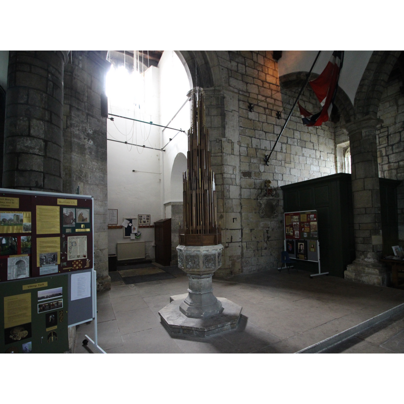
view of church interior - looking east
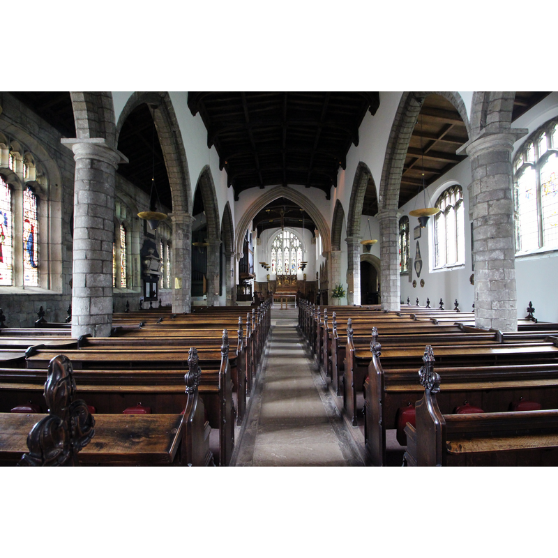
Copyright Statement: Image copyright © Beep boop beep, 2017
Image Source: digital photograph taken 19 July 2017 by Beep boop beep [https://commons.wikimedia.org/wiki/File:Interior_st_olaves_church.jpg] [accessed 27 August 2019]
Copyright Instructions: CC-BY-SA-4.0
INFORMATION
Font ID: 14046YOR
Object Type: Baptismal Font1
Font Century and Period/Style: 17th century(late?), Restoration
Church / Chapel Name: Parish Church of St. Olave, Marygate
Font Location in Church: Inside the church
Church Patron Saint(s): St. Olaf [aka Olaf II Haraldsson, Óláfr Haraldsson, Olav, Olav Haraldsson, Olave, Olof]
Church Address: 8 Marygate Ln, York YO30 7BJ, UK
Site Location: North Yorkshire, Yorkshire and the Humber, England, United Kingdom
Directions to Site: Located on the W side of the old city centre, N of the river Ouse, just W of St. Mary's Abbey, Marygate
Ecclesiastic Region: Diocese of York
Historical Region: Hundred of York
Additional Comments: the name of the church is pronounced locally 'Olive' -- disappeared font? (the one from the pre-Conquest church here)
Font Notes:
Click to view
There are twelve entries for York in the Domesday survey [https://opendomesday.org/place/SE6052/york/] [accessed 8 August 2019] eight of which mentions a church in it [cf. infra]. The entry for this parish in the Victoria County History (York, 1961) notes: "The church of ST. OLAVE, Marygate, was founded by Earl Siward of Northumbria before 1055 when he was buried in it. [...] It was given before 1086 by Alan, Earl of Brittany, who had received it from the Conqueror, to Stephen, a monk of Whitby, as a foundation grant for what was later to be St. Mary's Abbey. [...] Nothing is known of how the church was served in this early period. The church was presumably used conventually until replaced by the abbey church, the foundation stone of which William II is said to have laid in 1089 [...] The prevailing style is of the 15th century but it is of 18th-century construction since the church was largely rebuilt about 1721. It is said to have been much damaged while being used as a platform for guns in 1644. Little of the ancient structure remains." Parker (1847) notes the church and font: "A very late Perpendicular Church […] The font is of the time of Charles II" [i.e., 1660+]. [NB: the original church is believed to have been founded before the Conquest by Sigurd [aka Siward] (+1055?), a subject of King Cnut and governor of southern Northumbria [cf. supra]; the church was restored in the 19th century; we have no information on the medieval font(s) of the church]. The entry for St Mary's Abbey in the Victoria County History (York, vol. 3, 1974) confirms the Anglo-Saxon house: "On the north side of the Ouse at York there stood in pre-Conquest days the church or monasterium of St. Olave, [...] which in the days of the Conqueror had come, together with 4 acres of land around it, into the hands of Alan Rufus, son of Eudo, Count of Bretagne. [...] This church and land were given by the earl to Stephen, a monk of Whitby, on which to found a Benedictine abbey." The entry for this church in Historic England [Listing NGR: SE5985852177] notes: "Parish church. Late C15 on C13 foundations; early C18 arcades, south wall and partial reconstruction of north wall. Chancel 1889, enlarged 1908; vestry 1898, converted to South Chapel 1908; organ chamber 1907, new vestry 1908. Late C19 and early C20 work by G Fowler Jones of York and JF Doyle of Liverpool. [...] Octagonal font on stem with moulded foot and C20 tiered cover."
COORDINATES
UTM: 30U 625368 5981019
Latitude & Longitude (Decimal): 53.962306, -1.089056
Latitude & Longitude (DMS): 53° 57′ 44.3″ N, 1° 5′ 20.6″ W
LID INFORMATION
Date: modern / 20th century
Material: wood, oak?
Apparatus: pulley
Notes: [cf. FontNotes]
REFERENCES
- Victoria County History [online], University of London, 1993-. URL: https://www.british-history.ac.uk.
- Victoria County History [online], University of London, 1993-. URL: https://www.british-history.ac.uk.
- Parker, I. H. [John Henry?], "Architectural notes of the churches and other ancient buildings in the city and neighbourhood of York", Memoirs illustrative of the history and antiques of the county and city of York […], London: J. Murray, 1847, p. 21