Cople / Coggepole / Cochepol / Coupol / Cowepyll
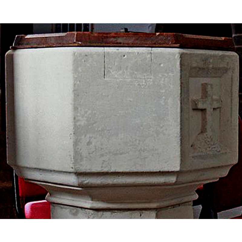
Image copyright © Hugh J. Griffiths, 2008
Permission received (email of 30 Nov 2008)
Results: 5 records
view of font
Scene Description: the font after its restoration, showing the repair with a new stone insert
Copyright Statement: Image copyright © Hugh J. Griffiths, 2008
Image Source: detail of a digital photograph taken 2008-11-12 by Hugh J. Giffiths http://www.eimagesite.net/s2/en/run.cgi?action=images;prid=7618;retcmd=imagelistl;titletext=Church%20of%20All%20Saints%2C%20Church%20of%20All%20Saints%2C%20Cople%20 [accessed 29 November 2008]
Copyright Instructions: Permission received (email of 30 Nov 2008)
view of font
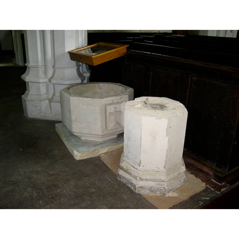
Scene Description: the font during the restoration process
Copyright Statement: Image copyright © Julie Scherrer, 2008
Image Source: digital photograph taken 14 June 2008 by Julie Scherrer [http://cople.photoblog.org.uk/c1540849.html] [accessed 29 November 2008]
Copyright Instructions: No known copyright restriction / Fair Dealing
view of font and cover
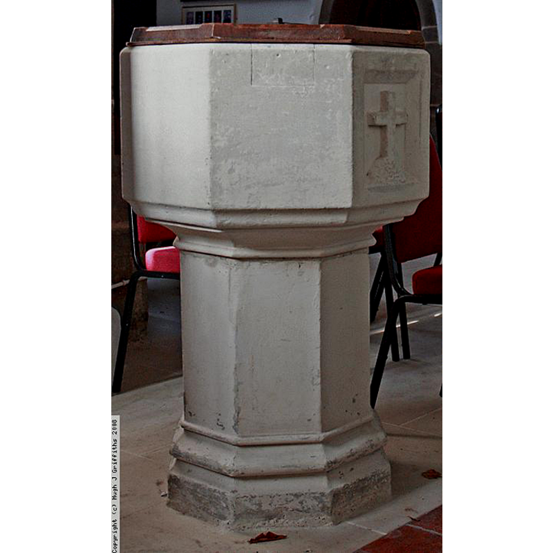
Scene Description: the font after its restoration
Copyright Statement: Image copyright © Hugh J. Griffiths, 2008
Image Source: digital photograph taken 2008-11-12 by Hugh J. Giffiths http://www.eimagesite.net/s2/en/run.cgi?action=images;prid=7618;retcmd=imagelistl;titletext=Church%20of%20All%20Saints%2C%20Church%20of%20All%20Saints%2C%20Cople%20 [accessed 29 November 2008]
Copyright Instructions: Permission received (email of 30 Nov 2008)
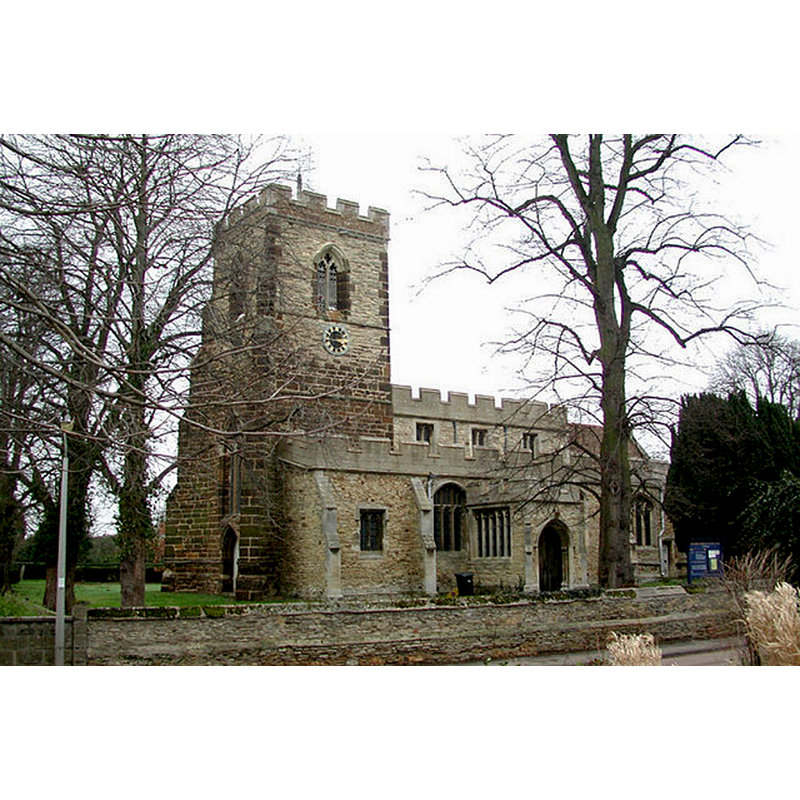
view of church exterior - northeast view
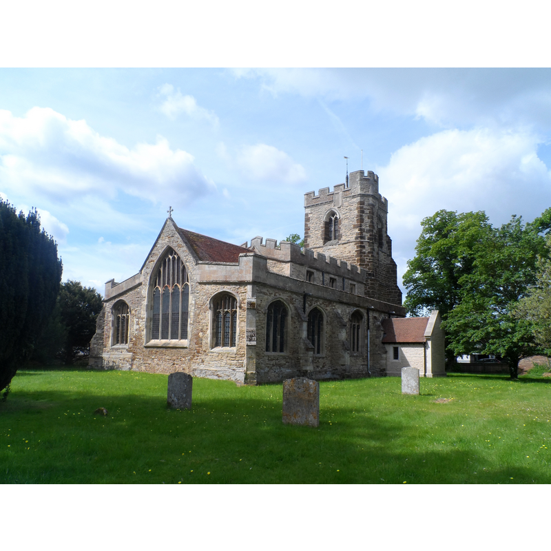
Scene Description: Source caption: "All Saints' church, Cople. Built around 1430 originally. Work continued into the next century and the south porch added 200 years later. The north porch shown here is obviously very recent."
Copyright Statement: Image copyright © Bikeboy, 2015
Image Source: digital photograph taken 30 May 2015 by Bikeboy [www.geograph.org.uk/photo/4509158] [accessed 16 September 2015]
Copyright Instructions: CC-BY-SA-2.0
view of church exterior - southwest view
Copyright Statement: Image copyright © John Salmon, 2002
Image Source: digital photograph taken 1 February 2002 by John Salmon [www.geograph.org.uk/photo/330011] [accessed 16 September 2015]
Copyright Instructions: CC-BY-SA-2.0
INFORMATION
Font ID: 14034COP
Object Type: Baptismal Font1
Font Century and Period/Style: 15th century [re-tooled?] / 19th century, Late Medieval? [altered?] / Victorian?
Church / Chapel Name: Parish Church of All Saints
Font Location in Church: Inside the church
Church Patron Saint(s): All Saints
Church Address: Grange Lane, Cople, Bedfordshire, MK44 3TT
Site Location: Bedfordshire, East, England, United Kingdom
Directions to Site: Located off the A603, 5 km E of Bedford
Ecclesiastic Region: Diocese of St. Albans
Historical Region: Hundred of Wichestanestou [in Domesday] -- Hundred of Wixamtree
Additional Comments: sent email request to Hugh Griffith's for permission [29 Nov 2008//mt -- permission rec'd 30 Nov 2008] -- unable to locate contact for Julie Scherrer -- disappeared font? (the one from the 13thC church here)
Font Notes:
Click to view
There are eight entries for Cople [variant spelling] in the Domesday survey [http://opendomesday.org/place/TL1048/cople/] [accessed 16 September 2015], none of which mention cleric or church in it, except for a lord of one of the parts, "Roger the priest". The Victoria County History (Bedford, vol. 3, 1912) notes: "Cople Church was granted to Chicksands by Simon de Beauchamp, [...] and confirmed by his son William in the reign of Henry III [i.e., 1216-1272] [...] In 1291 it was worth £5. [...] The chapels appear to be 16th-century additions, but otherwise the whole building seems to be of one date—the first half of the 15th century." The VCH entry does not mention a font in it. The present baptismal font consists of an octagonal basin with vertical sides, all plain except one which has been carved [re-carved?] with a Latin cross motif; moulded underbowl chamfer; plain octagonal stem; moulded lower base also octagonal. The font is covered in whitewash and it appears to have been re-cut. Onr of the basin sides, the lone left of the carved panel, shows a new-stone insert consistent with damage related to the removal of an old cover staple. The font may date from the major renovation of this church in the 15th century, but it has been re-cut. The wooden cover is octagonal and flat; appears modern. The last recorded repairs (floor alterations) in this church appear to date from 14 June 2008, at which time the font was dismantled [cf. images in http://cople.photoblog.org.uk/c1540849.html [accessed 29 November 2008]. [NB: the church dates back to the late 11th century, but we have no information on the earlier font(s) of this church]
COORDINATES
UTM: 30U 678676 5777988
Latitude & Longitude (Decimal): 52.1235, -0.3899
Latitude & Longitude (DMS): 52° 7′ 24.6″ N, 0° 23′ 23.64″ W
MEDIUM AND MEASUREMENTS
Material: stone
Font Shape: octagonal, mounted
Basin Interior Shape: round
Basin Exterior Shape: octagonal
Drainage System: centre hole in basin & base
REFERENCES
- Victoria County History [online], University of London, 1993-. URL: https://www.british-history.ac.uk.