Dorking / Dorchinges [Domesday] / Dorkinges
![Main image for Dorking / Dorchinges [Domesday] / Dorkinges](/static-50478a99ec6f36a15d6234548c59f63da52304e5/compressed/1190820001_compressed.png)
Image copyright © Colin Smith, 2019
Image and permission received (e-mail of 19 August 2019)
Results: 8 records
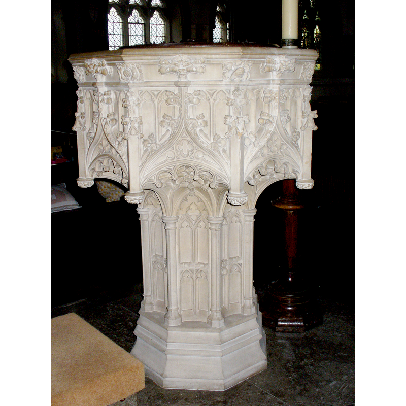
view of font
Scene Description: the modern font
Copyright Statement: Image copyright © Colin Smith, 2019
Image Source: digital photograph taken 21 November 2018 by Colin Smith
Copyright Instructions: Image and permission received (e-mail of 19 August 2019)
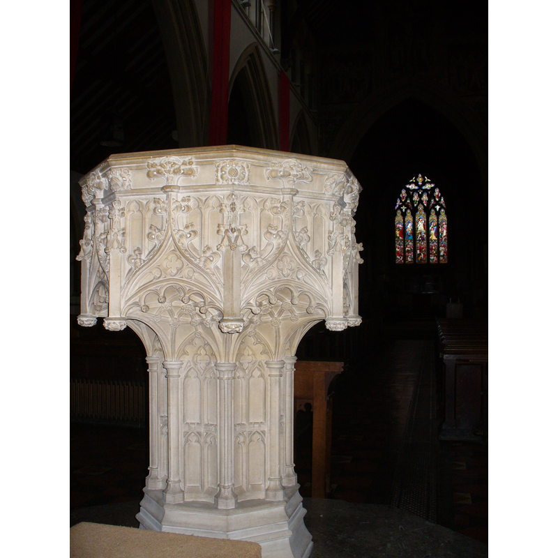
view of font
Scene Description: the modern font
Copyright Statement: Image copyright © Colin Smith, 2016
Image Source: digital photograph taken 10 February 2016 by Colin Smith
Copyright Instructions: Image and permission received (e-mail of 21 March 2016)
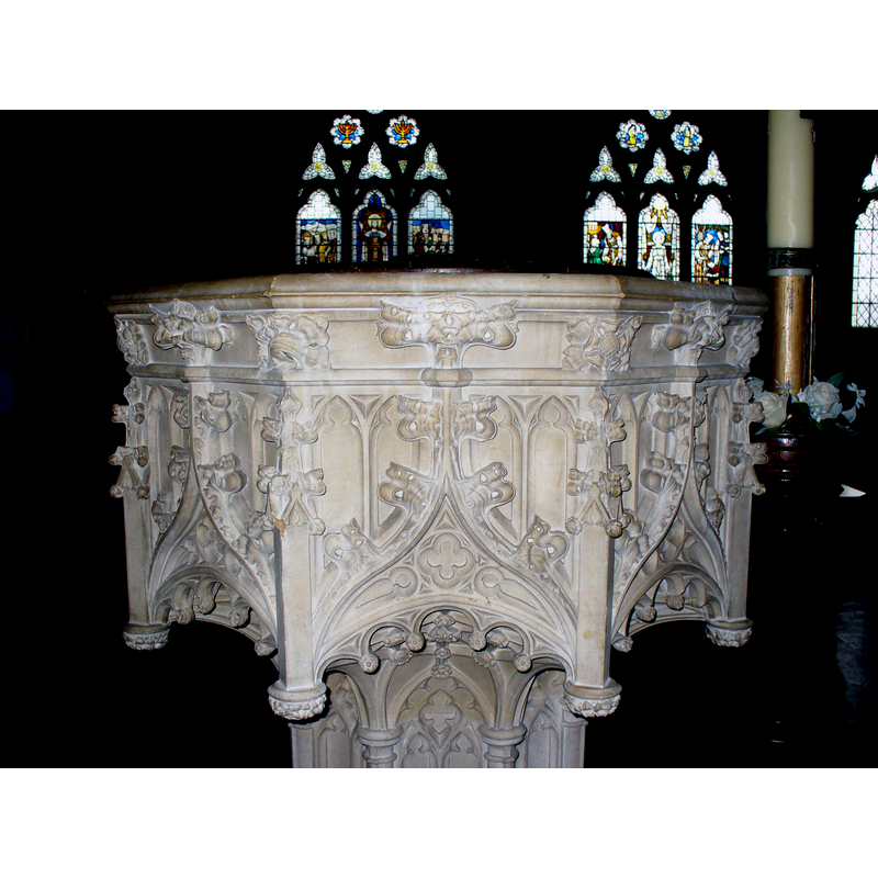
view of font
Scene Description: the modern font
Copyright Statement: Image copyright © Colin Smith, 2008
Image Source: digital photograph taken by Colin Smith 25 November 2008
Copyright Instructions: Standing permission
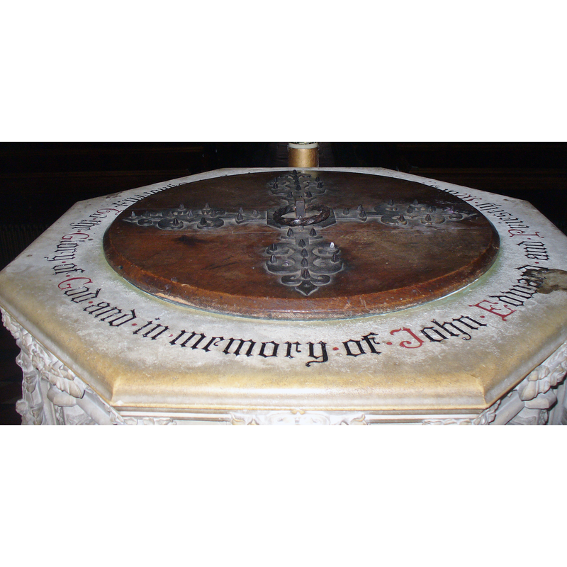
view of basin
Scene Description: the modern font
Copyright Statement: Image copyright © Colin Smith, 2008
Image Source: detail of a digital photograph taken by Colin Smith 25 November 2008
Copyright Instructions: Standing permission
view of church exterior - south view
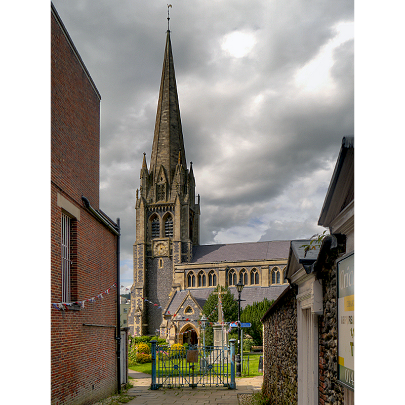
Scene Description: Source caption: "Dorking, St Martin's Church. St Martin’s is a Victorian building built between 1868 and 1877. It has one of the tallest church spires in England, the height to the weathervane being 210 feet. It is visible for miles around."
Copyright Statement: Image copyright © David Dixon, 2012
Image Source: digital photograph taken 3 August 2012 by David Dixon [www.geograph.org.uk/photo/3126677] [accessed 14 December 2015]
Copyright Instructions: CC-BY-SA-2.0
view of church interior - nave - looking east
![Source caption: "St Martin's Church, Dorking, Nave and Chancel Arch [...] Rebuilt by Henry Woodyer, between 1872 and 1874, the nave and aisles continue the design of his slightly earlier chancel in a grand and spacious 14th century decorated style. The Great Crucifixion over the chancel arch was designed by GH Rhead and made in 1892. The remainder of the decoration, with splendid archangels, was completed between 1901 and 1902 as a memorial to Queen Victoria. [source, "A look at St Martin's" published by the Friends of St Martin's, Dorking]"](/static-50478a99ec6f36a15d6234548c59f63da52304e5/compressed/1151214020_compressed.png)
Scene Description: Source caption: "St Martin's Church, Dorking, Nave and Chancel Arch [...] Rebuilt by Henry Woodyer, between 1872 and 1874, the nave and aisles continue the design of his slightly earlier chancel in a grand and spacious 14th century decorated style. The Great Crucifixion over the chancel arch was designed by GH Rhead and made in 1892. The remainder of the decoration, with splendid archangels, was completed between 1901 and 1902 as a memorial to Queen Victoria. [source, "A look at St Martin's" published by the Friends of St Martin's, Dorking]"
Copyright Statement: Image copyright © David Dixon, 2012
Image Source: digital photograph taken 3 August 2012 by David Dixon [www.geograph.org.uk/photo/3126757] [accessed 14 December 2015]
Copyright Instructions: CC-BY-SA-2.0
view of font cover
Scene Description: the modern font cover
Copyright Statement: Image copyright © Colin Smith, 2016
Image Source: digital photograph taken 10 February 2016 by Colin Smith
Copyright Instructions: Image and permission received (e-mail of 21 March 2016)
view of base
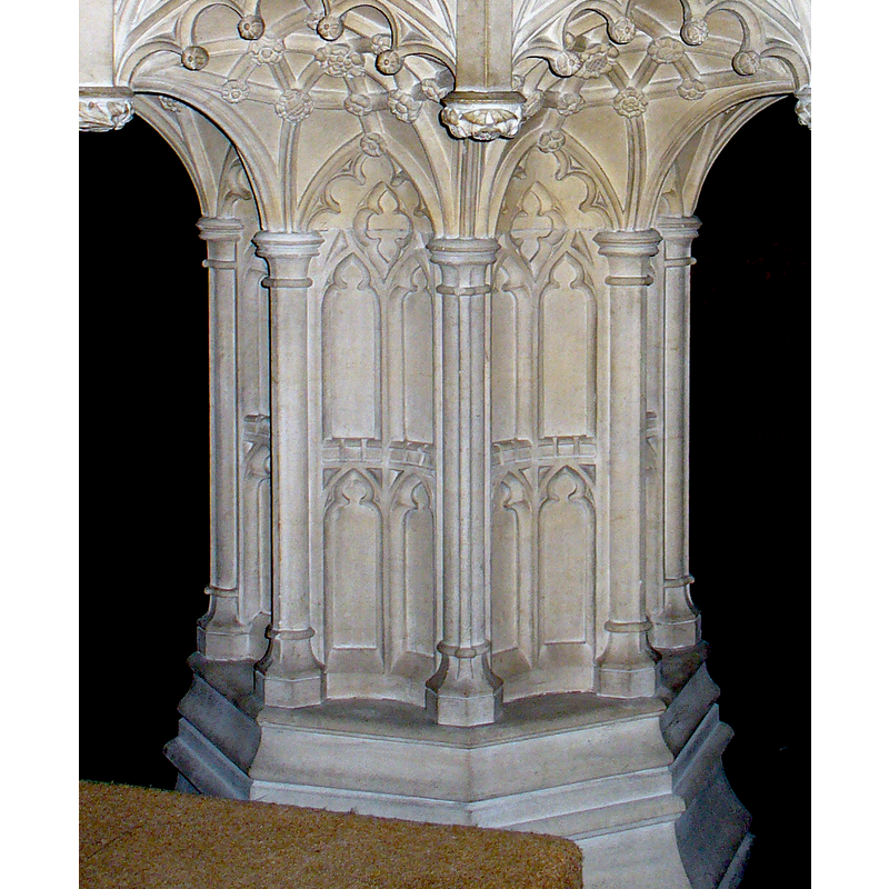
Scene Description: the modern font
Copyright Statement: Image copyright © Colin Smith, 2008
Image Source: detail of a digital photograph taken by Colin Smith 25 November 2008
Copyright Instructions: Standing permission
INFORMATION
Font ID: 14021DOR
Object Type: Baptismal Font1?
Font Century and Period/Style: 11th century, Pre-Conquest? / Norman
Church / Chapel Name: Parish Church of St. Martin
Church Patron Saint(s): St. Martin of Tours
Church Notes: church here documented 1086; present church is 19thC re-building
Church Address: Church Street, Dorking, Surrey, RH4 1DW
Site Location: Surrey, South East, England, United Kingdom
Directions to Site: Located on the A24, 20 km E of Guilford, 40 km SW of London
Ecclesiastic Region: Diocese of Guildford
Historical Region: Hundred of Wotton
Additional Comments: disappeared font? (the one of the Domesday-time church) -- cost of a font / price of a font= £200 ca. 1850
Font Notes:
Click to view
There is an entry for Dorking [variant spelling] in the Domesday survey [http://opendomesday.org/place/TQ1649/dorking/] [accessed 14 December 2015]; it mentions a church in it. Brayley (1850) mentions two fonts in this church: near the chancel he notes "a small font, (or bason), on a baluster column", which might be a later font [17-century+?] or a holy-water stoup; the second font noted in Brayley (ibid.): "When the church was rebuilt, a new and handsome octagonal font, of freestone, which stands in the nave, was constructed at a cost of about 200l., [£200] subscribed by the neighbouring gentry; whose arms were sculptured and emblazoned on the shields that ornamented the upper part. But all these heraldic distinctions have been recently obliterated by order of the archdeacon of Surrey." Noted in the Victoria County History (Surrey, vol. 3, 1911) notes: "The floor and lower parts of the walls of the old church remain in vaults under the present church. [...] Probably little or nothing remained of the building recorded in Domesday, except as old material worked up on the walls; but the chancel seems to have retained to the last at the angles of the east end four flat pilaster buttresses of mid-12th-century character." The VCH entry reports a baptismal font of the 19th-century re-building of this church. The font is of the type in which the sides of the traceried octagonal basin overhang a richly-adorned buttressed stem ; the underbowl itself resembling a late-Gothic vaulted ceiling. It is a good Victorian version of a Gothic font. [NB: we have no information on the font of the earlier church]
Credit and Acknowledgements: We are grateful to Colin Smith for his photographs of the modern font
COORDINATES
UTM: 30U 686237 5679095
Latitude & Longitude (Decimal): 51.232797, -0.332324
Latitude & Longitude (DMS): 51° 13′ 58.07″ N, 0° 19′ 56.36″ W
REFERENCES
- Victoria County History [online], University of London, 1993-. URL: https://www.british-history.ac.uk.
- Brayley, Edward Wedlake, A topographical history of Surrey, London: G. Willis, 1850, vol. 5: 100