Sonning / Sonninges
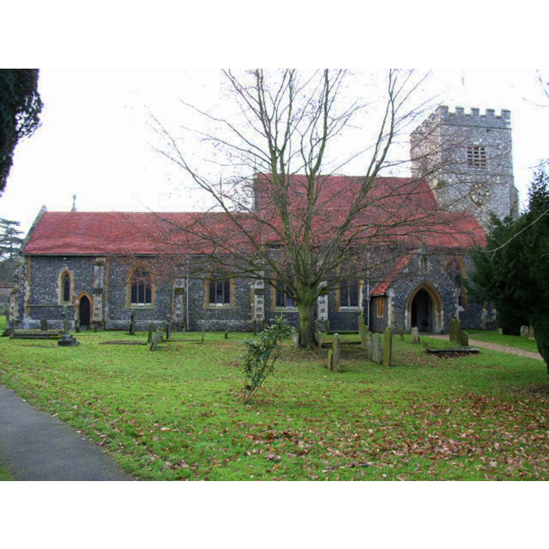
Image copyright © Andrew Smith, 2006
CC-BY-SA-3.0
Results: 2 records
view of church exterior - north view
Copyright Statement: Image copyright © Andrew Smith, 2006
Image Source: digital photograph taken 2 January 2006 by Andrew Smith [http://www.geograph.org.uk/photo/99292] [accessed 25 November 2011]
Copyright Instructions: CC-BY-SA-3.0
view of church interior - plan

Scene Description: showing the location of the font
Copyright Statement: Image copyright © Victoria County History, 2008
Image Source: Berkshire, vol. 3: 210-225 / [www.british-history.ac.uk/vch/berks/vol3/pp210-225] [accessed 25 March 2015]
Copyright Instructions: PERMISSION NOT AVAILABLE -- IMAGE NOT FOR PUBLIC USE
INFORMATION
Font ID: 14001SON
Object Type: Baptismal Font1
Font Century and Period/Style: 12th century, Norman
Cognate Fonts: [cf. FontNotes]
Church / Chapel Name: Parish Church of St. Andrew
Font Location in Church: There is a font in the S aisle, near the N side of the aisle, by the 3rd pillar
Church Patron Saint(s): St. Andrew
Church Address: Sonning, Berkshire, RG4 6UR, UK
Site Location: Berkshire, South East, England, United Kingdom
Directions to Site: Located on the A4, ENE of Reading
Ecclesiastic Region: Diocese of Oxford
Historical Region: Hundred of Charldon [in Domesday] -- Hundred of Sonning
Additional Comments: e-mail asking for confirmation of font sent to Sonning Parish web contact (20 Dec 2008//mt] [no reply: 25 Nov 2014] -- disappeared font? (the one from the Domesday-time church here)
Font Notes:
Click to view
There is an entry for Sonning [variant spelling] in the Domesday survey [http://domesdaymap.co.uk/place/SU7575/sonning/] [accessed 25 March 2015]; the chief tenant in 1086 was "Roger the priest", and there was a church in it. Buck (1951) notes: "the stone book-rest is attached to the pillar alongside which the font has been placed", of which Buck mentions Wraxall (Somerset), Sonning (Berkshire), Beckley (Oxfordshire) and Gillingham (Kent). The Victoria County History (Berkshire, vol. 3, 1923) remarks that the font was 'renewed' in 1852; a church interior plan in the VCH entry shows a font in south aisle, near the north side of the aisle, by the 3rd pillar, and further notes that some parts of the church date back to the Norman and Early English periods. An entry describing a photograph of this object in the Historic England Archive in The National Archives [ref.: CC97/02849] [https://discovery.nationalarchives.gov.uk/details/r/7c2e254e-9d1b-4600-a264-2f3ef9424213] [accessed 18 March 2024] reads: "The pillar font, with an original Norman spiral shaft and tower-like cover, standing against a painted column in the church. The church was mainly rebuilt in the Victorian period [...] Black and white [...] Photographer: Henry W Taunt" [NB: the photo is not available].
Paper Size: 5 x 8 INS
Photographer: Henry W Taunt
Paper Size: 5 x 8 INS
Photographer: Henry W Taunt
COORDINATES
UTM: 30U 644930 5704611
Latitude & Longitude (Decimal): 51.47407, -0.91314
Latitude & Longitude (DMS): 51° 28′ 26.65″ N, 0° 54′ 47.3″ W
MEDIUM AND MEASUREMENTS
Material: stone
REFERENCES
- Victoria County History [online], University of London, 1993-. URL: https://www.british-history.ac.uk.
- Buck, A.G. Randle, "Some Wiltshire fonts. Part II", LIV, CXCIV (June 1951), The Wiltshire Archaeological and Natural History Magazine, 1951, pp. 19-35; p. 35