Sherburn-in-Elmet / Scireburne / Sherburn
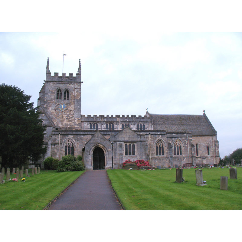
Image copyright © Gordon Hatton, 2012
CC-BY-SA-2.0
Results: 3 records
view of church exterior - south view
Scene Description: Source caption: "All Saints, Sherburn in Elmet. Situated on a hill to the west of the town, this church is more interesting than it would appear at first, with much original Norman work inside."
Copyright Statement: Image copyright © Gordon Hatton, 2012
Image Source: digital photograph taken 15 October 2012 by Gordon Hatton [www.geograph.org.uk/photo/3212040] [accessed 15 May 2015]
Copyright Instructions: CC-BY-SA-2.0
view of church exterior - south view
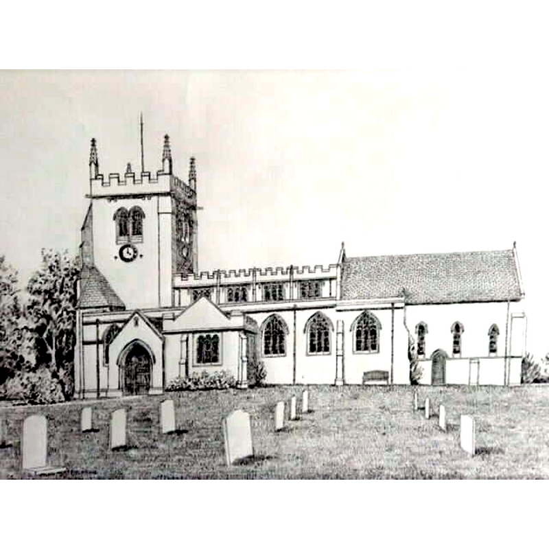
Copyright Statement: Image copyright © Robert Wilkes, 2015
Image Source: 2015 drawing by Robert Wilkes
Copyright Instructions: Standing permission
view of font

Scene Description: the modern font
Copyright Statement: Image copyright © Lesley Norfolk, 2008
Image Source: digital photograph taken 15 June 2003 by Lesley Norfolk [http://www.knottingley.org/today/Localimages/galleryone/sherburn/sherburn107.htm] [accessed 19 November 2008]
Copyright Instructions: PERMISSION NOT AVAILABLE -- IMAGE NOT FOR PUBLIC USE
INFORMATION
Font ID: 13993SHE
Object Type: Baptismal Font1
Font Century and Period/Style: 11th century, Pre-Conquest? / Norman
Church / Chapel Name: Parish Church of All Saints
Church Patron Saint(s): All Saints
Church Address: 36 Church Hill, Sherburn In Elmet, North Yorkshire LS25 6FL
Site Location: North Yorkshire, Yorkshire and the Humber, England, United Kingdom
Directions to Site: Located off (N) the B1222, 12 km W of Selby
Ecclesiastic Region: Diocese of York
Historical Region: Hundred of Barkston [in Domesday] -- formerly WRYrks
Additional Comments: disappeared fonts? (the fonts of the two Domesday-time churches here)
Font Notes:
Click to view
There is an entry for Sherburn [in Elmet] [variant spelling] in the Domesday survey [http://opendomesday.org/place/SE4833/sherburn-in-elmet/] [accessed 21 November 2018]; it reports two priest and two churches in it. Glynne's May 1862 visit to this church, in Butler (2007) reports: "The font is new: an octagonal bowl on a stem." The modern font consists of an octagonal basin with quatrefoiled panels on the sides; one of the panels has the IHS emblem in a traceried frame, but others are simply blank quatrefoils; heavily moulded underbowl chamfer; on a pedestal base with an arcade of eight pointed arches on columns with moulded capitals and bases. [NB: the older parts of the surviving building are said to be Anglo-Saxon, and there were two churches here at the time of the Domesday survey, but we have no information on either of the fonts].
Credit and Acknowledgements: We are grateful to Robert Wilkes for his drawing of this church
COORDINATES
UTM: 30U 614566 5962176
Latitude & Longitude (Decimal): 53.795528, -1.260648
Latitude & Longitude (DMS): 53° 47′ 43.9″ N, 1° 15′ 38.33″ W
REFERENCES
- Glynne, Stephen Richard, The Yorkshire notes of Sir Stephen Glynne (1825-1874), Woodbridge: The Boydell Press; Yorkshire Archaeological Society, 2007, p. 372