Saxton / Saxtun
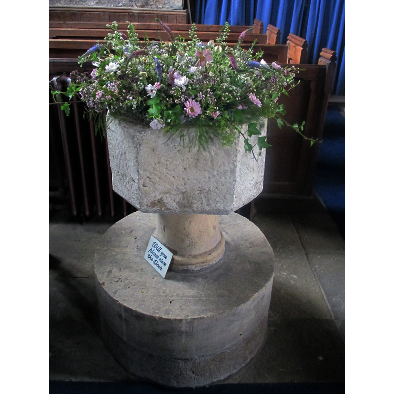
Image copyright © Mike Kirby, 2014
CC-BY-SA-2.0
Results: 3 records
view of font
Scene Description: a medieval octagonal basin on a late-19thC base
Copyright Statement: Image copyright © Mike Kirby, 2014
Image Source: digital photograph taken 31 July 2014 by Mike Kirby [www.geograph.org.uk/photo/4137252] [accessed 20 November 2018]
Copyright Instructions: CC-BY-SA-2.0
view of church exterior - northeast view
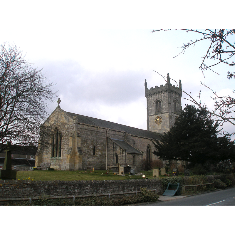
Copyright Statement: Image copyright © John Slater, 2013
Image Source: digital photograph taken 8 April 2013 by John Slater [www.geograph.org.uk/photo/3409759] [accessed 20 November 2018]
Copyright Instructions: CC-BY-SA-2.0
view of church exterior - southeast view
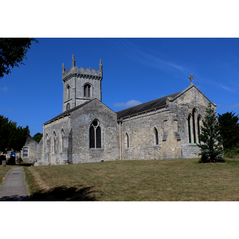
Scene Description: Source caption: "All Saints Church, Saxton. 11th Century and Norman in origin. Over the intervening years the buildings were extended including the tower, constructed during the 15th Century."
Copyright Statement: Image copyright © Chris Heaton, 2018
Image Source: digital photograph taken 11 July 2018 by Chris Heaton [www.geograph.org.uk/photo/5842138] [accessed 20 November 2018]
Copyright Instructions: CC-BY-SA-2.0
INFORMATION
Font ID: 13991SAX
Object Type: Baptismal Font1
Font Century and Period/Style: [composite font?], [composite]
Church / Chapel Name: Parish Church of All Saints
Font Location in Church: Inside the church
Church Patron Saint(s): All Saints
Church Address: Main St, Saxton, Tadcaster LS24 9PY, UK
Site Location: North Yorkshire, Yorkshire and the Humber, England, United Kingdom
Directions to Site: Located off (E) the B1217) and (W) the A162, 6 km SW of Tadcaster, 19 km ENE of Leeds, 24 SW of York
Ecclesiastic Region: Diocese of York
Historical Region: Hundred of Barkston -- formerly WRYrks
Additional Comments: altered font / composite font? (the present one has a 19thC base) -- disappeared font? (the one from the Domesday-time here)
Font Notes:
Click to view
There is an entry for Saxton [variant spelling] in the Domesday survey [http://opendomesday.org/place/SE4736/saxton/] [accessed 20 November 2018]; it reports "1.8 church" in it. Glynne's 30 January 1874 visit to this church, (in Butler, 2007) reports: "The font has a small octagonal bowl on a stem, perhaps modern." In Harman & Pevsner (2017): "Plain irregular octagon, on a base probably of 1876." [NB: the building goes back to Norman times but we have no information on the earlier font(s) of this church]. The entry for this church in Historic England [Listing NGR: SE4757836886] notes: "Church. C11 nave and chancel with C14 south chapel, and early C15 tower with restorations and additions of 1876 and 1907 and later additions. [...] Medieval octagonal font on probably C19 base." Fragments of an early cross were found in this church [cf. entry in Harman & Pevsner (2017: 473), the CRSBI (2018) [www.crsbi.ac.uk/site/2107/] [accessed 20 November 2018] and illustrations in The Megalithic Portal [www.megalithic.co.uk/article.php?sid=16814] [accessed 20 November 2018]], and a 1998 copyrighted photograph by Dianne Tillotson [www.flickr.com/photos/hipbookfairy/26590367545/]
COORDINATES
UTM: 30U 613294 5965537
Latitude & Longitude (Decimal): 53.826, -1.27872
Latitude & Longitude (DMS): 53° 49′ 33.6″ N, 1° 16′ 43.39″ W
MEDIUM AND MEASUREMENTS
Material: stone
Font Shape: octagonal, mounted
Basin Exterior Shape: octagonal
REFERENCES
- Glynne, Stephen Richard, The Yorkshire notes of Sir Stephen Glynne (1825-1874), Woodbridge: The Boydell Press; Yorkshire Archaeological Society, 2007, p. 356
- Harman, Ruth, Yorkshire West Riding: Sheffield and the South, New Haven; London: Yale University Press, 2017, p. 473