Routh / Rute / Rutha
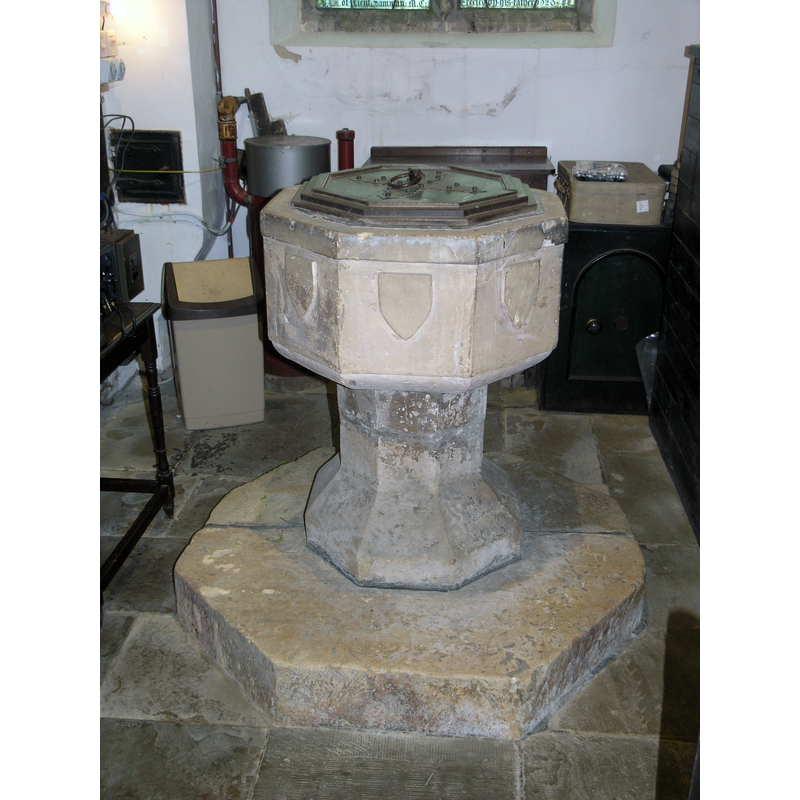
Image copyright © Colin Hinson, 2021
Standing permission
Results: 7 records
view of font and cover - east side
Copyright Statement: Image copyright © Colin Hinson, 2021
Image Source: digital photograph 16 October 2021 by Colin Hinson
Copyright Instructions: Standing permission
view of basin - interior
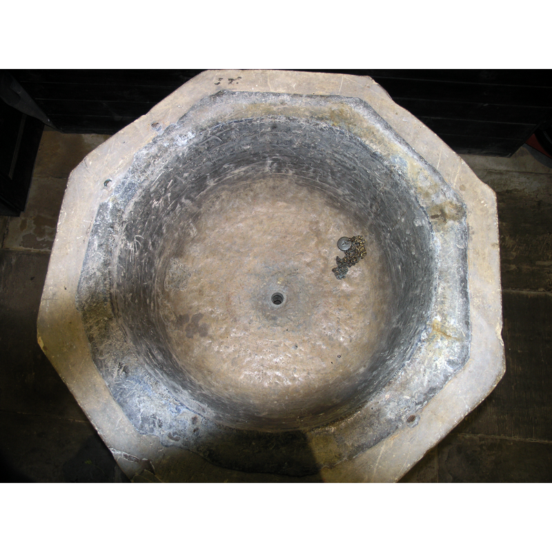
Scene Description: shwing the drain hole and the lead lining
Copyright Statement: Image copyright © Colin Hinson, 2021
Image Source: digital photograph 16 October 2021 by Colin Hinson
Copyright Instructions: Standing permission
symbol - shield - blank - 8
![[cf. FontNotes]](/static-50478a99ec6f36a15d6234548c59f63da52304e5/compressed/1220828012_compressed.png)
Scene Description: [cf. FontNotes]
Copyright Statement: Image copyright © Colin Hinson, 2021
Image Source: digital photograph 16 October 2021 by Colin Hinson
Copyright Instructions: Standing permission
view of church exterior - northwest view
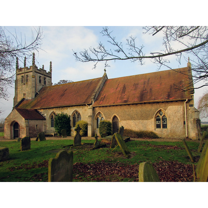
Copyright Statement: Image copyright © Jonathan Thacker, 2017
Image Source: digital photograph taken 15 February 2017 by Jonathan Thacker [www.geograph.org.uk/photo/5284167] [accessed 7 November 2019]
Copyright Instructions: CC-BY-SA-2.0
view of church exterior - southeast view
Copyright Statement: Image copyright © Jonathan Thacker, 2017
Image Source: digital photograph taken 15 February 2017 by Jonathan Thacker [www.geograph.org.uk/photo/5284167] [accessed 7 November 2019]
Copyright Instructions: CC-BY-SA-2.0
view of church interior - object
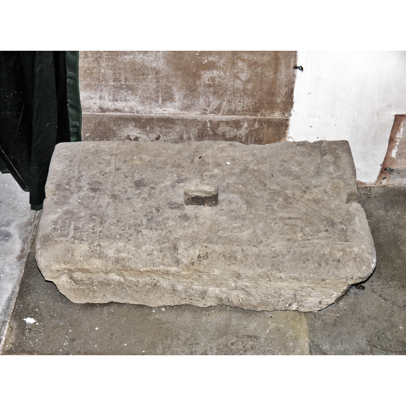
Scene Description: Saxon?
Copyright Statement: Image copyright © Colin Hinson, 2021
Image Source: digital photograph 16 October 2021 by Colin Hinson
Copyright Instructions: Standing permission
view of font and cover in context

Copyright Statement: Image copyright © See Around Britain, 2019
Image Source: edited detail of a digital photograph in See Around Britain [https://seearoundbritain.com/images/27782/p1020889.jpg] [accessed 7 November 2019]
Copyright Instructions: PERMISSION NOT AVAILABLE -- IMAGE NOT FOR PUBLIC USE
INFORMATION
Font ID: 13989ROU
Object Type: Baptismal Font1
Font Century and Period/Style: 14th - 15th century / 19th century, Medieval? / Victorian?
Workshop/Group/Artisan: heraldic font
Church / Chapel Name: Parish Church of All Saints [aka All Hallows]
Font Location in Church: Inside the church, beneath the tower
Church Patron Saint(s): All Saints
Church Notes: Routh's first church late-12thC; ptiest here documented 1213; present church 14thC; renovated 1900
Church Address: Meaux Ln, Routh, Hull, HU17 9SR, UK -- Tel.: +44 1482 868540
Site Location: East Riding of Yorkshire, Yorkshire and the Humber, England, United Kingdom
Directions to Site: Located off (S) the A1035, 3 km ENE from Beverley, 7 km S of Hull
Ecclesiastic Region: Diocese of York
Historical Region: Hundred of Holderness [Middle Hundred]
Additional Comments: disappeared font? (the one from the 12thC church here)
Font Notes:
Click to view
There are two entries, one of which multiple-place, for Routh [variant spellings] in the Domesday survey [https://opendomesday.org/place/TA0942/routh/] [accessed 7 November 2019] neither of which mentions cleric or church in it. Glynne's 30 April 1872 1834 visit to this church (in Butler, 2007) reports: "The font is of late date, has octagonal bowl, with shields on each face, and on an octagonal stem" [NB: Butler (ibid.) adds that the church had been renovated in 1864 and 1869, and that the west tower was completely replaced in 1904-5 -- the font Glynne noted, therefore, must have been just installed before his visit -- we have no information on the earlier font(s) of this church]. Poulson (1840) writes: "The font is under the lancet window in the north-west corner, it is a plain octagon basin and pedestal, with blank shields in each face". The entry for this parish in the Victoria County History (York East Riding, vol. 7, 2002) notes: "There was evidently a church at Routh by the late 12th century [...] The church was dedicated to ALL SAINTS, or ALL HALLOWS, by 1451 [...] About 1830 the nave was reroofed and its south wall rebuilt. [...] The church was further restored in the 1860s [...] Another, more radical, restoration was carried out in 1905 [...] the main work being the rebuilding of the tower. [...] Fittings include a late medieval, octagonal font". The entry for this church in Historic England [Listing NGR: TA0911042505] notes: "Church. C14 nave, C14 chancel, C16 - early C17 south porch, west tower of 1904: extensively restored by Brodick, Lowther and Walker in 1904"; the font is not mentioned in it.
Credit and Acknowledgements: We are grateful to Colin Hinson for his photographs of this font and object
COORDINATES
UTM: 30U 674744 5971927
Latitude & Longitude (Decimal): 53.866355, -0.342383
Latitude & Longitude (DMS): 53° 51′ 58.88″ N, 0° 20′ 32.58″ W
MEDIUM AND MEASUREMENTS
Material: stone
Font Shape: octagonal, mounted
Basin Interior Shape: round
Basin Exterior Shape: octagonal
Drainage System: centre hole in basin
Drainage Notes: lead lined
LID INFORMATION
Date: modern
Material: wood, oak?
Apparatus: no
Notes: octagonal and flat with moulded top; ring handle; modern
REFERENCES
- Victoria County History [online], University of London, 1993-. URL: https://www.british-history.ac.uk.
- Glynne, Stephen Richard, The Yorkshire notes of Sir Stephen Glynne (1825-1874), Woodbridge: The Boydell Press; Yorkshire Archaeological Society, 2007, p. 349
- Poulson, George, The History and Antiquities of the Seigniory of Holderness, in the East Riding [...], Hull: Robert Brown, 1840-1841, vol. 1: 340