Riccall / Richale
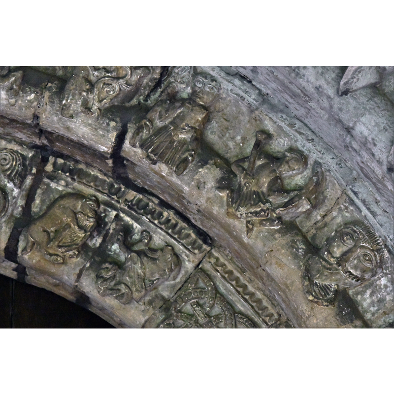
Image copyright © Michael Garlick, 2019
CC-BY-SA-2.0
Results: 4 records
view of church exterior - south portal - archivolt - detail
Copyright Statement: Image copyright © Michael Garlick, 2019
Image Source: digital photograph taken 2 August 2019 by Michael Garlick [www.geograph.org.uk/photo/6238279] [accessed 22 October 2019]
Copyright Instructions: CC-BY-SA-2.0
view of church exterior in context - northeast view
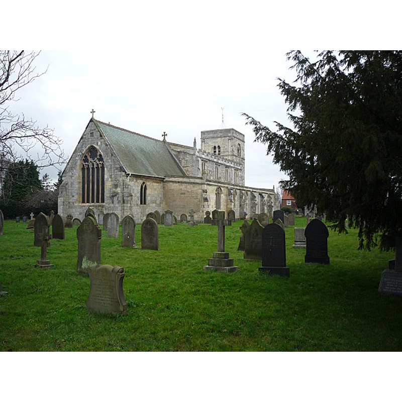
Copyright Statement: Image copyright © DS Pugh, 2012
Image Source: digital photograph taken 8 January 2012 by DS Pugh [www.geograph.org.uk/photo/2757352] [accessed 22 October 2019]
Copyright Instructions: CC-BY-SA-2.0
view of church exterior - west view
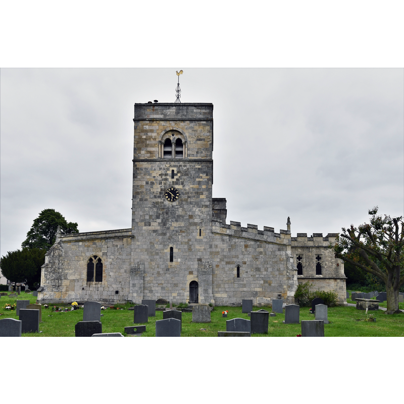
Copyright Statement: Image copyright © Michael Garlick, 2019
Image Source: digital photograph taken 2 August 2019 by Michael Garlick [www.geograph.org.uk/photo/6238270] [accessed 22 October 2019]
Copyright Instructions: CC-BY-SA-2.0
view of church exterior - southeast view
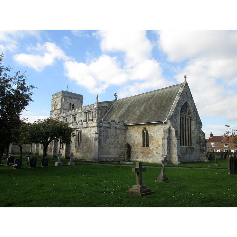
Copyright Statement: Image copyright © John Slater, 2018
Image Source: digital photograph taken 19 October 2018 by John Slater [www.geograph.org.uk/photo/5950344] [accessed 22 October 2019]
Copyright Instructions: CC-BY-SA-2.0
INFORMATION
Font ID: 13987RIC
Object Type: Baptismal Font1?
Font Century and Period/Style: 12th century, Late Norman
Church / Chapel Name: Parish Church of St. Mary
Font Location in Church: [disappeared?]
Church Patron Saint(s): St. Mary the Virgin
Church Address: Church St, Riccall, York, YO19 6PN, UK
Site Location: East Riding of Yorkshire, Yorkshire and the Humber, England, United Kingdom
Directions to Site: Located off (W) the A19, on the E bank of the Ouse river, 5-6 km N of Selby, 15 km S of York
Ecclesiastic Region: Diocese of York
Historical Region: Hundred of Howden
Additional Comments: disappeared font? (the one from the medieval church here)
Font Notes:
Click to view
There are two entries for Riccall [variant spelling] in the Domesday survey [https://opendomesday.org/place/SE6137/riccall/] [accessed 22 October 2019] neither of which mentions cleric nor church in it. Glynne's first visit to this church in February 1825 (in Butler, 2007) does not mention a font. His second visit in October 1867 (ibid.) reports "a new one of Norman character", likely from the renovations of the church that took place between 1862 and 1865. The entry for this parish in the Victoria County History (York East Riding, vol. 3, 1976) notes: "Part of the surviving fabric of the church apparently dates from the 12th century. The church belonged to the prebendary of Riccall, and the parish was within his peculiar jurisdiction. [...] The church of ST. MARY is of stone and consists of chancel, aisled and clerestoried nave with south porch, and west tower. The three westernmost bays of the nave may be mid- to late-12th century in date, if the now reset north and south doorways were original features of it, and the tower probably belongs to the last years of that century. Arcades were cut through both side walls early in the 13th century and narrow aisles built which also lapped the tower. A further bay was added on the east and the chancel was rebuilt, and presumably extended, and provided with a north chapel later in the century"; no font mentioned in this entry. The entry for this church in Historic England [Listing NGR: SE6195937833] notes: "Church. Mid-late C12 nave with early C13 arcades and late C13 chancel and north chapel, and probable C15 south chapel with later additions and alterations including restorations of 1864-5"; no font mentioned here either.
COORDINATES
UTM: 30U 627667 5966709
Latitude & Longitude (Decimal): 53.8332, -1.06
Latitude & Longitude (DMS): 53° 49′ 59.52″ N, 1° 3′ 36″ W
REFERENCES
- Glynne, Stephen Richard, The Yorkshire notes of Sir Stephen Glynne (1825-1874), Woodbridge: The Boydell Press; Yorkshire Archaeological Society, 2007, p. 331