Fulford
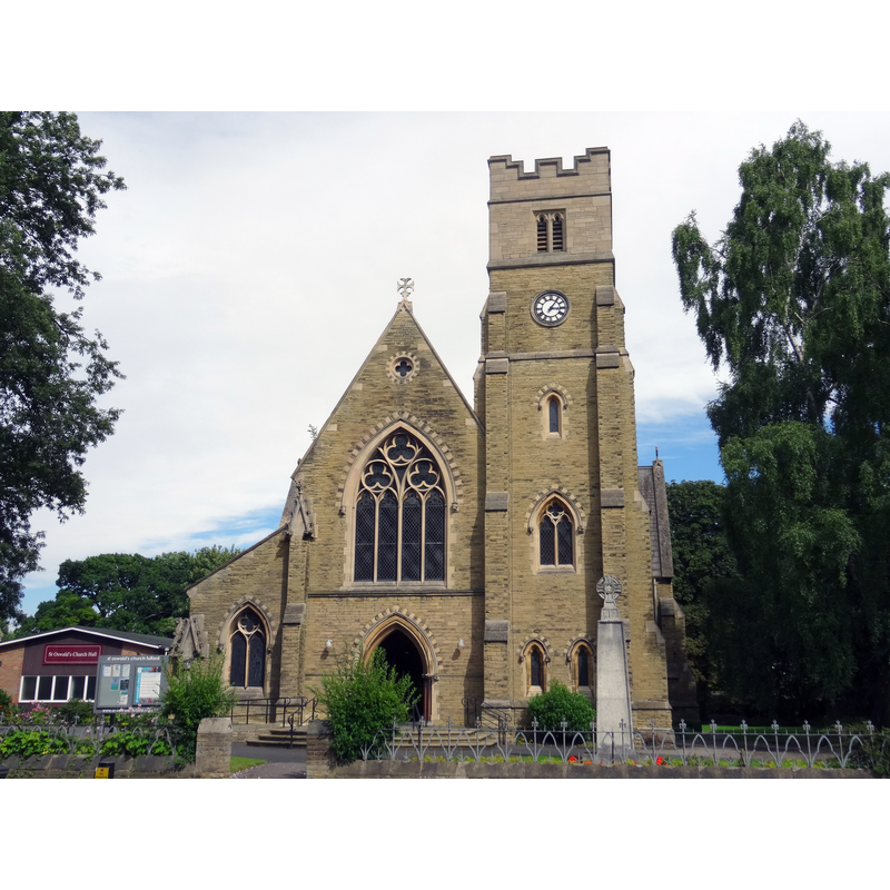
Image copyright © Symac / Sylvain Machefert, 2015
CC-BY-SA-3.0
Results: 3 records
view of church exterior - west view
Scene Description: the modern church seen from Main St
Copyright Statement: Image copyright © Symac / Sylvain Machefert, 2015
Image Source: digital photograph taken 9 August 2015 by Symac / Sylvain Machefert [https://commons.wikimedia.org/wiki/File:St_Oswald's_Church,_Fulford_-_201508_-_2.jpg] [accessed 21 October 2019]
Copyright Instructions: CC-BY-SA-3.0
view of church exterior - south view
![Old St Oswald's was converted into a private dwelling in 1980 [www.yorkpress.co.uk/news/4671235.converted-church-st-oswalds-hall-in-fulford-york/] [accessed 21 October 2019]](/static-50478a99ec6f36a15d6234548c59f63da52304e5/compressed/1191021001_compressed.png)
Scene Description: Old St Oswald's was converted into a private dwelling in 1980 [www.yorkpress.co.uk/news/4671235.converted-church-st-oswalds-hall-in-fulford-york/] [accessed 21 October 2019]
Copyright Statement: Image copyright © Colin Hinson, 2011
Image Source: digital photograph taken 2 September 2011 by Colin Hinson [www.genuki.org.uk/sites/default/files/media/colin_hinson/YKS/ERY/Photographs/ERY/FulfordOldStOswaldNowHall.jpg] [accessed 21 October 2019]
Copyright Instructions: Standing permission
view of church interior - looking east
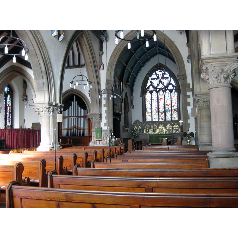
Scene Description: the modern church
Copyright Statement: Image copyright © Chemical Engineer, 2019
Image Source: digital photograph taken 21 October 2019 by Chemical Engineer [https://commons.wikimedia.org/wiki/File:Fulford_St_Oswalds_Interior_2011.jpg] [accessed 21 October 2019]
Copyright Instructions: CC-BY-SA-4.0
INFORMATION
Font ID: 13958FUL
Object Type: Baptismal Font1?
Font Date: ca. 1349?
Font Century and Period/Style: 14th century (mid?), Medieval
Church / Chapel Name: Parish Church of St. Oswald
Church Patron Saint(s): St. Oswald of Nothumbria
Church Notes: Old St Oswald's was converted into a private dwelling in 1980 [www.yorkpress.co.uk/news/4671235.converted-church-st-oswalds-hall-in-fulford-york/] [accessed 21 October 2019]
Church Address: Love Ln, Fulford, York YO10 4QF, UK
Site Location: East Riding of Yorkshire, Yorkshire and the Humber, England, United Kingdom
Directions to Site: Located N of the A64, 2-3 km SE of Yorck town centre, on the E bank of the Ouse
Ecclesiastic Region: Diocese of York
Additional Comments: disappeared fonts? (the one from the original mid-12thC and the other from the re-built church of the 14thC)
Font Notes:
Click to view
No individual entry found for this Fulford in the Domesday survey. There is no mention of any font in Glynne's notes of his 4 December 1851 visit to this church (in Butler, 2007). The Ecclesiologist (vol. XXVIII, 1867: 286), in its report on 'Church restoration in Yorkshire in 1866', notes: "The old church [was] built in 1349 […] The new church was consecrated on the 24th December, 1866 […] The font, like the pulpit, is the work of Mr. Forsyth, of London". Pevsner & Neave (1995) write: "Canopy by Brierle, 1919." The entry for this parish in the Victoria County History (York East Riding, vol. 3, 1976) notes: "The surviving fabric of the 'old' church, which was replaced in the 19th century, shows that it was built c. 1150. [...] Fulford chapel was first expressly mentioned in 1349, when it was dedicated [...] at least by the mid 17th century baptisms and marriages also took place at Fulford. [...] The 'old' church of ST. OSWALD, in St. Oswald's Road, consists of chancel, nave, and west tower. It has been suggested that the nave was built c. 1150 and the chancel added c. 1180, the rubble masonry of the chancel being built up against the finer ashlar of the nave. [...] The interior has been partly stripped of its fittings. [...] A new church of ST. OSWALD was built on Fulford Road to replace the old one and was opened in 1866. [...] The church was burnt out in 1877 but restored and reopened early in 1878. [...] The unsafe spire was removed and the belfry stage of the tower rebuilt in 1924. [...] The 18th-century font was transferred from the old church." This font is described as "'Georgian, simple and delicate; small stone bowl is supported on a column'" in Christopher Rainger's An overview of thearchaeological investigations undertaken in the 1980’s, withan assessment of the history of the churchand its dedication [https://ffhyork.weebly.com/uploads/8/2/0/5/8205739/old_st_oswalds_history___investigations_-_crs_paper_website_version_-_january_2017.pdf] [accessed 21 October 2019].
COORDINATES
UTM: 30U 625968 5978485
Latitude & Longitude (Decimal): 53.9394, -1.08096
Latitude & Longitude (DMS): 53° 56′ 21.84″ N, 1° 4′ 51.46″ W
LID INFORMATION
Date: 1919
Notes: canopy [cf. FontNotes]
REFERENCES
- Victoria County History [online], University of London, 1993-. URL: https://www.british-history.ac.uk.