Guiseley / Othelai
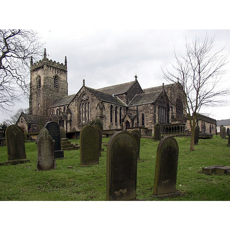
Image copyright © Humphrey Bolton, 2007
CC-BY-SA-2.0
Results: 1 records
view of church exterior - southeast view
Scene Description: Source caption: "St Oswald's Church, Guiseley. This is a Norman church, of which the south arcade of four bays and the south doorway survive. Pevsner liked the south transept, with its large south window [...]; he considered that it was probably built between 1260 and 1275. The north arcade and tower are later, in Perpendicular style. By the late 19C the church was too small, due to the growth of the town, but the rebuilding of the nave and north aisle, and the new chancel, were not started until James Howson became Rector in 1906; they were completed by 1909.
Copyright Statement: Image copyright © Humphrey Bolton, 2007
Image Source: digital photograph taken 15 February 2007 by Humphrey Bolton [www.geograph.org.uk/photo/340809] [accessed 25 October 2018]
Copyright Instructions: CC-BY-SA-2.0
INFORMATION
Font ID: 13949GUI
Object Type: Baptismal Font1?
Font Century and Period/Style: 11th century, Pre-Conquest? / Norman
Church / Chapel Name: Parish Church of St. Oswald
Church Patron Saint(s): St. Oswald of Nothumbria
Church Address: The Green, Guiseley, Leeds, LS20 9BB, UK -- Tel.: (01943) 870208
Site Location: West Yorkshire, Yorkshire and the Humber, England, United Kingdom
Directions to Site: Located off the A65, 3 km S of Otley, 15 km NW of Leeds
Ecclesiastic Region: Diocese of Leeds
Historical Region: Hundred of Skyrak -- formerly WRYrks
Additional Comments: disappeared font? (the one from the Domesday-time church here?)
Font Notes:
Click to view
There is an entry for Guiseley [variant spelling] in the Domesday survey [http://opendomesday.org/place/SE1942/guiseley/] [accessed 26 October 2018]; it reports a priest and a church in it. There is no mention of a font in Glynne's 4 December 1858 visit to this church (in Butler, 2007). [NB: the church dates back to the mid-12th century, and there are three earlier crosses here, one of which with Runic scrolls on it, but we have no information of the original font of this church]. The entry for this church in Historic England [Listing NGR: SE1941542142] notes: "Church. Late C11 or early C12, C13, C15, with additions and alterations, dated 1909, by Sir Charles Nicholson (Pevsner)"; it mentions no font in it.
COORDINATES
UTM: 30U 585058 5970409
Latitude & Longitude (Decimal): 53.87517, -1.70622
Latitude & Longitude (DMS): 53° 52′ 30.61″ N, 1° 42′ 22.39″ W
REFERENCES
- Glynne, Stephen Richard, The Yorkshire notes of Sir Stephen Glynne (1825-1874), Woodbridge: The Boydell Press; Yorkshire Archaeological Society, 2007, p. 198