Lower Slaughter / Sclostre
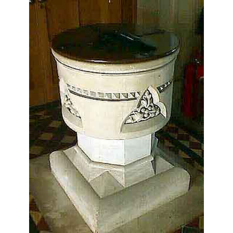
Image copyright © John Wilkes, 2008
Standing permission
Results: 3 records
view of font and cover
Scene Description: the modern font
Copyright Statement: Image copyright © John Wilkes, 2008
Image Source: digital photograph by John Wilkes [www.allthecotswolds.com]
Copyright Instructions: Standing permission
view of church exterior - west tower
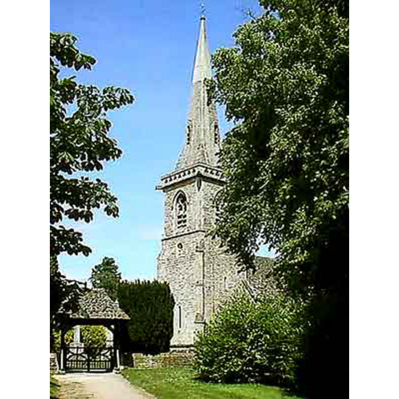
Copyright Statement: Image copyright © John Wilkes, 2008
Image Source: digital photograph by John Wilkes [www.allthecotswolds.com]
Copyright Instructions: Standing permission
view of church interior - nave - looking east
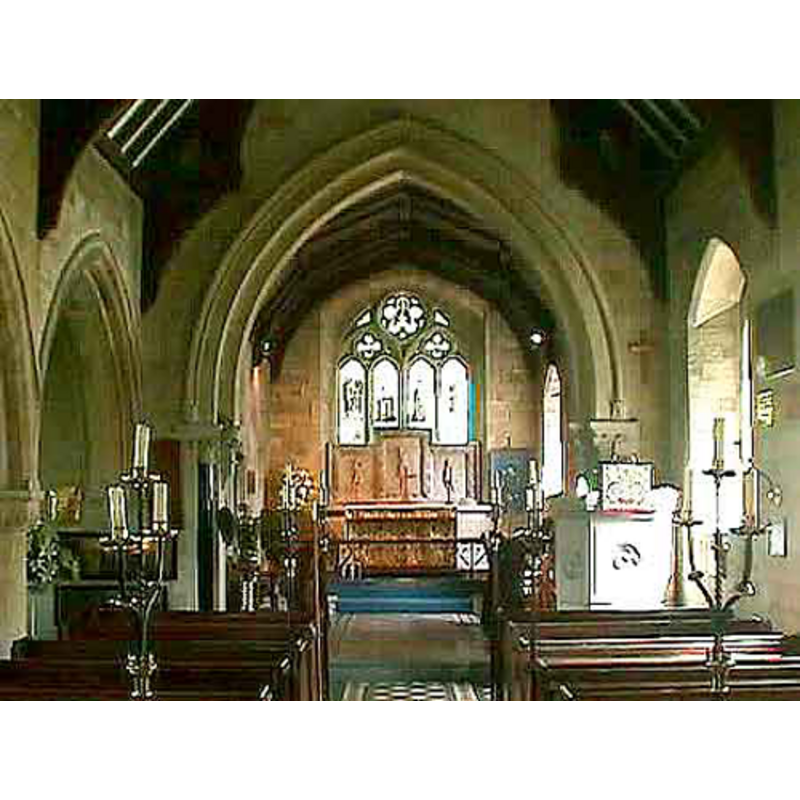
Copyright Statement: Image copyright © John Wilkes, 2008
Image Source: digital photograph by John Wilkes [www.allthecotswolds.com]
Copyright Instructions: Standing permission
INFORMATION
Font ID: 13941SLA
Object Type: Baptismal Font1?
Font Century and Period/Style: 13th century (mid?), Medieval
Church / Chapel Name: Parish Church of St. Mary
Church Patron Saint(s): St. Mary the Virgin
Church Address: Lower Slaughter, Gloucestershire, GL54 2HR
Site Location: Gloucestershire, South West, England, United Kingdom
Directions to Site: Located 6 km SW of Stow-on-the-Wold
Ecclesiastic Region: Diocese of Gloucester
Historical Region: Hundred of Salmonsbury [in Domesday] -- Hundred of Slaughter
Additional Comments: disappeared font? (the one from the medieval church/chapel here)
Font Notes:
Click to view
There is an entry for [Lower] Slaughter [variant spelling] in the Domesday survey [http://domesdaymap.co.uk/place/SP1622/lower-slaughter/] [accessed 6 October 2014], but it mentions neither cleric nor church in it. Modern baptismal font consisting of a cylindrical basin decorated with a band of nail-head and four floral motifs inscribed in trefoiled windows on the sides; raised on an octagonal stem and an octagonal-to-square lower base. The wooden cover is flat and round, with metal decoration; appears modern. The font may probably be dated to the 1860s renovation of the building. The entry for this parish in the Victoria County History (Gloucester, vol. 6, 1965) notes the existence of a chapel-of-ease or parish church here since the mid 13th century, "almost completely rebuilt in 1867", but we have no information of the original font of this church.
Credit and Acknowledgements: We are grateful to John Wilkes, of www.allthecotswolds.com, for his photographs of the church and the new font
COORDINATES
UTM: 30U 585202 5750830
Latitude & Longitude (Decimal): 51.901701, -1.761591
Latitude & Longitude (DMS): 51° 54′ 6.13″ N, 1° 45′ 41.73″ W
LID INFORMATION
Date: modern?
Material: wood
Apparatus: no
Notes: [cf. FontNotes]
REFERENCES
- Victoria County History [online], University of London, 1993-. URL: https://www.british-history.ac.uk.