Lower Oddington
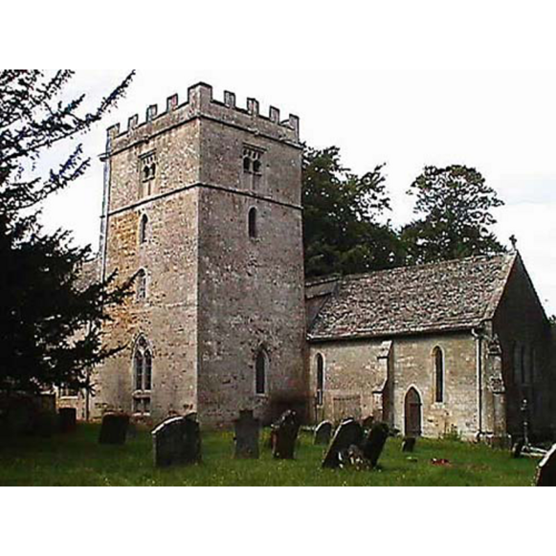
Image copyright © John Wilkes, 2008
Standing permission
Results: 2 records
view of church exterior
Copyright Statement: Image copyright © John Wilkes, 2008
Image Source: digital photograph by John Wilkes [www.allthecotswolds.com]
Copyright Instructions: Standing permission
view of church interior - nave - looking east

Copyright Statement: Image copyright © Alf Beard, 2007
Image Source: digital photograph by Alf Beard 2007 [http://www.wishful-thinking.org.uk/genuki/GLS/Oddington/StNicholas2.html] [accessed 2 November 2008]
Copyright Instructions: PERMISSION NOT AVAILABLE -- IMAGE NOT FOR PUBLIC USE
INFORMATION
Font ID: 13940ODD
Object Type: Baptismal Font1
Font Century and Period/Style: 15th century, Perpendicular
Church / Chapel Name: Parish Church of St. Nicholas
Font Location in Church: Inside the church, in the W end of the S nave
Church Patron Saint(s): St. Nicholas of Myra
Church Notes: medieval Doom wall paintings inside the church -- detailed photos by David Ross available at the Britain Express site [http://www.britainexpress.com/counties/glouces/churches/Oddington/index.htm] [accessed 2 November 2008]
Church Address: Lower Oddington, Gloucestershire, GL56 0XE, UK
Site Location: Gloucestershire, South West, England, United Kingdom
Directions to Site: Located off (N) the B4450, just E of Stow-on-the-Wold ["The ancient parish church of St. Nicholas stands at a distance from both villages, and is a mile from the farther end of Upper Oddington" [cf. VCH entry in FontNotes]]
Ecclesiastic Region: Diocese of Gloucester
Historical Region: Hundred of Slaughter
Additional Comments: disappeared font? (the one from the 12thC church here)
Font Notes:
Click to view
No individual entry for this Oddington found in the Domesday survey. The entry for this parish in the Victoria County History (Gloucester, vol. 6, 1965) notes: "There was a church in Oddington by the 12th century, and part of its fabric has survived. [...] The old church, a building of rubble masonry with a Cotswold stone roof, was built at various dates from the 12th to the 15th century [...] The 15th-century font is octagonal with sculptured faces to the bowl, chamfer, and pedestal" [the VCH footnote cites: "Trans. B.G.A.S. vii, 87"]. The accompanying plan of the church interior in the VCH entry shows the font at the west end of the south nave. Noted in Verey & Brooks (1999-2002): "Font. C15 with octagonal bowl carved with quatrefoils, and trefoil-headed panels on the chamfer and pedestal."
Credit and Acknowledgements: We are grateful to John Wilkes, of www.allthecotswolds.com, for his photograph of this church
COORDINATES
UTM: 30U 592165 5753891
Latitude & Longitude (Decimal): 51.92811, -1.6596
Latitude & Longitude (DMS): 51° 55′ 41.2″ N, 1° 39′ 34.56″ W
REFERENCES
- Victoria County History [online], University of London, 1993-. URL: https://www.british-history.ac.uk.
- Victoria County History [online], University of London, 1993-. URL: https://www.british-history.ac.uk.
- Verey, David, Gloucestershire, London: Penguin Books, 1999-2002, vol. 1: 531