Fingall / Finegala / Finegale / Fingale / Finghall / Fynkale
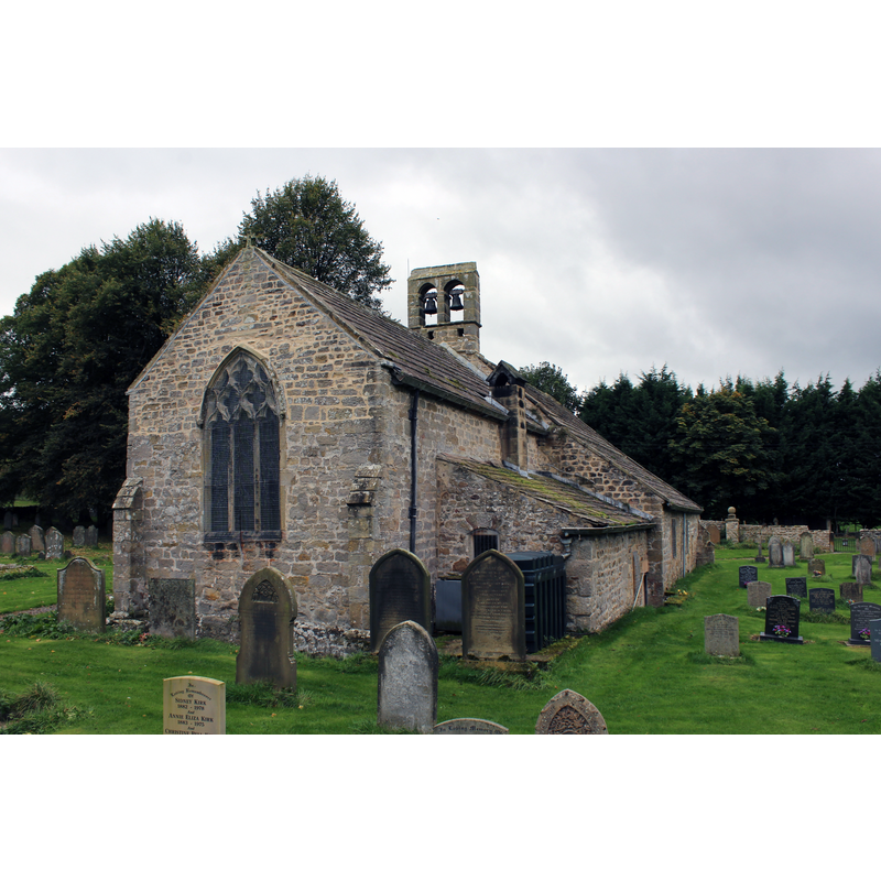
Image copyright © Chris Heaton, 2017
CC-BY-SA-2.0
Results: 3 records
view of church exterior - northeast view
Scene Description: Source caption: "This ancient 12th century church lies about half a mile north east of the village it serves. [...] The Ordnance Survey shows the site of a Medieval Village close to the church - and this must have been the community originally served."
Copyright Statement: Image copyright © Chris Heaton, 2017
Image Source: digital photograph taken 7 October 2017 by Chris Heaton [www.geograph.org.uk/photo/5564963] [accessed 21 November 2019]
Copyright Instructions: CC-BY-SA-2.0
view of church exterior - southwest view
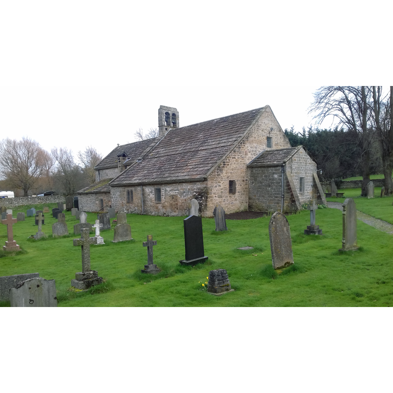
Copyright Statement: Image copyright © The joy of all things, 2018
Image Source: digital photograph taken 14 April 2018 by The joy of all things [https://commons.wikimedia.org/wiki/File:The_Church_of_St_Andrew,_Finghall.jpg] [accessed 21 November 2019]
Copyright Instructions: CC-BY-SA-4.0
design element - motifs - roll moulding


INFORMATION
Font ID: 13935FIN
Object Type: Baptismal Font1
Font Century and Period/Style: 13th century, Early English
Church / Chapel Name: Parish Church of St. Andrew
Font Location in Church: Inside the church
Church Patron Saint(s): St. Andrew
Church Notes: there may have been an earlier Anglo-Saxon church or chapel here but no trace of it remains; present church goes back to 12thC
Church Address: Fingall, Leyburn DL8 5LY, UK
Site Location: North Yorkshire, Yorkshire and the Humber, England, United Kingdom
Directions to Site: Located off (S) the A684, 6-8 km E of Leyburn, 10-12 S of Richmond. The church is located about 1 km NE of the village
Ecclesiastic Region: Diocese of Leeds
Historical Region: Hundred of Land of Count Alan -- formerly Richmondshire
Additional Comments: disappeared font? (the one from the mid-12thC or earlier church here)
Font Notes:
Click to view
There is an entry for Fingall [variant spelling] in the Domesday survey [https://opendomesday.org/place/SE1889/fingall/] [accessed 21 November 2019] but it mentions niether cleric nor church in it. Glynne's 30 May 1871 visit to this church (in Butler, 2007) notes: "The font has plain octagonal bowl". The entry for this parish in the Victoria County History (York North Riding, vol. 1, 1914) notes: "A church probably stood here in the 12th century, with a nave of the same size and a smaller chancel, but no details of that date remain unless we except a blocked doorway in the south wall of the nave, which from its outline seems to be of about 1140"; no font mentioned in it. The entry for this church in Historicv England [Listing NGR: SE1906390166] notes; "Church. Mid C12, c1200, mid and late C14. [...] C13 octagonal font, tapering as an inverted pyramid, onto a circular base with roll moulding; C17 wooden pyramidal cover with finial." [NB: the fabric of the building goes back at the 12thC]
COORDINATES
UTM: 30U 584033 6018418
Latitude & Longitude (Decimal): 54.306722, -1.708472
Latitude & Longitude (DMS): 54° 18′ 24.2″ N, 1° 42′ 30.5″ W
MEDIUM AND MEASUREMENTS
Material: stone
Font Shape: octagonal, mounted
Basin Interior Shape: round
Basin Exterior Shape: octagonal
LID INFORMATION
Date: 17th century?
Material: wood, oak?
Notes: [cf. FontNotes]
REFERENCES
- Victoria County History [online], University of London, 1993-. URL: https://www.british-history.ac.uk.
- Glynne, Stephen Richard, The Yorkshire notes of Sir Stephen Glynne (1825-1874), Woodbridge: The Boydell Press; Yorkshire Archaeological Society, 2007, p. 180