Collingham nr. Whetherby / Collinham
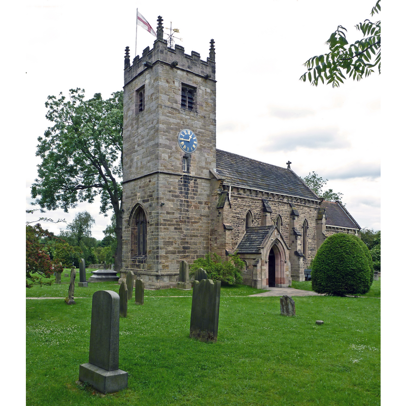
Image copyright © Tim Green, 2012
CC-BY-SA-2.0
Results: 2 records
view of church exterior - southwest view
Copyright Statement: Image copyright © Tim Green, 2012
Image Source: digital photograph taken 17 June 2012 by Tim Green [www.flickr.com/photos/93416311@N00/7403528192] [accessed 25 October 2018]
Copyright Instructions: CC-BY-SA-2.0
view of church exterior - southeast view
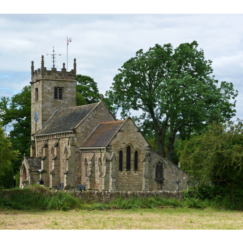
Copyright Statement: Image copyright © Tim Green, 2012
Image Source: digital photograph taken 17 June 2012 by Tim Green [www.flickr.com/photos/93416311@N00/7388718436] [accessed 25 October 2018]
Copyright Instructions: CC-BY-SA-2.0
INFORMATION
Font ID: 13925COL
Object Type: Baptismal Font1?
Font Century and Period/Style: 10th century (?), Pre-Conquest
Church / Chapel Name: Parish Church of St. Oswald
Church Patron Saint(s): St. Oswald of Nothumbria
Church Address: Church Lane, Collingham, West Yorkshire, LS22 5AU
Site Location: West Yorkshire, Yorkshire and the Humber, England, United Kingdom
Directions to Site: Located off the A58, 3 km SSW of Whetherby
Ecclesiastic Region: Diocese of Leeds
Additional Comments: disappeared font (the one from the 10thC (?) Anglo-Saxon church here)
Font Notes:
Click to view
No individual entry found for Collingham in the Domesday survey. Glynne's 1 December 1865 visit to this church (in Butler, 2007) reports: "The font is modern, but octagonal; too small." [NB: the font noted by Glynne is probably from the 1841 restoration; we have no information on the earlier font of this church]. The Parish web site [http://collinghamwithharewood.org/aboutus.aspx] [accessed 22 September 2011] notes: "Although much altered in 1840-1, the church building is thought to be Saxon, with much of the stonework of the nave and chancel pre-dating the Norman Conquest of 1066. The church is dedicated to St Oswald, an Anglo-Saxon saint. There are substantial fragments of two Anglo-Saxon crosses - the Apostle's Cross, dated between the 8th and 10th Centuries, and a second Runic Cross decorated with intertwined dragons, thought to date from circa 900AD."
COORDINATES
UTM: 30U 604644 5974573
Latitude & Longitude (Decimal): 53.909, -1.407
Latitude & Longitude (DMS): 53° 54′ 32.4″ N, 1° 24′ 25.2″ W
REFERENCES
- Glynne, Stephen Richard, The Yorkshire notes of Sir Stephen Glynne (1825-1874), Woodbridge: The Boydell Press; Yorkshire Archaeological Society, 2007, p. 146