King's Stanley / Stantone
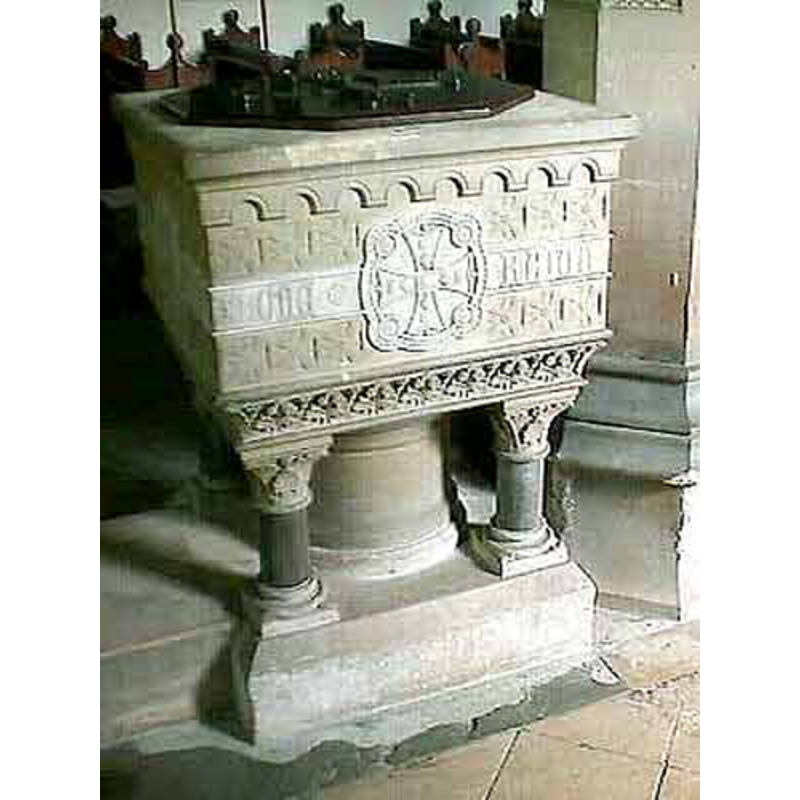
Image copyright © John Wilkes, 2008
Standing permission
Results: 4 records
view of font and cover
Scene Description: the modern font
Copyright Statement: Image copyright © John Wilkes, 2008
Image Source: digital photograph by John Wilkes [www.allthecotswolds.com]
Copyright Instructions: Standing permission
view of church exterior - south view
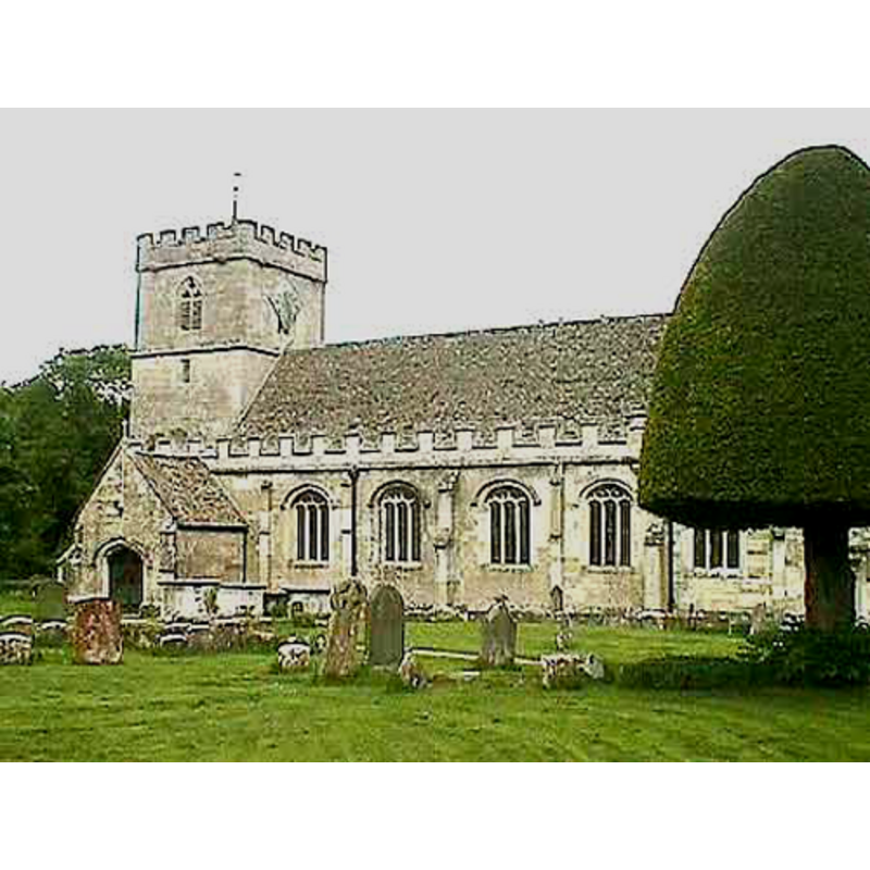
Copyright Statement: Image copyright © John Wilkes, 2008
Image Source: digital photograph by John Wilkes [www.allthecotswolds.com]
Copyright Instructions: Standing permission
view of church interior - nave - looking east
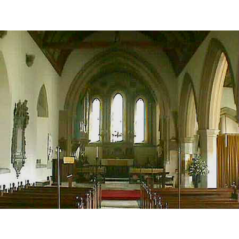
Scene Description: the main/north nave
Copyright Statement: Image copyright © John Wilkes, 2008
Image Source: digital photograph by John Wilkes [www.allthecotswolds.com]
Copyright Instructions: Standing permission
view of font - detail
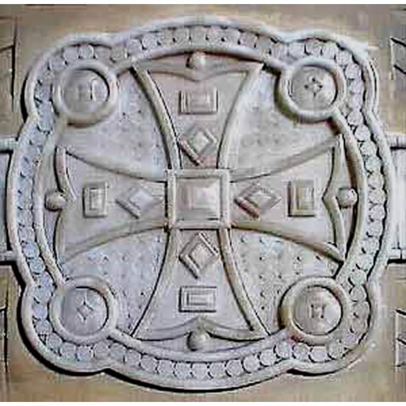
Scene Description: on the modern font
Copyright Statement: Image copyright © John Wilkes, 2008
Image Source: digital photograph by John Wilkes [www.allthecotswolds.com]
Copyright Instructions: Standing permission
INFORMATION
Font ID: 13907KIN
Object Type: Baptismal Font1
Font Century and Period/Style: 12th century, Late Norman
Church / Chapel Name: Parish Church of St. George
Font Location in Church: [disappeared?]
Church Patron Saint(s): St. George
Church Address: Brockley Rd, King's Stanley, Stonehouse GL10 3LH, UK
Site Location: Gloucestershire, South West, England, United Kingdom
Directions to Site: Located at the junction with Brockley Road, off the A419, just SE of Stonehouse, WSW of Stroud
Ecclesiastic Region: Diocese of Gloucester
Historical Region: Hundred of Whitstone -- Hundred of Blachelaue [in Domesday]
Additional Comments: disappeared font? the 12thC font [cf. FontNotes]
Font Notes:
Click to view
There is an entry for [King's] Stanton [variant spelling] in the Domesday survey [https://opendomesday.org/place/SO8103/kings-stanley/] [accessed 14 February 2019] but it mentions neither cleric nor church in it. The entry for this parish in the Victoria County History (Gloucester, vol. 10, 1972) notes: "The parish church at King's Stanley had evidently been built by the end of the 12th century […] The church once had a 12th-century font comprising a large bowl with central pedestal and angle shafts; it was replaced by a new one of similar design […] probably at the restoration in the 1870s." The new font is noted in Verey & Brooks (1999-2002): "Font, 1877, a square bowl of cream-coloured stone with inset ivory-coloured marble panels." [NB: the new font is covered in very un-Norman decoration -- we have no information on the missing original font]
COORDINATES
UTM: 30U 549960 5731744
Latitude & Longitude (Decimal): 51.734384, -2.276531
Latitude & Longitude (DMS): 51° 44′ 3.78″ N, 2° 16′ 35.51″ W
MEDIUM AND MEASUREMENTS
Material: stone
Font Shape: square, mounted?
Basin Exterior Shape: square?
REFERENCES
- Victoria County History [online], University of London, 1993-. URL: https://www.british-history.ac.uk.
- Verey, David, Gloucestershire, London: Penguin Books, 1999-2002, vol. 1: 430