Clapton-on-the-Hill / Clapton (Gloucs.)
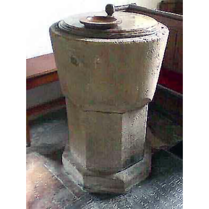
Image copyright © John Wilkes, 2008
Standing permission
Results: 7 records
view of font and cover
Copyright Statement: Image copyright © John Wilkes, 2008
Image Source: digital photograph by John Wilkes [www.allthecotswolds.com]
Copyright Instructions: Standing permission
design element - motifs - scallop - 8
Scene Description: may have been cut at a later date to fit the octagonal pedestal base [cf. Font notes]
Copyright Statement: Image copyright © John Wilkes, 2008
Image Source: digital photograph by John Wilkes [www.allthecotswolds.com]
Copyright Instructions: Standing permission
view of church exterior - southeast view
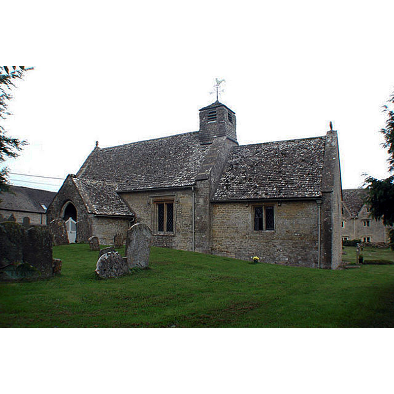
Copyright Statement: Image copyright © John Salmon, 2007
Image Source: digital photograph taken 7 September 2002 by John Salmon [www.geograph.org.uk/photo/343055] [accessed 13 December 2018]
Copyright Instructions: CC-BY-SA-2.0
view of church interior - nave - looking east
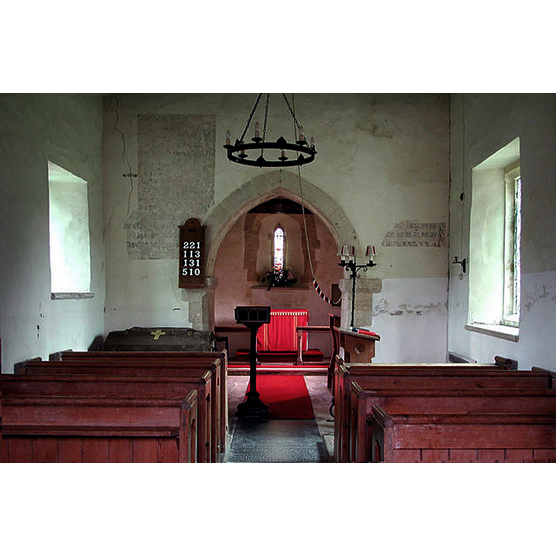
Copyright Statement: Image copyright © John Salmon, 2007
Image Source: digital photograph taken 7 September 2002 by John Salmon [www.geograph.org.uk/photo/343057] [accessed 13 December 2018]
Copyright Instructions: CC-BY-SA-2.0
view of font and cover in context
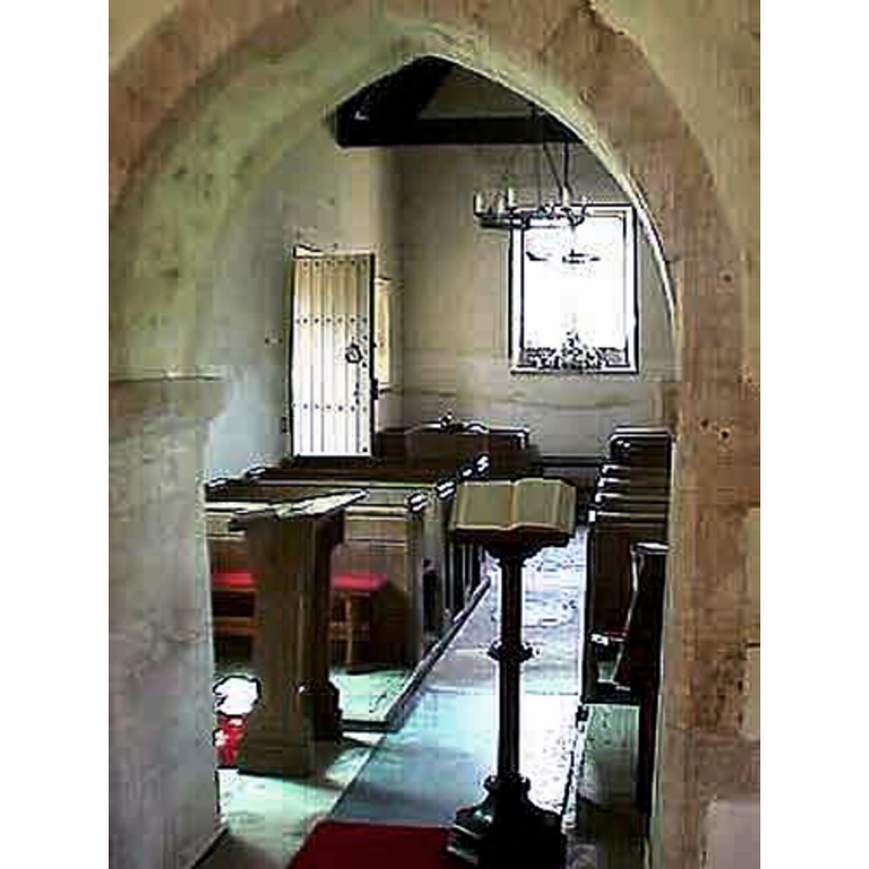
Scene Description: at the west end of the nave, by the south door
Copyright Statement: Image copyright © John Wilkes, 2008
Image Source: digital photograph by John Wilkes [www.allthecotswolds.com]
Copyright Instructions: Standing permission
view of font and cover

Copyright Statement: Image copyright © Guy Thornton, 2011
Image Source: digital photograph taken 5 June 2011 by Guy Thornton [www.flickr.com/photos/bwthornton/5804112206/in/photostream/] [accessed 13 December 2018]
Copyright Instructions: PERMISSION NOT AVAILABLE -- IMAGE NOT FOR PUBLIC USE
view of font and cover in context
Scene Description: at the west end of the nave
Copyright Statement: Image copyright © Guy Thornton, 2011
Image Source: digital photograph taken 5 June 2011 by Guy Thornton [www.flickr.com/photos/bwthornton/5804111288/in/photostream/] [accessed 13 December 2018]
Copyright Instructions: PERMISSION NOT AVAILABLE -- IMAGE NOT FOR PUBLIC USE
INFORMATION
Font ID: 13892CLA
Object Type: Baptismal Font1
Font Century and Period/Style: 12th century, Late Norman
Church / Chapel Name: Parish Church of St. James
Font Location in Church: Inside the church, at the W end of the nave, S side
Church Patron Saint(s): St. James
Church Address: 1 South Terrace, Clapton-on-the-Hill, Cheltenham GL54 2LG, UK
Site Location: Gloucestershire, South West, England, United Kingdom
Directions to Site: Located off the A429, 12 km NW of Burford
Ecclesiastic Region: Diocese of Gloucester
Historical Region: Hundred of Slaughter
Additional Comments: altered font?
Font Notes:
Click to view
No individual entry found for this Clapton / Clapton-on-the-Hill in the Domesday survey. The Victoria County History (Gloucester, vol. 6, 1965) notes: "Architectural evidence indicates that Clapton church existed by the late 12th century; the absence of any medieval documentary reference to it is explained by the fact that it was a chapel of ease to Bourton-on-the-Water. [...] Most of the fabric may be of the late 12th century,, the date of the responds of the chancel arch, the south doorway with its lintel and small tympanum hidden by plaster, and the plain tub font"; the VCH entry footnotes this latter part: "'Glos. Fonts', Trans. B.G.A.S. xlix, 132–3." The baptismal font consists of a bucket-shaped basin, the lower end of which has large scallops that appear to have been cut to fit it onto a plain octagonal pedestal; it is not clear whether the 'fitting' is original or was carried out at a later date, though the base appears medieval. The wooden cover is round and flat, with a knob finial; probably modern.
Credit and Acknowledgements: We are grateful to John Wilkes, of www.allthecotswolds.com, for his photographs of church and font
COORDINATES
UTM: 30U 585066 5746197
Latitude & Longitude (Decimal): 51.86008, -1.764715
Latitude & Longitude (DMS): 51° 51′ 36.29″ N, 1° 45′ 52.97″ W
MEDIUM AND MEASUREMENTS
Material: stone
Font Shape: bucket-shaped, mounted
Basin Interior Shape: round
Basin Exterior Shape: round
LID INFORMATION
Material: wood
Apparatus: no
Notes: [cf. FontNotes]
REFERENCES
- Victoria County History [online], University of London, 1993-. URL: https://www.british-history.ac.uk.