Hornby / Hornby-with-Farleton / Hornebi
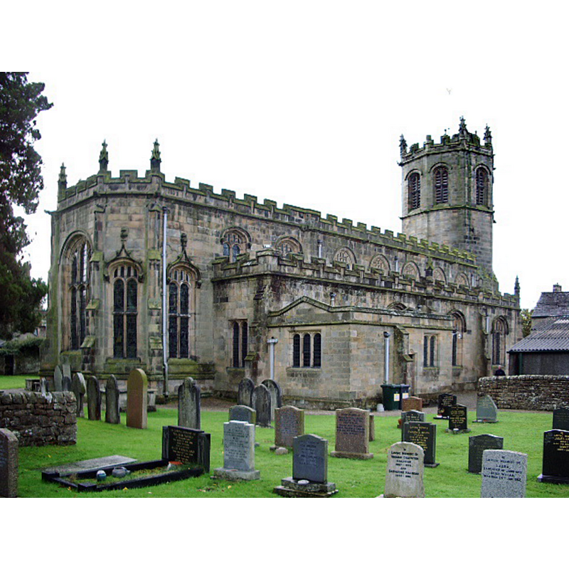
Image copyright © Alexander P Kapp, 2007
CC-BY-SA-2.0
Results: 6 records
view of church exterior - northeast view
Copyright Statement: Image copyright © Alexander P Kapp, 2007
Image Source: digital photograph taken 12 November 2007 by Alexander P Kapp [www.geograph.org.uk/photo/611822] [accessed 25 February 2019]
Copyright Instructions: CC-BY-SA-2.0
view of church exterior - southeast view
![INT W W/MODERN FONT+COVER IN CNTXT digital photograph taken 12 November 2007 by Alexander P Kapp [www.geograph.org.uk/photo/611854] [accessed 25 February 2019]
MODERN FONT+COVER digital photograph taken 12 November 2007 by Alexander P Kapp [www.geograph.org.uk/photo/611835] [accessed 25 February 2019]](/static-50478a99ec6f36a15d6234548c59f63da52304e5/compressed/1190302023_compressed.png)
Scene Description: INT W W/MODERN FONT+COVER IN CNTXT digital photograph taken 12 November 2007 by Alexander P Kapp [www.geograph.org.uk/photo/611854] [accessed 25 February 2019]
MODERN FONT+COVER digital photograph taken 12 November 2007 by Alexander P Kapp [www.geograph.org.uk/photo/611835] [accessed 25 February 2019]
Copyright Statement: Image copyright © Alexander P Kapp, 2007
Image Source: digital photograph taken 12 November 2007 by Alexander P Kapp [www.geograph.org.uk/photo/611826] [accessed 25 February 2019]
Copyright Instructions: CC-BY-SA-2.0
view of font and cover in context
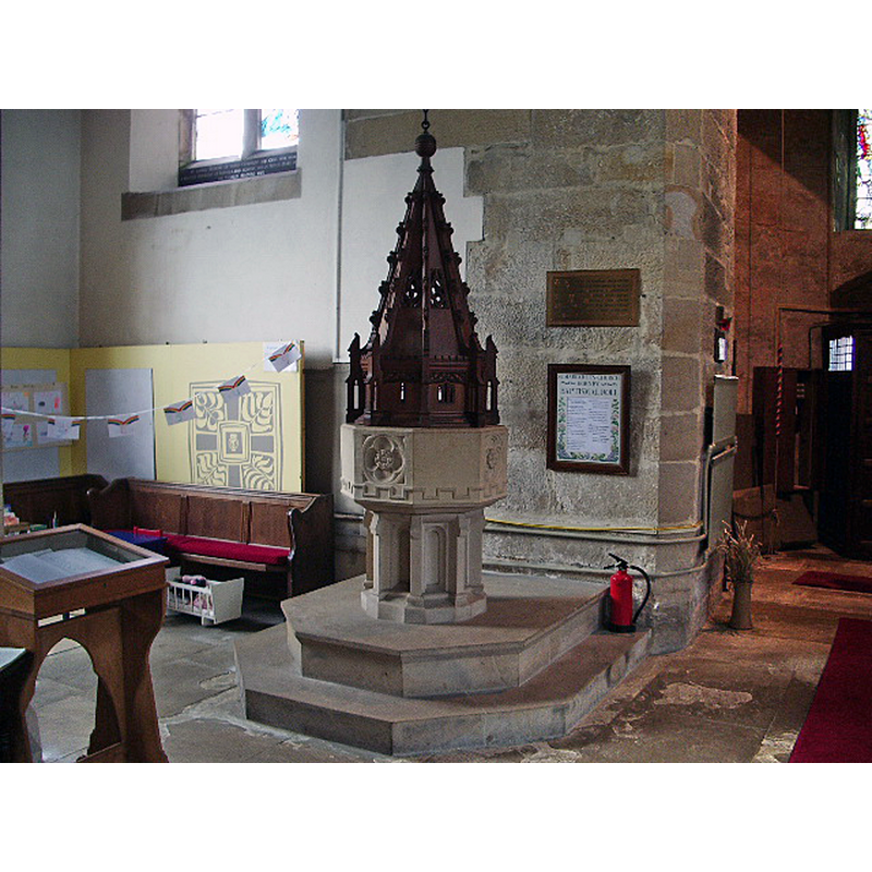
Scene Description: the modern font at the west end of the nave
Copyright Statement: Image copyright © Alexander P Kapp, 2007
Image Source: digital photograph taken 12 November 2007 by Alexander P Kapp [www.geograph.org.uk/photo/611835] [accessed 25 February 2019]
Copyright Instructions: CC-BY-SA-2.0
view of church interior - west end
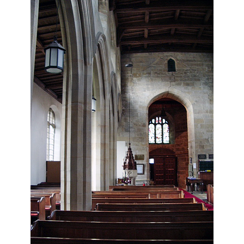
Copyright Statement: Image copyright © Alexander P Kapp, 2007
Image Source: digital photograph taken 12 November 2007 by Alexander P Kapp [www.geograph.org.uk/photo/611854] [accessed 25 February 2019]
Copyright Instructions: CC-BY-SA-2.0
view of church interior - nave - looking west
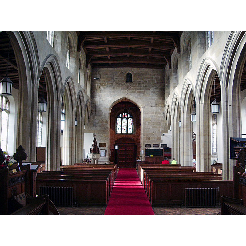
Copyright Statement: Image copyright © Alexander P Kapp, 2007
Image Source: digital photograph taken 12 November 2007 by Alexander P Kapp [www.geograph.org.uk/photo/611852] [accessed 25 February 2019]
Copyright Instructions: CC-BY-SA-2.0
view of church interior - looking east
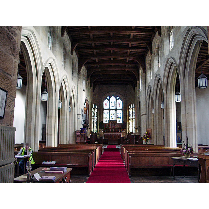
Copyright Statement: Image copyright © Alexander P Kapp, 2007
Image Source: digital photograph taken 12 November 2007 by Alexander P Kapp [www.geograph.org.uk/photo/611833] [accessed 25 February 2019]
Copyright Instructions: CC-BY-SA-2.0
INFORMATION
Font ID: 13888HOR
Object Type: Baptismal Font1?
Font Date: 1338?
Font Century and Period/Style: 14th century, Decorated
Church / Chapel Name: Parish Church of St. Margaret
Church Patron Saint(s): St. Margaret of Antioch [aka Margaret the Virgin, Marina]
Church Notes: church here before 1338 -- A photograph of the pre-Conquest cross base can be seen at the English Heritage -- National Monuments Record [http://www.imagesofengland.org.uk/details/default.aspx?pid=1&id=182421] [accessed 11 October 2008]
Church Address: Main St, Hornby, Lancaster LA2 8LD, UK -- Tel.: 015242 21712
Site Location: Lancashire, North West, England, United Kingdom
Directions to Site: Located on the A683, 8 km ENE of Lancaster
Ecclesiastic Region: Diocese of Blackburn
Historical Region: Hundred of Amounderness
Additional Comments: disappeared font(s)?
Font Notes:
Click to view
There are two entries for this Hornby [variant spelling] in the Domesday survey [https://opendomesday.org/place/SD5868/hornby/] [accessed 25 February 2019] neither of which mentions cleric or church in it. The entry for this parish in the Victoria County History (Lancaster, vol. 8, 1914) notes on St. Margaret's church: "No part is older than the 16th century, the tower having been built in 1514. by Sir Edward Stanley Lord Mounteagle, and the chancel being also his work, but uncompleted at the time of his death in 1524. The rest of the building is modern. The older nave, to which Lord Mounteagle built his tower and chancel, was pulled down and a new nave without aisles erected in 1817 under one wide spanned roof. This was again reconstructed in 1889, when the ceiling and a west gallery were removed, north and south arcades erected, a clearstory added ranging with that of Lord Mounteagle's chancel, and the old square pews which filled the church replaced by modern seating […] On the south side of the churchyard is the pyramidal base of a pre-Conquest cross […] The fittings, including the font and pulpit, are all modern". The entry for this church in English Heritage [Listing NGR: SD5851168581] notes: "Church, with tower built in 1514 by Sir Edward Stanley Lord Monteagle, chancel incomplete at his death in 1524, nave rebuilt 1817, and arcades and clerestorey added 1889", but mentions no font in it. [NB: we have no information on the earlier fonts of the original or the later churches]
COORDINATES
UTM: 30U 523828 5995969
Latitude & Longitude (Decimal): 54.111326, -2.635519
Latitude & Longitude (DMS): 54° 6′ 40.78″ N, 2° 38′ 7.87″ W
REFERENCES
- Victoria County History [online], University of London, 1993-. URL: https://www.british-history.ac.uk.