East Chiltington / Childeltune / Childetune
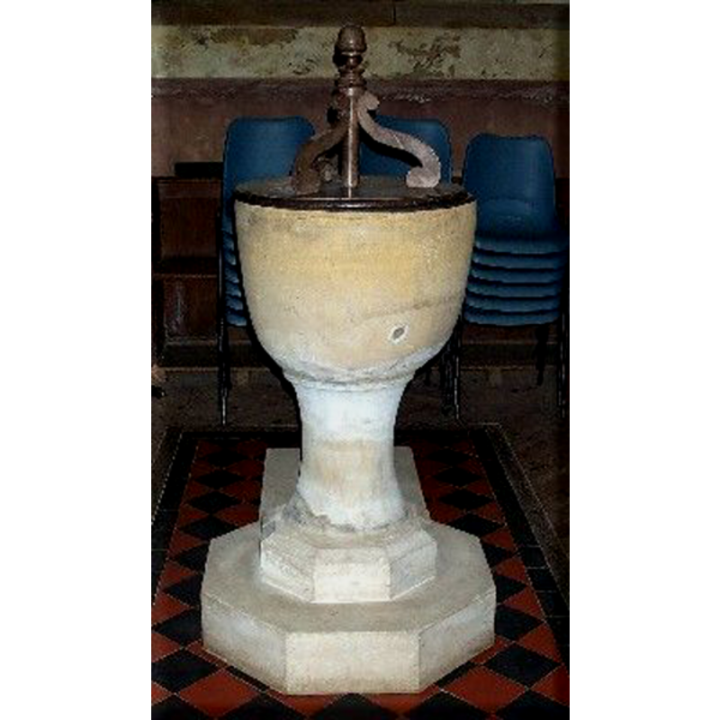
Image copyright © Mark Collins, 2008
Standing permission
Results: 3 records
view of font and cover
Copyright Statement: Image copyright © Mark Collins, 2008
Image Source: digital photograph by Mark Collins [http://www.roughwood.net/ChurchAlbum/EastSussex/EastChiltington/EastChiltington2004.htm] [accessed 5 October 2008]
Copyright Instructions: Standing permission
view of church exterior - south view
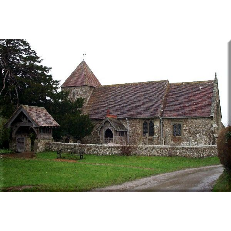
Copyright Statement: Image copyright © Mark Collins, 2008
Image Source: digital photograph by Mark Collins [http://www.roughwood.net/ChurchAlbum/EastSussex/EastChiltington/EastChiltington2004.htm] [accessed 5 October 2008]
Copyright Instructions: Standing permission
view of church interior - nave - looking east
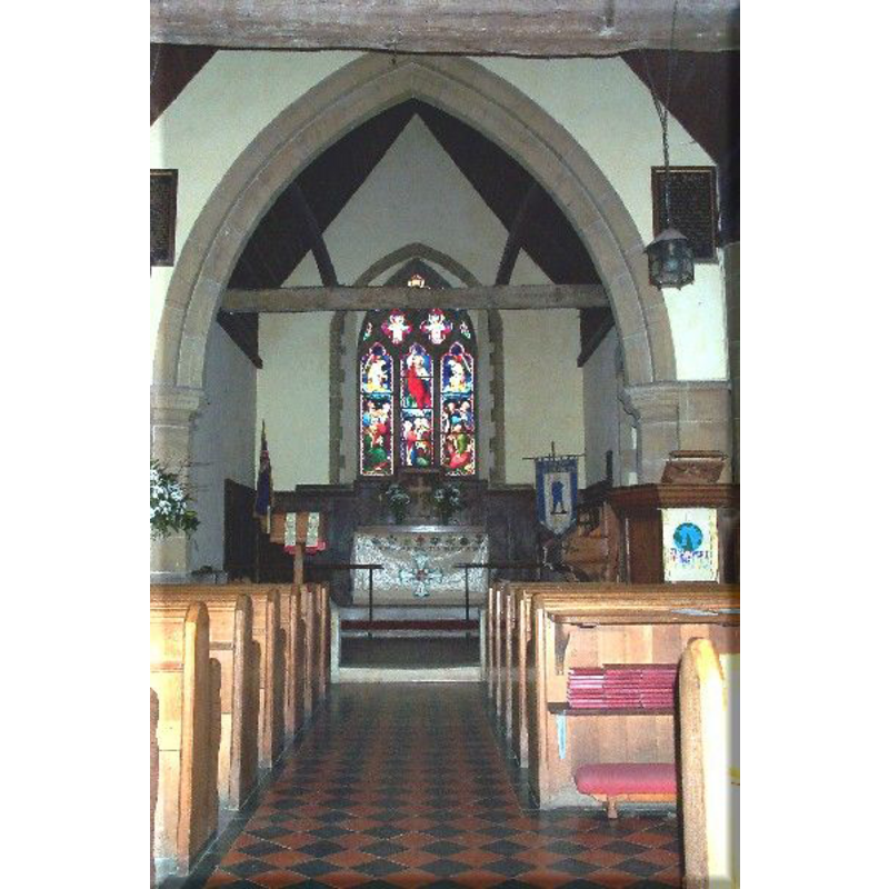
Copyright Statement: Image copyright © Mark Collins, 2008
Image Source: digital photograph by Mark Collins [http://www.roughwood.net/ChurchAlbum/EastSussex/EastChiltington/EastChiltington2004.htm] [accessed 5 October 2008]
Copyright Instructions: Standing permission
INFORMATION
Font ID: 13885CHI
Object Type: Baptismal Font1
Font Century and Period/Style: 13th century [basin only] [composite font], Medieval [composite]
Church / Chapel Name: Parish Church [formerly a chapel]
Font Location in Church: Inside the church, in the W end of the nave, beneath the tower arch
Church Address: Chapel Lane, East Chiltington, East Sussex,
Site Location: East Sussex, South East, England, United Kingdom
Directions to Site: Located off (W) the A275, 4 km W of Barcombe, 7 km NNW of Lewes
Ecclesiastic Region: Diocese of Chichester
Historical Region: Hundred of Streat -- Rape of Lewes -- Sussex
Additional Comments: altered font: the basin appears older and may have been re-tooled or re-carved; the pedetal and lower base appear to be modern.
Font Notes:
Click to view
The Victoria County History (Sussex, vol. 7, 1940) notes: "The chapel, now parish church, of unknown dedication, [...] The nave dates to the early 12th century. A west tower was added c. 1200. The chancel was rebuilt later. The church was restored in 1889–90." There is mention of a font in the VCH entry for this parish, but the VCH shows a floor plan of the church interior showing the font under the tower arch. The font consists of a round and plain tapering basin raised on a circular pedestal base and an octagonal lower base; on a modern plinth with kneeling extension. The wooden cover consists of a round platform with three (?) vertical scrolls around a central pivot with a knob finial; Victorian?
Credit and Acknowledgements: We are grateful to Mark Collins, of www.roughwood.net, for his photographs of church and font
COORDINATES
UTM: 30U 707117 5645027
Latitude & Longitude (Decimal): 50.919659, -0.053157
Latitude & Longitude (DMS): 50° 55′ 10.77″ N, 0° 3′ 11.36″ W
MEDIUM AND MEASUREMENTS
Material: stone
Font Shape: round, mounted -- chalice-shaped
Basin Interior Shape: round
Basin Exterior Shape: round
LID INFORMATION
Material: wood
Apparatus: no
Notes: [cf. FontNotes]
REFERENCES
- Victoria County History [online], University of London, 1993-. URL: https://www.british-history.ac.uk.