Edgeworth / Egeisuurde / Egesworde
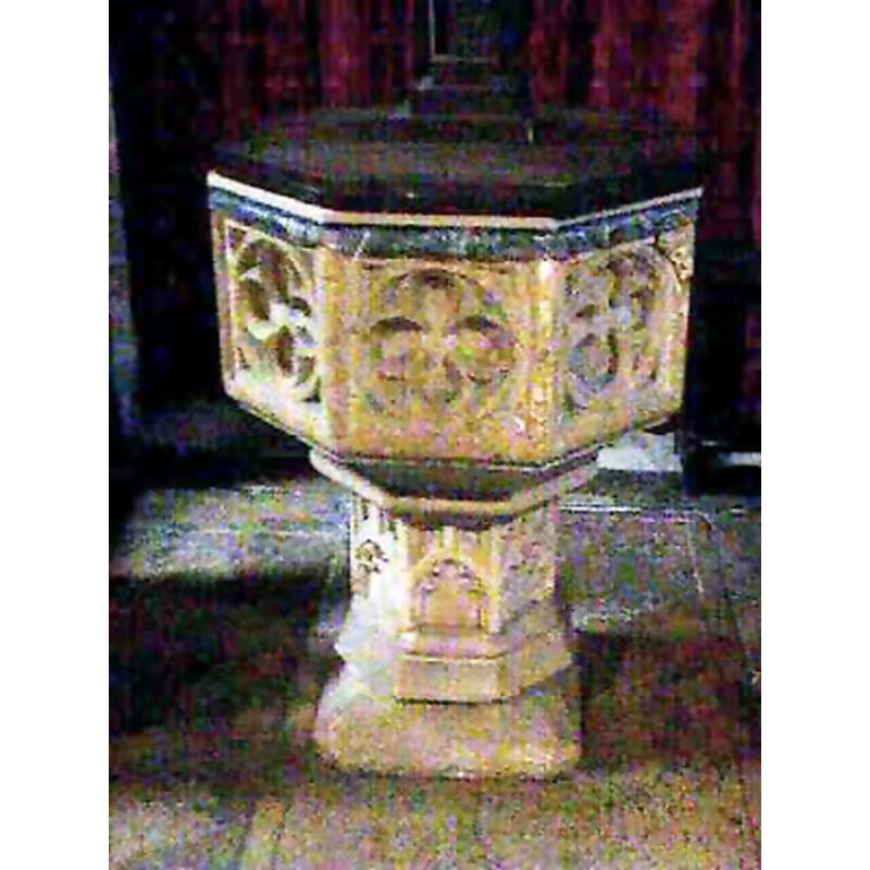
Image copyright © John Wilkes, 2008
Standing permission
Results: 6 records
view of font and cover
Copyright Statement: Image copyright © John Wilkes, 2008
Image Source: digital photograph by John Wilkes [www.allthecotswolds.com]
Copyright Instructions: Standing permission
design element - motifs - quatrefoil - in a circle - in a square - 8
Copyright Statement: Image copyright © John Wilkes, 2008
Image Source: digital photograph by John Wilkes [www.allthecotswolds.com]
Copyright Instructions: Standing permission
design element - motifs - moulding
Copyright Statement: Image copyright © John Wilkes, 2008
Image Source: digital photograph by John Wilkes [www.allthecotswolds.com]
Copyright Instructions: Standing permission
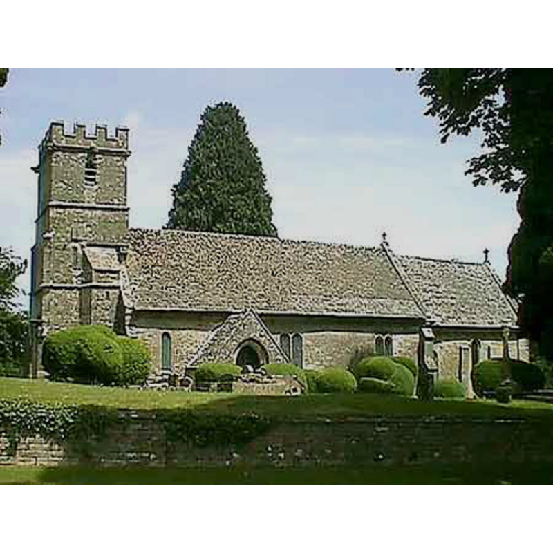
view of church exterior - south view
Copyright Statement: Image copyright © John Wilkes, 2008
Image Source: digital photograph by John Wilkes [www.allthecotswolds.com]
Copyright Instructions: Standing permission
design element - architectural - arch or window - cinquefoiled - 8
Scene Description: truncated stem? [cf. Font notes]
Copyright Statement: Image copyright © John Wilkes, 2008
Image Source: digital photograph by John Wilkes [www.allthecotswolds.com]
Copyright Instructions: Standing permission
design element - motifs - moulding
Scene Description: [cf. Font notes]
Copyright Statement: Image copyright © John Wilkes, 2008
Image Source: digital photograph by John Wilkes [www.allthecotswolds.com]
Copyright Instructions: Standing permission
INFORMATION
Font ID: 13878EDG
Object Type: Baptismal Font1
Font Century and Period/Style: 15th century, Perpendicular
Church / Chapel Name: Parish Church of St. Mary
Font Location in Church: Inside the church
Church Patron Saint(s): St. Mary the Virgin
Church Address: Edgeworth, Gloucester GL6 7JQ, UK
Site Location: Gloucestershire, South West, England, United Kingdom
Directions to Site: Located 8 NW of Cirencester
Ecclesiastic Region: Diocese of Gloucester
Historical Region: Hundred of Bisley
Additional Comments: altered font: the pedestal base has been truncated -- disappeared font? (the one from the 11th-century church here)
Font Notes:
Click to view
There are two entries for Edgeworth [variant spelling] in the Domesday survey [http://opendomesday.org/place/SO9405/edgeworth/] [accessed 18 June 2018], neither of which mentions priest or church in it. The entry for this parish in the Victoria County History (Gloucester, vol. 11, 1976) notes: "Architectural evidence shows that there was a church at Edgeworth by the 11th century and a chaplain was recorded there c. 1220. [...] The earliest part of the building, the west part of the nave, dates from the 11th century and incorporates a north doorway, now blocked. [...] The font, which has an octagonal bowl with quatrefoil panels and a shortened stem, and the piscina in the nave also date from the 15th century. Noted in Verey & Brooks (1999-2002): "Font. Perp[endicular]; octagonal bowl with quatrefoils and truncated panelled stem." The shorthened stem has cinquefoiled arch heads and mouldings at top and bottom. Octagonal wooden cover, flat. [NB: we have no information on the font of the 11th-century church here].
Credit and Acknowledgements: We are grateful to John Wilkes, of www.allthecotswolds.com, for his photographs of church and font
COORDINATES
UTM: 30U 563762 5733893
Latitude & Longitude (Decimal): 51.752308, -2.076295
Latitude & Longitude (DMS): 51° 45′ 8.31″ N, 2° 4′ 34.66″ W
MEDIUM AND MEASUREMENTS
Material: stone
Font Shape: octagonal, mounted
Basin Interior Shape: round
Basin Exterior Shape: octagonal
Drainage Notes: lead-lining
LID INFORMATION
Material: wood
Apparatus: no
Notes: [cf. FontNotes]
REFERENCES
- Victoria County History [online], University of London, 1993-. URL: https://www.british-history.ac.uk.
- Verey, David, Gloucestershire, London: Penguin Books, 1999-2002, vol. 1: 355