Dowdeswell / Dodesuuelle
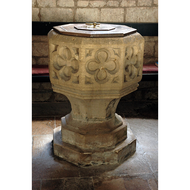
Image copyright © Philip Halling, 2010
CC-BY-SA-2.0
Results: 6 records
view of font and cover
Copyright Statement: Image copyright © Philip Halling, 2010
Image Source: digital photograph taken 5 December 2010 by Philip Halling [www.geograph.org.uk/photo/2190248] [accessed 7 February 2019]
Copyright Instructions: CC-BY-SA-2.0
design element - motifs - quatrefoil - 8
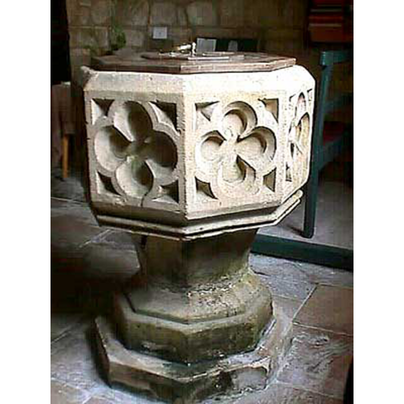
Copyright Statement: Image copyright © John Wilkes, 2008
Image Source: digital photograph by John Wilkes [www.allthecotswolds.com]
Copyright Instructions: Standing permission
design element - motifs - moulding - parallel - 2
Scene Description: [cf. Font notes]
Copyright Statement: Image copyright © John Wilkes, 2008
Image Source: digital photograph by John Wilkes [www.allthecotswolds.com]
Copyright Instructions: Standing permission
view of church exterior - tympanum
Scene Description: Source caption: "A tympanum of the Tree of Life on Dowdeswell church. These are normally placed above the door at the entrance to a church, this one was found in the 19th century and placed high in the gable of the south organ chamber of St Michael's church, Dowdeswell."
Copyright Statement: Image copyright © Philip Halling, 2010
Image Source: digital photograph taken 5 December 2010 by Philip Halling [www.geograph.org.uk/photo/2190248] [accessed 7 February 2019]
Copyright Instructions: CC-BY-SA-2.0
view of church exterior in context - south view
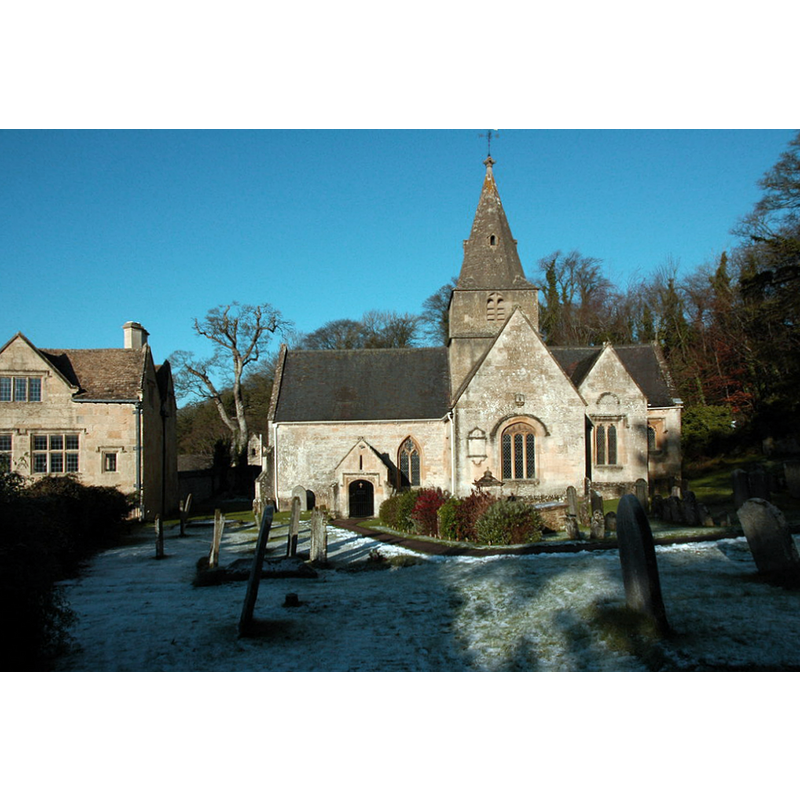
Scene Description: Source caption: "The church at Lower Dowdeswell serves the parishes of Dowdeswell and Andersford."
Copyright Statement: Image copyright © Philip Halling, 2010
Image Source: digital photograph taken 5 December 2010 by Philip Halling [www.geograph.org.uk/photo/2187961] [accessed 7 February 2019]
Copyright Instructions: CC-BY-SA-2.0
view of church interior - nave - looking east
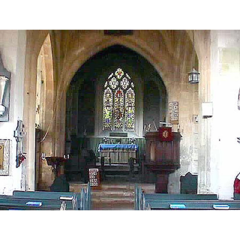
Copyright Statement: Image copyright © John Wilkes, 2008
Image Source: digital photograph by John Wilkes [www.allthecotswolds.com]
Copyright Instructions: Standing permission
INFORMATION
Font ID: 13875DOW
Object Type: Baptismal Font1
Font Century and Period/Style: 15th century, Perpendicular
Church / Chapel Name: Parish Church of St. Michael [aka St Michael and All Saints]
Font Location in Church: Inside the church
Church Patron Saint(s): St. Michael / St. Michael & All Saints
Church Address: Dowdeswell, Gloucestershire, GL54 4LX
Site Location: Gloucestershire, South West, England, United Kingdom
Directions to Site: Located 10 km SE of Cheltenham
Ecclesiastic Region: Diocese of Gloucester
Historical Region: Hundred of Bradley -- Hundred of Wacrescumbe [in Domesday]
Additional Comments: disappeared font? (the one from the Norman church here)
Font Notes:
Click to view
There is an entry for Dodeswell [variant spelling] in the Domesday survey [https://opendomesday.org/place/SP0019/dowdeswell/] [accessed 7 February 2019]; it mentions "0.5 church lands" in it, but not a preiest or a church, though there probably were. Verey & Brooks (1999-2002) note: "Font. Perp[endicular]. Octagonal bowl with quatrefoils." The entry for this parish in the Victoria County History (Gloucester, vol. 9, 2001) notes: "Dowdeswell church, on architectural evidence, was founded during the Norman period. [...] Fragments from a Norman church were found buried in the churchyard in the 19th century, including a tympanum with the 'Tree of Life' motif and some dogtooth ornament and part of a capital, which were later set in the south wall of the organ chamber built in 1867. [...] The font, which has quatrefoil panels on the bowl, dates from the 15th century." The panels on the sides of tha basin are deeply carved, and there is a double moulding around the lower end; the underbowl appears plain; the upper part of the pedestal base is plain, but the lower is splayed, with a step. Small octagonal plinth. The flat wooden cover is octagonal and has metal decoration and a ring handle. [NB: we have no information on the earlier font of this church].
Credit and Acknowledgements: We are grateful to John Wilkes, of www.allthecotswolds.com, for his photographs of church and font
COORDINATES
UTM: 30U 568840 5747905
Latitude & Longitude (Decimal): 51.877667, -1.999953
Latitude & Longitude (DMS): 51° 52′ 39.6″ N, 1° 59′ 59.83″ W
MEDIUM AND MEASUREMENTS
Material: stone
Font Shape: octagonal, mounted
Basin Interior Shape: round
Basin Exterior Shape: octagonal
LID INFORMATION
Material: wood
Apparatus: no
Notes: [cf. FontNotes]
REFERENCES
- Victoria County History [online], University of London, 1993-. URL: https://www.british-history.ac.uk.
- Verey, David, Gloucestershire, London: Penguin Books, 1999-2002, vol. 1: 322