Bisley / Bisley nr. Woking / Bisteleye / Busheley / Busseleghe / Busssley
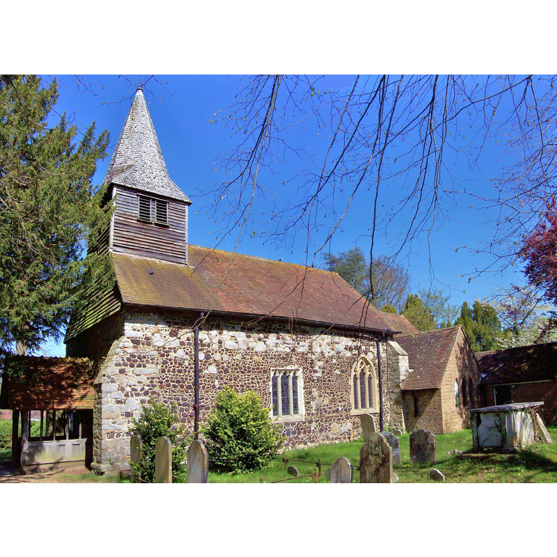
Image copyright © Len Williams, 2014
CC-BY-SA-2.0
Results: 1 records
view of church exterior - south view
Scene Description: Source caption: "St John the Baptist Church, Bisley. This view of the church of St John the Baptist at Bisley shows the 13th century Nave and the Belfry and Porch which were added during the 14th century. Extensive renovation of the church was carried out during the 19th century."
Copyright Statement: Image copyright © Len Williams, 2014
Image Source: digital photograph taken 16 April 2014 by Len Williams [www.geograph.org.uk/photo/3934513] [accessed 18 December 2015]
Copyright Instructions: CC-BY-SA-2.0
INFORMATION
Font ID: 13848BIS
Object Type: Baptismal Font1
Font Date: ca. 1872?
Font Century and Period/Style: 12th century / 19th century, Late Norman? / Victorian?
Church / Chapel Name: Parish Church of St. John the Baptist
Font Location in Church: Inside the church
Church Patron Saint(s): St. John the Baptist
Church Address: Church Lane, Bisley, Surrey, GU24 9DX
Site Location: Surrey, South East, England, United Kingdom
Directions to Site: Located on the A322, just S of Chobham, 6 km NW of Woking
Ecclesiastic Region: Diocese of Guildford
Historical Region: Hundred of Godley
Additional Comments: disappeared font(s)?
Font Notes:
Click to view
No individual entry found for this Bisley in the Domesday survey. Allen (1831) notes: "The font is round, quite plain." The entry for this parish in the Victoria County History (Surrey, vol. 3, 1911) reports: "The nave is probably that of a 12th-century building, but no details of that or even of the two following centuries are left […] The altar table and font are modern […] The church contains no ancient monuments" [NB: not certain whether the font noted in Allen was the early one, as the renovation of this church occurred in the early 1870s; if not the old font, we have no information on the earlier font(s) of this church]
COORDINATES
UTM: 30U 665327 5688893
Latitude & Longitude (Decimal): 51.327268, -0.627013
Latitude & Longitude (DMS): 51° 19′ 38.17″ N, 0° 37′ 37.25″ W
MEDIUM AND MEASUREMENTS
Material: stone
Font Shape: round
Basin Interior Shape: round
Basin Exterior Shape: round
REFERENCES
- Victoria County History [online], University of London, 1993-. URL: https://www.british-history.ac.uk.
- Allen, Thomas, A History of the County of Surrey ; comprising every object of topographical, geological, or historical interest, London: Isaac Taylor Hinton, 1831, vol. 2: 60