Salford Priors / Priors Salford / Salford
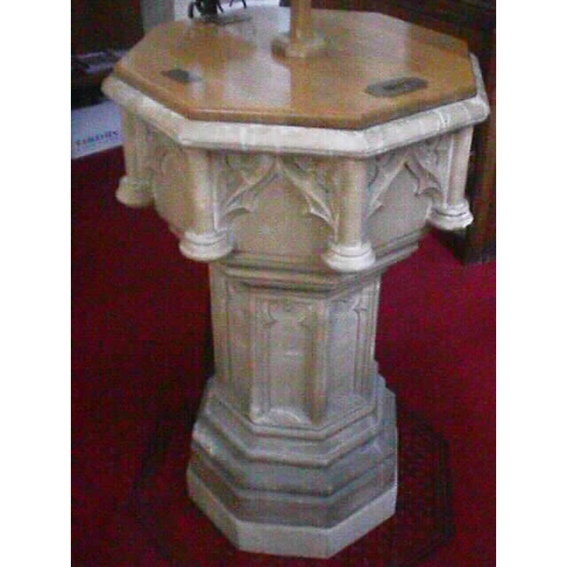
Image copyright © John Wilkes, 2008
Standing permission
Results: 3 records
view of font and cover
Scene Description: the modern font
Copyright Statement: Image copyright © John Wilkes, 2008
Image Source: digital photograph taken by John Wilkes 20 September 2008 [www.allthecotswolds.com]
Copyright Instructions: Standing permission
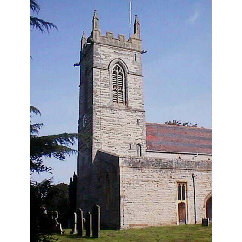
view of church exterior - southwest end
Copyright Statement: Image copyright © John Wilkes, 2008
Image Source: digital photograph taken by John Wilkes 20 September 2008 [www.allthecotswolds.com]
Copyright Instructions: Standing permission
view of church exterior - north portal - tympanum
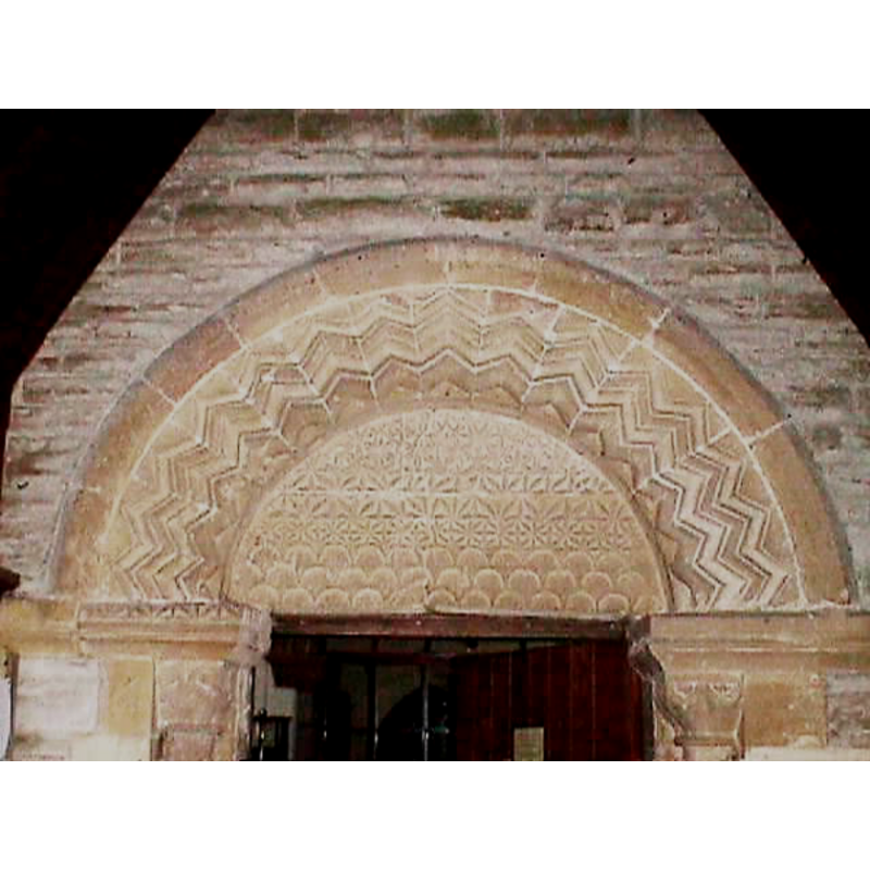
Scene Description: 12th-century, Norman
Copyright Statement: Image copyright © John Wilkes, 2008
Image Source: digital photograph taken by John Wilkes 20 September 2008 [www.allthecotswolds.com]
Copyright Instructions: Standing permission
INFORMATION
Font ID: 13846SAL
Object Type: Baptismal Font1?
Font Century and Period/Style: 12th century, Late Norman
Church / Chapel Name: Parish Church of St. Matthew
Font Location in Church: Inside the church, in the SW corner of the S aisle
Church Patron Saint(s): St. Matthew
Church Address: Station Road, Salford Priors, Warwickshire WR11 8XL
Site Location: Warwickshire, West Midlands, England, United Kingdom
Directions to Site: Located on the A46, 10 km SSW of Alcester, 13 km W of Stratford-upon-Avon
Ecclesiastic Region: Diocese of Coventry
Historical Region: Hundred of Fernecombe [in Domesday] -- Hundred of Barlichway
Additional Comments: disappeared font?
Font Notes:
Click to view
There is an entry for this Salford in the Domesday survey [http://domesdaymap.co.uk/place/SP0751/salford-priors/] [accessed 22 July 2014]; it mentions a priest but not a church in it. The Victoria County History (Warwick, vol. 3, 1945) notes on this church: "There was a priest at Salford in 1086. [...] The church was granted with the manor to the canons of Kenilworth by Henry I [i.e., 1100-1135] and confirmed by Simon, Bishop of Worcester. [...] The nave and west tower date from about the middle of the 12th century. There was also a south aisle, probably narrow, with an arcade of three or four bays. The subsequent development of the plan to its present lines was rather abnormal." The present baptismal font here consists of an octagonal basin decorated with Gothic arch heads on the sides, between columns at the angles; the underbowl is graded; the octagonal stem has foiled panels, and the lower base is moulded. The wooden cover is octagonal and flat, with a Latin cross finial. Both font and and cover appear modern, although the font design is somewhat reminiscent of the 14th and 15th century [NB: we have no information on the original font of this church]
Credit and Acknowledgements: We are grateful to John Wilkes, of www.allthecotswolds.com, for his photographs of church and modern font
COORDINATES
UTM: 30U 576022 5779088
Latitude & Longitude (Decimal): 52.157045, -1.888717
Latitude & Longitude (DMS): 52° 9′ 25.36″ N, 1° 53′ 19.38″ W
LID INFORMATION
Date: modern
Material: wood
Apparatus: no
Notes: [cf. FontNotes]
REFERENCES
- Victoria County History [online], University of London, 1993-. URL: https://www.british-history.ac.uk.