Barnsley / Bearmodeslea / Bechebrie
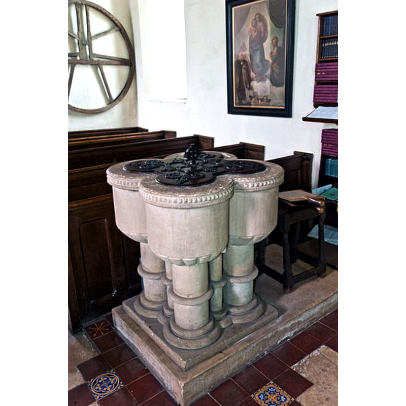
Image copyright © David Ross & Britain Express Ltd, 2018
Standing permission
Results: 5 records
view of font and cover in context - northeast view
Scene Description: the modern font
Copyright Statement: Image copyright © David Ross & Britain Express Ltd, 2018
Image Source: digital photograph by David Ross & Britain Express Ltd [www.britainexpress.com/counties/glouces/churches/Barnsley.htm] [accessed 19 December 2018]
Copyright Instructions: Standing permission
view of font and cover - northwest view
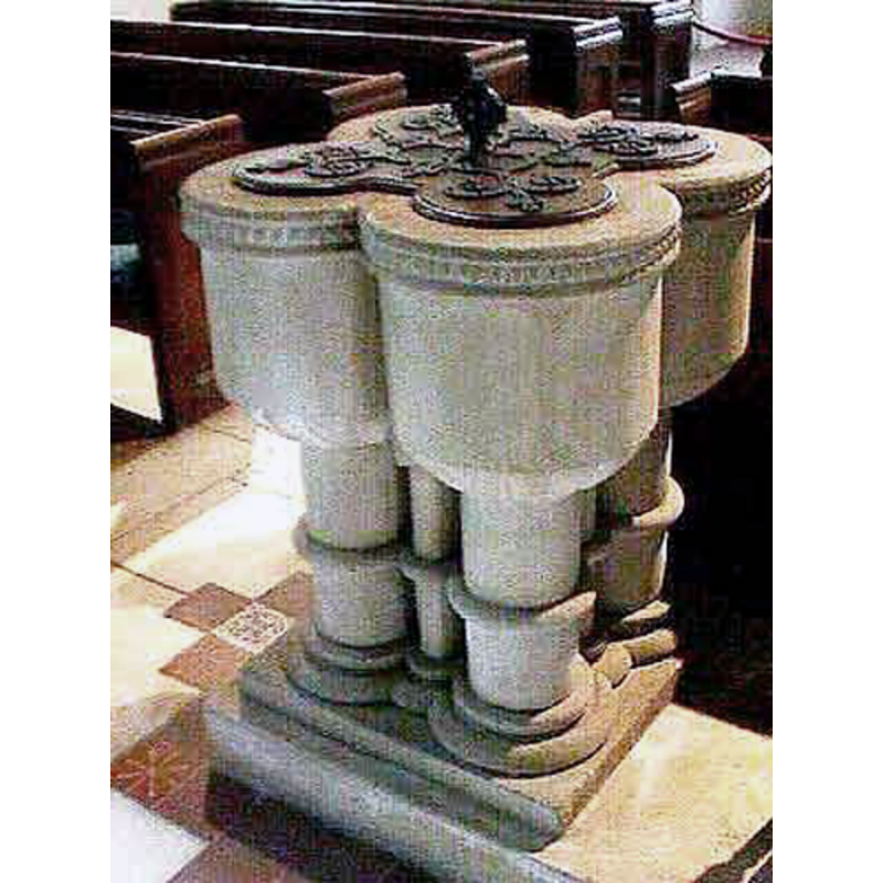
Scene Description: the modern font
Copyright Statement: Image copyright © John Wilkes, 2008
Image Source: digital photograph by John Wilkes [www.allthecotswolds.com]
Copyright Instructions: Standing permission
view of church exterior - southeast view
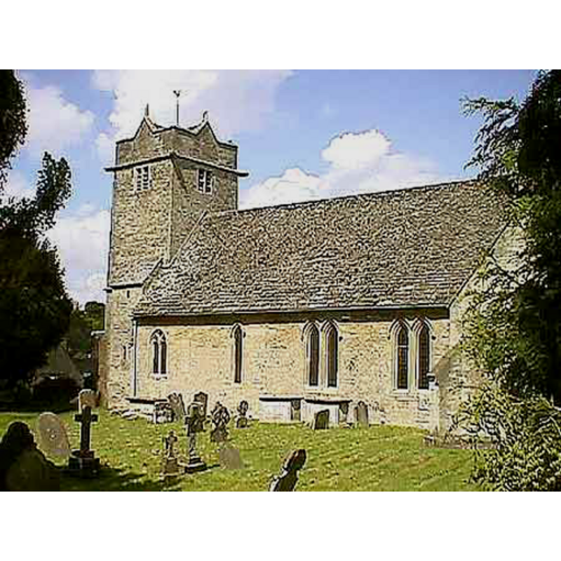
Copyright Statement: Image copyright © John Wilkes, 2008
Image Source: digital photograph by John Wilkes [www.allthecotswolds.com]
Copyright Instructions: Standing permission
view of church interior - nave - looking west
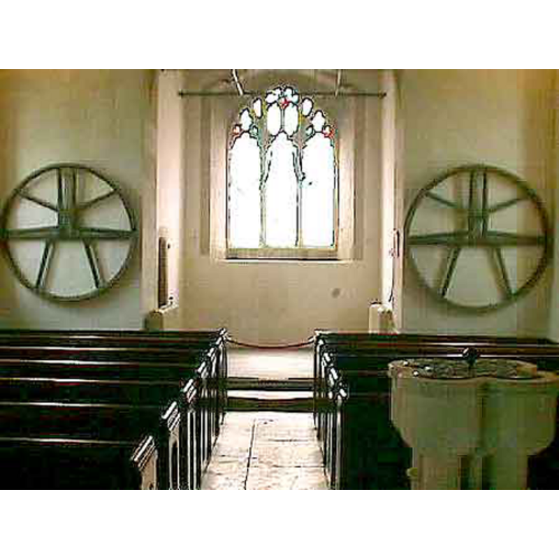
Scene Description: the modern font in the foreground, right side
Copyright Statement: Image copyright © John Wilkes, 2008
Image Source: digital photograph by John Wilkes [www.allthecotswolds.com]
Copyright Instructions: Standing permission
view of church interior - nave - looking east
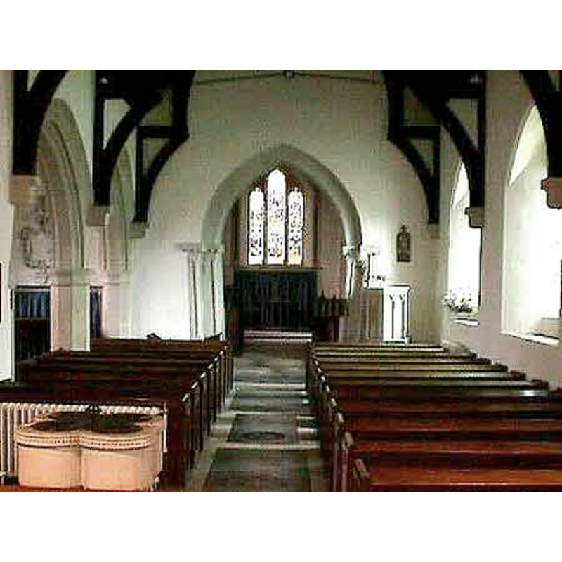
Scene Description: the modern font in the foreground, left side
Copyright Statement: Image copyright © John Wilkes, 2008
Image Source: digital photograph by John Wilkes [www.allthecotswolds.com]
Copyright Instructions: Standing permission
INFORMATION
Font ID: 13840BAR
Object Type: Baptismal Font1
Font Century and Period/Style: 11th century, Pre-Conquest? / Norman
Cognate Fonts: the original, the font at Broadwell, Oxon.
Church / Chapel Name: Parish Church of St. Mary the Virgin
Font Location in Church: [cf. FontNotes]
Church Patron Saint(s): St. Mary the Virgin
Church Address: Church St, Barnsley S70 2AH, UK -- Tel.: +44 7549 876505
Site Location: Gloucestershire, South West, England, United Kingdom
Directions to Site: Located off (N) the A628, 7 km NE of Cirencester, in the Cotswolds
Ecclesiastic Region: Diocese of Gloucester [formerly Worcester]
Historical Region: Hundred of Bibury [in Domesday] -- Hundred of Brightwells Barrow
Additional Comments: replica / copy font [cf. FontNotes] -- disappeared font? (the one from the Domesday-time church here)
Font Notes:
Click to view
There is an entry for Barnsley [variant spelling] in the Domesday survey [http://opendomesday.org/place/SP0705/barnsley/] [accessed 3 October 2018]; the entry mentions a priest as one of the lords in 1086 and "3.0 church lands", but not the church itself, though there must have been one in it. The entry for this parish in the Victoria County History (Gloucester, vol. 7, 1981) notes: "The Norman church apparently comprised chancel and nave and from that church survive the corbel table, now partly concealed, the chancel arch responds, the north doorway, and the bases of a south doorway. [...] The font was replaced c. 1840 by a Norman one, originally from Bradwell (Oxon.), but in 1845 that was returned to Bradwell and a close copy of it made for Barnsley." Verey & Brooks (1999-2002) note: "A copy of the Norman font at Broadwell, Oxfordshire, which found its way into Barnsley church for a few years, and was returned to its proper guardians in 1845." The entry for this church in Historic England [Listing NGR: SP0772905095] notes: "Anglican parish church. C12 foundation, with subsequent alterations of every century, including substantial restoration of 1843-7", but mentions no font in it. [NB: we do not have any information on the whereabouts of this replica font, nor on when the font was actually made] The present font at St. Mary's is of quatrefoil shape, probably Victorian.
Credit and Acknowledgements: We are grateful to John Wilkes, 2008, of www.allthecotswolds.com, and to David Ross and Britain Express Ltd, for their photographs of the church and the Victorian font
COORDINATES
UTM: 30U 576675 5733245
Latitude & Longitude (Decimal): 51.74486, -1.8894
Latitude & Longitude (DMS): 51° 44′ 41.5″ N, 1° 53′ 21.84″ W
REFERENCES
- Victoria County History [online], University of London, 1993-. URL: https://www.british-history.ac.uk.
- Verey, David, Gloucestershire, London: Penguin Books, 1999-2002, p. vol. 1: 159