Peopleton / Peblentune / Peobleton / Pepytton / Piolincgtune / Piplintune / Pipplenton / Publington
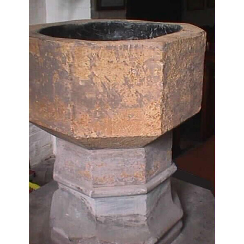
Image copyright © John Wilkes, 2008
Standing permission
Results: 3 records
view of font
Copyright Statement: Image copyright © John Wilkes, 2008
Image Source: digital photograph by John Wilkes [www.allthecotswolds.com]
Copyright Instructions: Standing permission
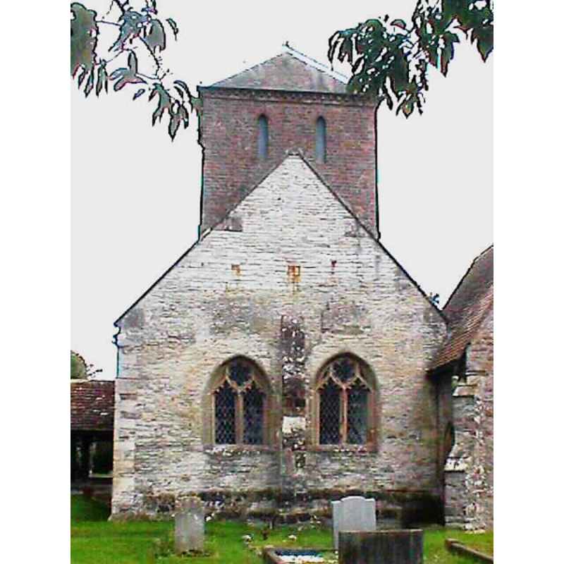
view of church exterior
Copyright Statement: Image copyright © John Wilkes, 2008
Image Source: digital photograph by John Wilkes [www.allthecotswolds.com]
Copyright Instructions: Standing permission
design element - motifs - moulding
Copyright Statement: Image copyright © John Wilkes, 2008
Image Source: digital photograph by John Wilkes [www.allthecotswolds.com]
Copyright Instructions: Standing permission
INFORMATION
Font ID: 13839PEO
Object Type: Baptismal Font1
Font Date: ca. 1500?
Font Century and Period/Style: 14th - 15th century, Early Perpendicular
Church / Chapel Name: Parish Church of St. Nicholas
Font Location in Church: Inside the church
Church Patron Saint(s): St. Nicholas of Myra
Church Address: Norchard Lane, Peopleton, Worcestershire WR10 2EE
Site Location: Worcestershire, West Midlands, England, United Kingdom
Directions to Site: Located off (N) the A44, NNW of Pershore
Ecclesiastic Region: Diocese of Worcester
Historical Region: Hundred of Pershore
Font Notes:
Click to view
There are two entries for Peopleton [variant spelling] in the Domesday survey [http://domesdaymap.co.uk/place/SO9350/peopleton/] [accessed 15 October 2014], neither of which mentions cleric or priest in it. Miller (1890), who gives the dedication of this church as St. Michael's, notes: "The font is octagonal, late 14th century. The doorway is 13th century." Miller (ibid.) gives the first recorded rector here as "Will'us Aleyn... 1289". The Victoria County History (Worcester, vol. 4, 1924) notes: "a late 14th or early 15th-century font with plain octagonal bowl and stem and a moulded base." In Brooks & Pevsner (2007).
Credit and Acknowledgements: We are grateful to John Wilkes, of www.allthecotswolds.com, for his photographs of church and font
COORDINATES
UTM: 30U 562101 5778296
Latitude & Longitude (Decimal): 52.151666, -2.092325
Latitude & Longitude (DMS): 52° 09′ 06″ N, 2° 05′ 32.37″ W
MEDIUM AND MEASUREMENTS
Material: stone
Font Shape: octagonal, mounted
Basin Interior Shape: round
Basin Exterior Shape: octagonal
Drainage System: centre hole in basin
Drainage Notes: lead lining
REFERENCES
- Victoria County History [online], University of London, 1993-. URL: https://www.british-history.ac.uk.
- Brooks, Alan, Worcestershire, New Haven; London: Yale University Press, 2007, p. 520
- Miller, George [Revd.], The Parishes of the Diocese of Worcester, Birmingham: Hall & English, 1890, vol. 2:229-230