Grafton Flyford / Garstune / Graston
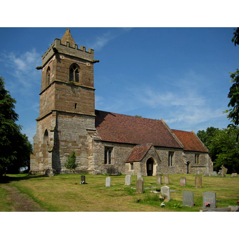
Image copyright © Philip Halling, 2008
CC-BY-SA-2.0
Results: 3 records
view of church exterior - southwest view
Copyright Statement: Image copyright © Philip Halling, 2008
Image Source: digital photograph taken 8 June 2008 by Philip Halling [www.geograph.org.uk/photo/843574] [accessed 17 September 2014]
Copyright Instructions: CC-BY-SA-2.0
view of church interior - nave - looking east
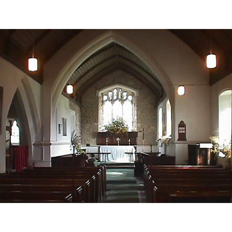
Copyright Statement: Image copyright © John Wilkes, 2008
Image Source: digital photograph taken by John Wilkes September 2008
Copyright Instructions: Standing permission
design element - motifs - moulding
Copyright Statement: Image copyright © John Wilkes, 2008
Image Source: digital photograph taken by John Wilkes September 2008
Copyright Instructions: Standing permission
INFORMATION
Font ID: 13824GRA
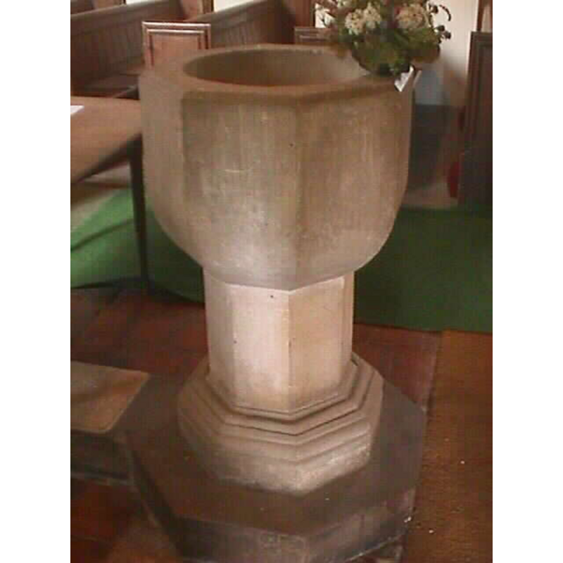
Object Type: Baptismal Font1?
Font Century and Period/Style: 11th century, Norman
Church / Chapel Name: Parish Church of St. the Baptist
Church Patron Saint(s): St. John the Baptist
Church Address: Grafton Flyford, Worcestershire WR7 4PG
Site Location: Worcestershire, West Midlands, England, United Kingdom
Directions to Site: Located off (N) the A422, 8 km E of Worcester
Ecclesiastic Region: Diocese of Worcester
Historical Region: Hundred of Pershore
Additional Comments: disappeared font? (the one from the medieval church here, possibly Domesday-time)
Font Notes:
Click to view
There are two entries for Grafton [Flyford] [variant spelling] in the Domesday survey [http://domesdaymap.co.uk/place/SO9656/grafton-flyford/] [accessed 17 September 2014], one of which reports a priest in it, but no church is mentioned, though there probably was one here. The Victoria County History (Worcester, vol. 4, 1924) notes: "The church, with the exception of the 14th-century tower, was entirely rebuilt in 1875 [...] a modern font." Baptismal font consisting of a plain octagonal basin with rounded underbowl, raised on a plain octagonal stem and a moulded lower base, also octagonal; modern. [NB: we have no information on the medieval font]
Credit and Acknowledgements: We are grateful to John Wilkes, of www.allthecotswolds.com, for his photographs of church and font
COORDINATES
UTM: 30U 564477 5783649
Latitude & Longitude (Decimal): 52.199518, -2.056578
Latitude & Longitude (DMS): 52° 11′ 58.27″ N, 2° 3′ 23.68″ W
REFERENCES
- Victoria County History [online], University of London, 1993-. URL: https://www.british-history.ac.uk.