Hanbury nr. Droiwich / Hambir / Hambury-juxta-Witham / Hambyrie / Hanbyrie / Heanberi / Heanburg / Heanbyrg / Heanbyri / Henbury
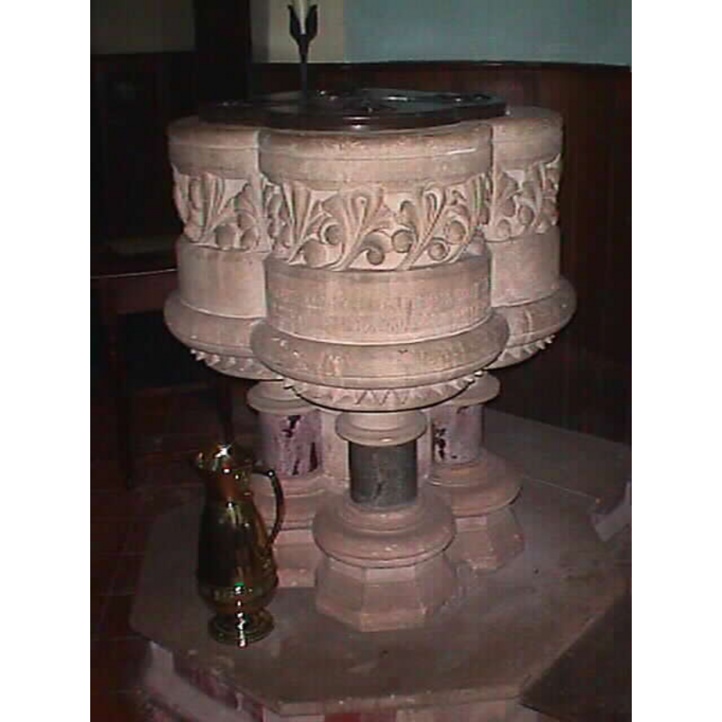
Image copyright © John Wilkes, 2008
Standing permission
Results: 2 records
view of font and cover
Copyright Statement: Image copyright © John Wilkes, 2008
Image Source: digital photograph taken by John Wilkes September 2008
Copyright Instructions: Standing permission
view of church exterior - south view
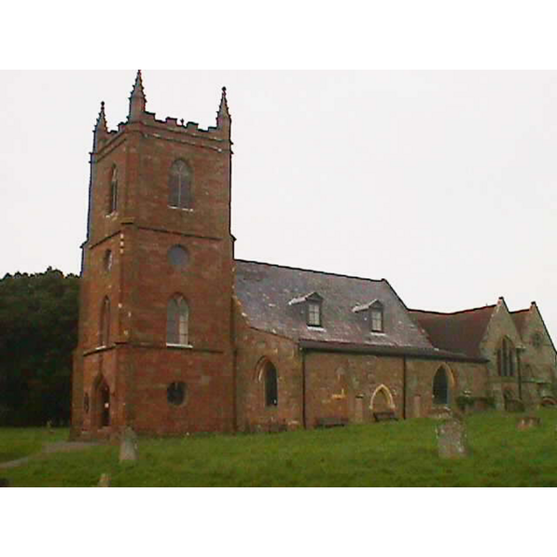
Copyright Statement: Image copyright © John Wilkes, 2008
Image Source: digital photograph taken by John Wilkes September 2008
Copyright Instructions: Standing permission
INFORMATION
Font ID: 13823HAN
Object Type: Baptismal Font1?
Font Century and Period/Style: 11th century, Norman
Church / Chapel Name: Parish Church of St. Mary the Virgin
Church Patron Saint(s): St. Mary the Virgin
Church Address: Hanbury, Stoke Prior, Worcestershire B60 4BP
Site Location: Worcestershire, West Midlands, England, United Kingdom
Directions to Site: Located off the M5, near Droitwich
Ecclesiastic Region: Diocese of Worcester
Historical Region: Hundred of Ash [Domesday] -- Hundred of Oswaldslow
Additional Comments: disappeared font? (the font of the Domesday-time likely church here)
Font Notes:
Click to view
There is an entry for this Hanbury [variant spelling] in the Domesday survey [http://domesdaymap.co.uk/place/SO9463/hanbury/] [accessed 24 September 2014]; it reports a priest but does not mention a church, though there likely was one. Noake (1868) reports "a handsome new font" introduced in the 1861 renovation of the old church. Miller (1890) reports a church here re-built in two stages, 1793 and 1861, and mentions no font in it. The Victoria County History (Worcester, vol. 3, 1913) notes: "There was a priest at Hanbury at the date of the Domesday Survey. [...] The earliest part of the fabric is the south arcade, which dates from about 1210, and was probably an insertion in the south wall of an earlier structure. [...] The font is modern in 13th-century style." Noted in Pevsner (1968): "Font. Probably by Street [i.e., George Edmund Street]. Given on the occasion of the restoration, in 1860." English Heritage [Listing NGR: SO9542564392] (1969) reports: "The nave has a C19 font." The modern font is a Victorian object made 'in the style of' the Early English quatrefoil shape inside and out; the base has the coloured marble stems some Victorian architects seemed to favour. Wooden cover to match, though rather discreet. [NB: we have no information on the earlier font of the Domesday-time church here].
Credit and Acknowledgements: We are grateful to John Wilkes, of www.allthecotswolds.com, for his photographs of church and font
COORDINATES
UTM: 30U 564437 5791649
Latitude & Longitude (Decimal): 52.27144, -2.05564
Latitude & Longitude (DMS): 52° 16′ 17.18″ N, 2° 3′ 20.3″ W
REFERENCES
- Victoria County History [online], University of London, 1993-. URL: https://www.british-history.ac.uk.
- Brooks, Alan, Worcestershire, New Haven; London: Yale University Press, 2007, p. 345
- Miller, George [Revd.], The Parishes of the Diocese of Worcester, Birmingham: Hall & English, 1890, vol. 2: 58-60
- Noake, John, Noake's Guide to Worcestershire: the complete text, London; Worcester: Longman and Co.; J. Noake, 1868, p. 193
- Pevsner, Nikolaus, Worcestershire, Harmondsworth: Penguin, 1968, p. 184