Stapleford nr. Salisbury
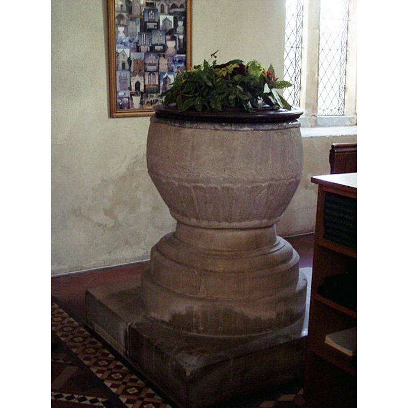
Image copyright © Trish Steel, 2008
CC-BY-SA-3.0
Results: 5 records
view of font and cover
Copyright Statement: Image copyright © Trish Steel, 2008
Image Source: digital photograph taken 8 February 2007 by Trish Steel [www.geograph.org.uk/photo/333432] [accessed 22 February 2012]
Copyright Instructions: CC-BY-SA-3.0
design element - patterns - fluted or ribbed
Scene Description: [cf. Font notes]
Copyright Statement: Image copyright © Trish Steel, 2008
Image Source: digital photograph taken 8 February 2007 by Trish Steel [www.geograph.org.uk/photo/333432] [accessed 22 February 2012]
Copyright Instructions: CC-BY-SA-3.0
view of church exterior - southwest view
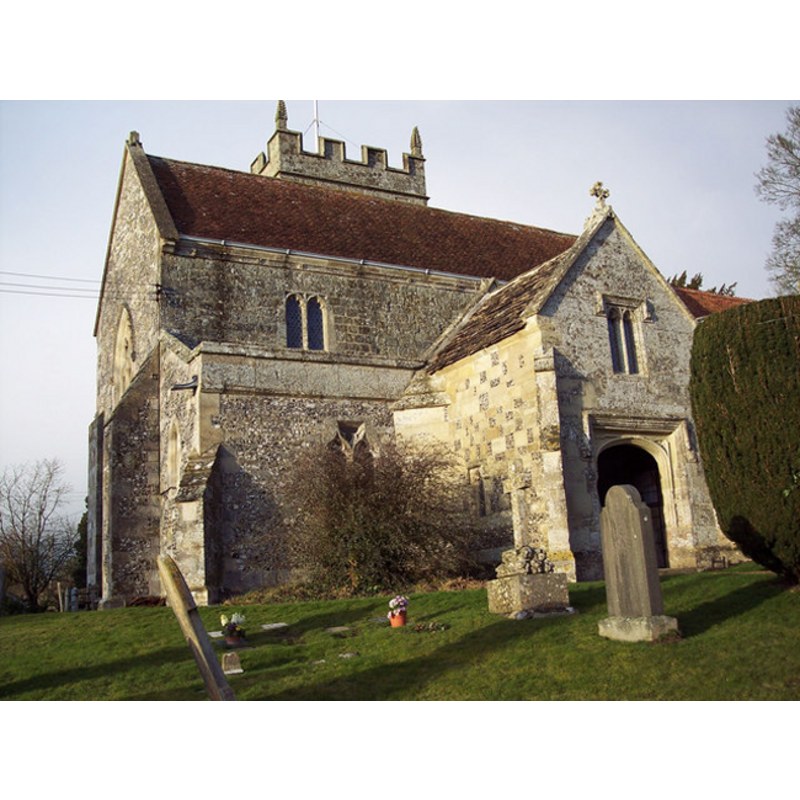
Copyright Statement: Image copyright © Trish Steel, 2008
Image Source: digital photograph taken 8 February 2007 by Trish Steel [www.geograph.org.uk/photo/333426] [accessed 22 February 2012]
Copyright Instructions: CC-BY-SA-3.0
view of church exterior - north view
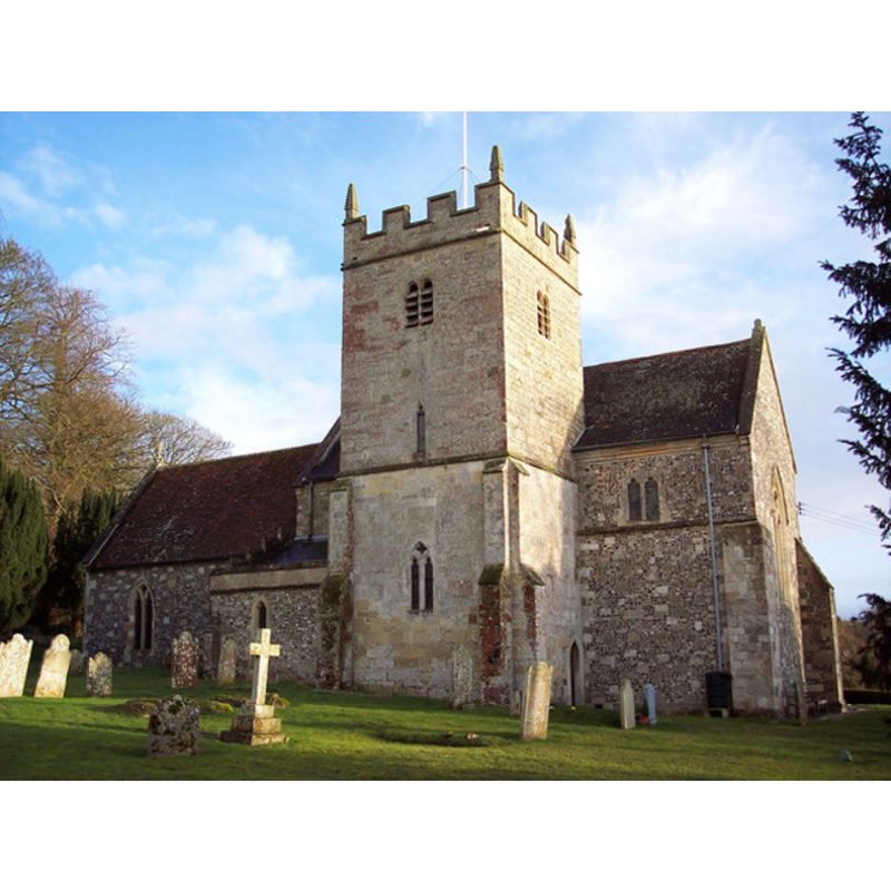
Copyright Statement: Image copyright © Trish Steel, 2008
Image Source: digital photograph taken 8 February 2007 by Trish Steel [www.geograph.org.uk/photo/333475] [accessed 22 February 2012]
Copyright Instructions: CC-BY-SA-3.0
view of church interior - nave - looking southwest
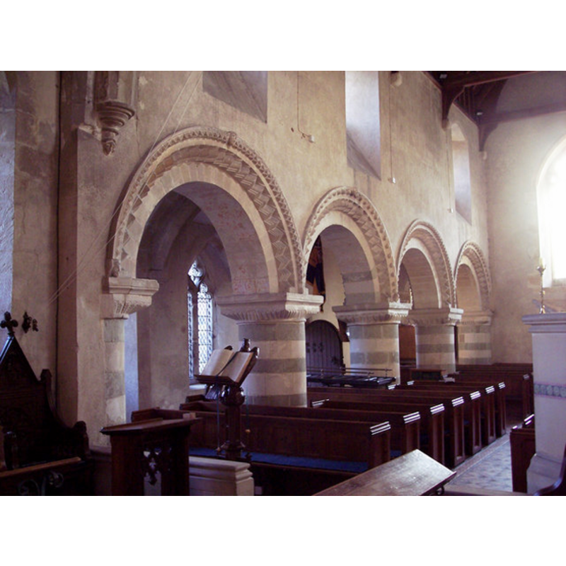
Scene Description: view from the presbitery: the south door is visible trough the second arch of the old arcade that separates the nave from the south aisle
Copyright Statement: Image copyright © Trish Steel, 2008
Image Source: digital photograph taken 8 February 2007 by Trish Steel [www.geograph.org.uk/photo/333442] [accessed 22 February 2012]
Copyright Instructions: CC-BY-SA-3.0
INFORMATION
Font ID: 13820STA
Object Type: Baptismal Font1
Font Date: ca. 1100-1150?
Font Century and Period/Style: 12th century [basin only], Norman
Church / Chapel Name: Parish Church of St. Mary
Font Location in Church: Inside the church, in the S aisle [cf. FontNotes]
Church Patron Saint(s): St. Mary the Virgin
Church Notes: "church of ST. MARY was so called in 1446 and probably in 1239 or earlier." [cf. VCH entry in bib.]
Church Address: Berwick Road, Stapleford, Wiltshire SP3 4LN
Site Location: Wiltshire, South West, England, United Kingdom
Directions to Site: Located off (E) the B3083, 6 km NW of Wilton, 11 km NW of Salisbury
Ecclesiastic Region: Diocese of Salisbury
Historical Region: Hundred of Branchbury [in Domesday] / Hundred of Branch and Dole
Additional Comments: altered font? (only the basin appears original)
Font Notes:
Click to view
There is an entry for this Stapleford in the Domesday survey [http://opendomesday.org/place/SU0737/stapleford/] [accessed 22 June 2016], but it mentions neither cleric nor church in it. A note on the restoration of this church appeared in The Ecclesiologist (no. CXLV, Aug 1861: 285) and mentions the location of the font: "The font is to stand against the westermost pillar on the south side", but it is not clear from the context whether that was the original location or not. The font is classed in Buck (1950) as one of a group of "Middle Norman circular Fonts, c. 1100-1150" in Wiltshire. Noted in Pevsner & Cherry (1975): "Font. Circular, Norman. Up the lower half flat leaves or simply a motif of flat fluting." The Victoria County History (Wiltshire, vol. 15, 1995) notes: "Stapleford church, which belonged to Salisbury cathedral in the earlier 12th century, [...] was served by a rector in 1220 [...] The oldest parts of the church, the north and west walls of the nave, the south arcade, and the west wall of the aisle, are late 12th-century, but the nave is narrow and its shape may be that of the nave of an earlier church. [...] Registers of burials survive from 1633, of baptisms and marriages from 1637"; there is no mention of a font in the VCH entry for this parish. The font consists of a round basin of almost barrel shape bearing a broad band of piping or flat ribs all around the underbowl and ending in a roll moulding; raised of a round moulded base and a quadrangular plinth, both modern. The wooden cover is round and flat; appears modern as well.
COORDINATES
UTM: 30U 576907 5665474
Latitude & Longitude (Decimal): 51.135561, -1.90076
Latitude & Longitude (DMS): 51° 8′ 8.02″ N, 1° 54′ 2.74″ W
MEDIUM AND MEASUREMENTS
Material: stone
Font Shape: round, mounted
Basin Interior Shape: round
Basin Exterior Shape: round
LID INFORMATION
Date: modern?
Material: wood, oak?
Apparatus: no
Notes: [cf. FontNotes]
REFERENCES
- Buck, A.G. Randle, "Some Wiltshire fonts. Part I", LIII, CXCIII (December 1950), The Wiltshire Archaeological and Natural History Magazine, 1950, pp. 458-470; p. 469
- Cox, John Charles, Nottinghamshire, London: Allen, 1912, p. 477
- Gardner, Samuel, A Guide to English Gothic Architecture (illustrated by numerous drawings & photographs), Cambridge: Cambridge University Press, 1925, Wiltshire, vol. 15: 252-263 / [www.british-history.ac.uk/vch/wilts/vol15/pp252-263] [accessed 22 June 2016]