Dilton / Old Dilton
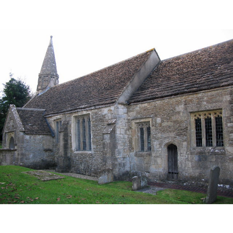
Image copyright © Phil Williams, 2005
CC-BY-SA-3.0
Results: 6 records
view of church exterior - southeast view
Copyright Statement: Image copyright © Phil Williams, 2005
Image Source: digital photograph taken 15 November 2005 by Phil Williams [www.geograph.org.uk/photo/78975] [accessed 16 January 2012]
Copyright Instructions: CC-BY-SA-3.0
view of church exterior - southwest view
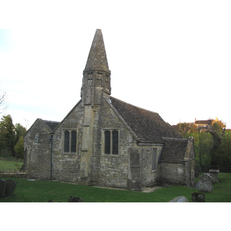
Scene Description: exterior of the Church of St. Mary, Old Dilton; it is located in a valley setting next to the River Biss is still in active use.
Copyright Statement: Image copyright © Phil Williams, 2005
Image Source: digital photograph taken 15 November 2005 by Phil Williams [www.geograph.org.uk/photo/78962] [accessed 16 January 2012]
Copyright Instructions: CC-BY-SA-3.0
view of font

Scene Description: ca. 1806
Copyright Statement: Image copyright © Wiltshire Treasures, 2007
Image Source: 1806 watercolour by John Buckler (1770-1851) in Wiltshire Treasures [http://history.wiltshire.gov.uk/museums/] [accessed 24 February 2012]
Copyright Instructions: PERMISSION NOT AVAILABLE -- IMAGE NOT FOR PUBLIC USE
view of basin - upper view
Scene Description: notice the the depth and size of the inner well [cf. FontNotes]
Copyright Statement: Image copyright © Neil MacDougall, 2011
Image Source: detail of digital photograph taken 2 October 2011 by Neil MacDougall [www.panoramio.com/photo/60182438] [accessed 24 February, 2012]
Copyright Instructions: PERMISSION NOT AVAILABLE -- IMAGE NOT FOR PUBLIC USE
view of church interior - nave - looking east
Scene Description: the re-cut font in the foreground
Copyright Statement: Image copyright © Neil MacDougall, 2011
Image Source: digital photograph taken 2 October 2011 by Neil MacDougall [www.panoramio.com/photo/60182438] [accessed 24 February, 2012]
Copyright Instructions: PERMISSION NOT AVAILABLE -- IMAGE NOT FOR PUBLIC USE
view of church interior - nave - looking west
Scene Description: the re-cut font is visible at the west end of the nave
Copyright Statement: Image copyright © Wiltshire & Swindon History Centre, 2012
Image Source: 1964 B&W photograph in Wiltshire Community History [http://history.wiltshire.gov.uk/gallery/church/dilton_marsh_picP17794.jpg] [accessed 24 February 2012]
Copyright Instructions: PERMISSION NOT AVAILABLE -- IMAGE NOT FOR PUBLIC USE
INFORMATION
Font ID: 13794DIL
Object Type: Baptismal Font1
Font Century and Period/Style: 15th century [re-cut], Perpendicular [altered?]
Church / Chapel Name: Parish Church of St. Mary [redundant]
Font Location in Church: Inside the church, at the W end of the nave
Church Patron Saint(s): St. Mary the Virgin
Church Notes: Redundant since April 1973 -- now in the care of the Churches Conservation Trust
Church Address: Old Dilton Road, Dilton Marsh, Westbury, Wiltshire, BA13 3RA
Site Location: Wiltshire, South West, England, United Kingdom
Directions to Site: Located near Dilton Marsh, 4 km SW of Westbury, 4 km NNW of Warminster
Ecclesiastic Region: Diocese of Salisbury
Historical Region: Hundred of Westbury
Additional Comments: altered font: re-cut?
Font Notes:
Click to view
The font here is documented in an 1806 watercolour by John Buckler (1770-1851). The Victoria County History (Wiltshire, vol. 8, 1965) notes the Holy Trinity Church in Ditton Marsh, as well as an earlier church in Dilton proper: "The church of St. Mary, Dilton, is a small building [...] The architectural features of the church date from the 15th century onwards, but doubtless the structure is more ancient"; the VCH entry does not mention a font in its entry for the parish. The National Monuments Record (English Heritage) [www.imagesofengland.org.uk/Details/Default.aspx?id=313756] [accessed 24 February 2012] reports: "Recut C15 octagonal stone font at west end." The Wiltshire Council' Wiltshire Community History page [http://history.wiltshire.gov.uk/community/getchurch.php?id=856] [accessed 24 February 2012], however, states: "A 19th century copy of a 15th century octagonal font was also provided." The surfaces of the font show the style, as well as the very sharp angles and contrasts, of a modern font, however, the shape and size of the inner well of the basin alone is an indication that the font may well be a re-cut of an old one [NB: although many 19th-century fonts were made following traditional font designs, it is not very common to find the inside depth of the old fonts replicated in them. A likely check to corroborate the dating would be to lift or remove the metal lining of the basin and check the state of the stone surface and drain under it, as even the most thorough re-cuts or re-carvings rarely affect those areas.]
COORDINATES
UTM: 30U 555573 5676846
Latitude & Longitude (Decimal): 51.240278, -2.203889
Latitude & Longitude (DMS): 51° 14′ 25″ N, 2° 12′ 14″ W
MEDIUM AND MEASUREMENTS
Material: stone
Font Shape: octagonal, mounted
Basin Interior Shape: round
Basin Exterior Shape: octagonal
REFERENCES
- Victoria County History [online], University of London, 1993-. URL: https://www.british-history.ac.uk.
- Byrne, Matthew, Beautiful churches saved by The Churches Conservation Trust, London: Frances Lincoln, 2013, p. 135-136