Heytesbury No. 1 / Haytchbury / Hegtredesbyri / Hestrebe
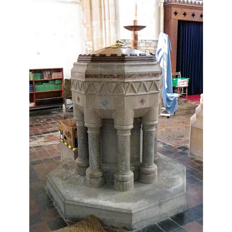
Image copyright © Maigheach-gheal, 2011
CC-BY-SA-2.0
Results: 4 records
view of font and cover
Scene Description: Source caption: "Font, The Church of St Peter and St Paul [...] The coloured marble font dates from the Butterfield restoration of 1864 to 1867."
Copyright Statement: Image copyright © Maigheach-gheal, 2011
Image Source: digital photograph taken 12 December 2010 by Maigheach-gheal [www.geograph.org.uk/photo/2218822] [accessed 22 December 2020]
Copyright Instructions: CC-BY-SA-2.0
view of church exterior - southwest view
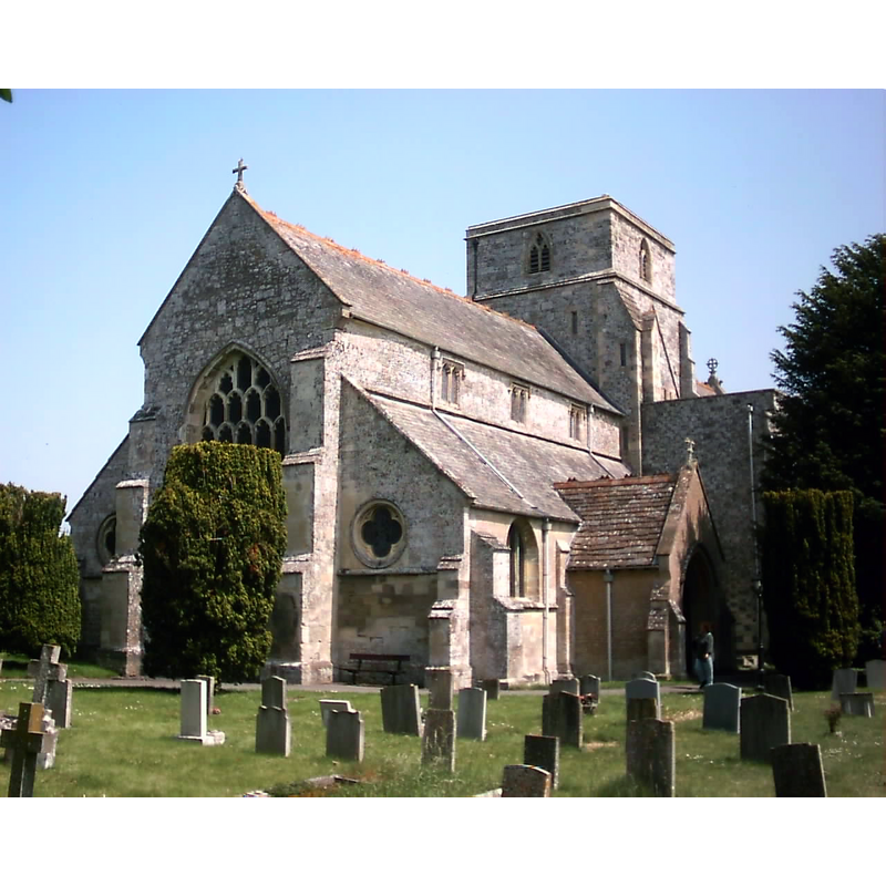
Scene Description: Source caption: "Church of St. Peter and St. Paul. The church was originally collegiate which would account for its imposing size".
Copyright Statement: Image copyright © Kevin Farmer, 2010
Image Source: digital photograph taken 6 June 2007 by Kevin Farmer [www.geograph.org.uk/photo/1946840] [accessed 22 January 2020
Copyright Instructions: CC-BY-SA-2.0
view of church exterior - northwest view
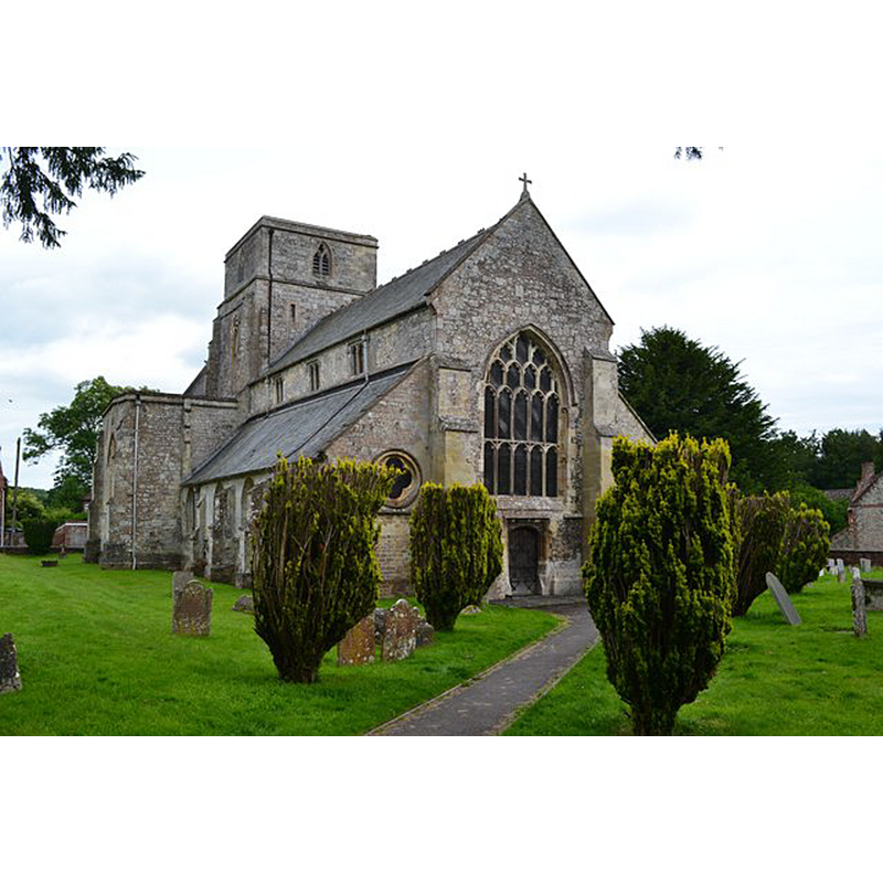
Copyright Statement: Image copyright © David Martin, 2016
Image Source: digital photograph taken 7 July 2016 by David Martin [www.geograph.org.uk/photo/5026366] [accessed 22 January 2020]
Copyright Instructions: CC-BY-SA-2.0
view of church interior - looking west
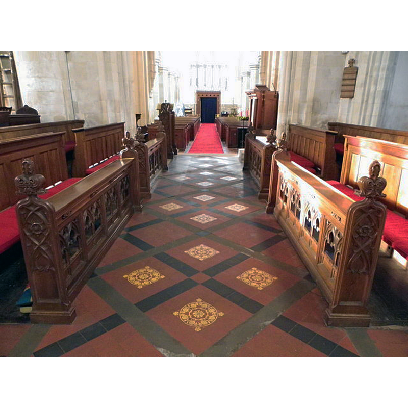
Scene Description: Source caption: "The Church of St Peter and St Paul. Looking west down the length of the church from the sanctuary steps."
Copyright Statement: Image copyright © Maigheach-gheal, 2011
Image Source: digital photograph taken 12 December 2010 by Maigheach-gheal [www.geograph.org.uk/photo/2219234] [accessed 22 December 2020]
Copyright Instructions: CC-BY-SA-2.0
INFORMATION
Font ID: 13775HEY
Object Type: Baptismal Font1?
Font Century and Period/Style: 11th century, Pre-Conquest? / Norman
Church / Chapel Name: Collegiate Church of St. Peter and St. Paul
Font Location in Church: [cf. FontNotes]
Church Patron Saint(s): St. Peter & St. Paul
Church Address: High St, Heytesbury, Warminster BA12 0EF, UK
Site Location: Wiltshire, South West, England, United Kingdom
Directions to Site: Located off (S) the A36, 5 km ESE of Warminster
Ecclesiastic Region: Diocese of Salisbury
Historical Region: Hundred of Heytesbury
Additional Comments: disappeared font? (the one from the Domesday-time church here)
Font Notes:
Click to view
There is an entry for Heytesbury in the Domesday survey [https://opendomesday.org/place/ST9242/heytesbury/] [accessed 22 January 2020]; it mentions "1 church. 3.0 church lands" and notes "Alward the priest" as the lord in 1086. The present font in this church [cf. Index entry for Heytesbury No. 2] dates from the 'over-restoration' -as Pevsner (1975) describes it- by Butterfield in 1865. There is no trace of the original font locally, but the Catalogue of the manuscripts, maps, charts […] of the British Museum (1844) lists a "Drawing, in Indian ink, of the square stone font at Heytesbury; by S.H. Grimm, in August, 1790: 10 1/2 in. x 7 1/2 in. (P.R. Kaye, IV. 482", representing probably the original Norman font. The Victoria County History (Wiltshire, vol. 3, 1956) mentions that the church of Heytesbury is noted in the Domesday Book. The entry for this church in Historic England [Listing NGR: ST9250142559] notes: "Collegiate and Anglican parish church. Late C12, C13, C14, C15, C16, restored 1864-67 by W. Butterfield [...] Butterfield fittings include coloured marble font in south aisle".
COORDINATES
UTM: 30U 562303 5670475
Latitude & Longitude (Decimal): 51.1823, -2.1086
Latitude & Longitude (DMS): 51° 10′ 56.28″ N, 2° 6′ 30.96″ W
MEDIUM AND MEASUREMENTS
Material: stone
Font Shape: square
Basin Exterior Shape: square
REFERENCES
- Victoria County History [online], University of London, 1993-. URL: https://www.british-history.ac.uk.
- British Museum, Catalogue of the manuscript maps, charts, and plans, and of the topographical drawings in the British Museum, London: Printed by order of the Trustees, 1844-, p. 299
- Cox, John Charles, Nottinghamshire, London: Allen, 1912, p. 266