London No. 90
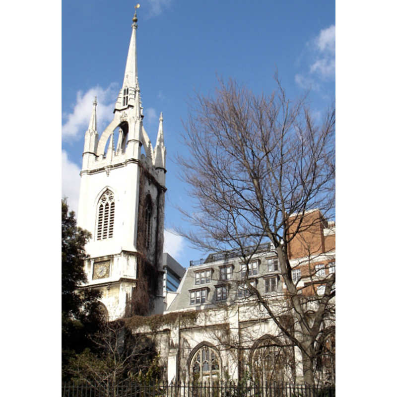
Image copyright © Lonpicman, 2006
CC-BY-SA-3.0 Attribution 3.0 Unported
Results: 2 records
view of church exterior - southwest end
Copyright Statement: Image copyright © Lonpicman, 2006
Image Source: digital photograph taken 2 March 2006 by Lonpicman [https://en.wikipedia.org/wiki/File:St_Dunstans_In_The_East.jpg] [accessed 16 July 2013]
Copyright Instructions: CC-BY-SA-3.0 Attribution 3.0 Unported
view of church exterior - southeast view
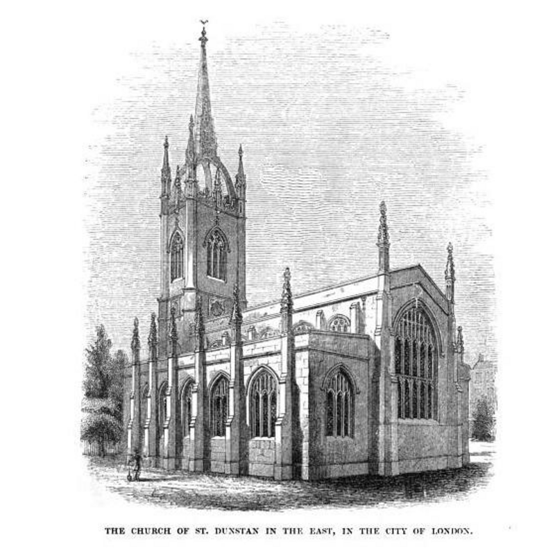
Copyright Statement: Image copyright © [in the public domain]
Image Source: engraving in Murray (1859: [p. 2])
Copyright Instructions: PD
INFORMATION
Font ID: 13663LON
Object Type: Baptismal Font1?
Font Century and Period/Style: Medieval
Church / Chapel Name: Parish Church of St. Dunstan-in-the-East [now in ruins]
Font Location in Church: [cf. FontNotes]
Church Patron Saint(s): St. Dunstan
Church Notes: The original church was built ca. 1100 -- largely destroyed in the Second World War -- the ruins are now a public garden
Church Address: St Dunstan's Hill, London, Greater London, England, EC4
Site Location: Greater London, South East, England, United Kingdom
Directions to Site: This church, of which only the ruins remain, is situated on the W side of St. Dunstan's Hill, Upper Thames Street, half way between London Bridge and the Tower of London
Ecclesiastic Region: Diocese of London
Additional Comments: disappeared font? Or is the "mean design" font the one from the medieval church? / destroyed font? -- famous person font: according to the Oxford Dictionary of National Biography [www.oxforddnb.com/view/printable/4328] [accessed 16 July 2013], Sir Julius Caesar [formerly Adelmare] "was baptized on 10 February 1558 at the church of St Dunstan-in-the-East"
Font Notes:
Click to view
Allen (1839?) reports that "the patronage of this rectory was anciently in the prior and canons of Canterbury, who, in 1365, granted it to Simon their archbishop, and his successors"; that building, however, notes Allen (ibid.) from a plaque in the south porch, suffered much in the Great Fire of 1666, and "was repaired by sir Christopher Wren"; Allen (ibid.), however, gives no clue to the date of the font he describes: "The font is octangular, of a mean design, and unworthy of the church; it occupies a pew in the south aisle." Murray (1859) noptes: "St. Dunstan's MS. book contains the following entry:-- '30th March, 1645. Ordered and agreed that a convenient place shall be made in the body of the Church, near the reading place, for a font, or baptizing place, according to the Directory, and alteration of other Churches in the City; and that the silver basin now used for the Sacrament of the Lord's Supper shall be put into an iron hoop, and used for baptisms.'" Blatch (1995) notes: "The mediaeval church was one of the wealthiest in the City [...] In the Regency period [...] the rest of the church was rebuilt by the architect David Laing between 1817 and 1821 in Georgian Perpendicular style, an early example of Gothic Revival [...] St Dunstan's was gutted in the 1939-45 War and has been left as a ruin to show what the City suffered". [NB: we have no information on the font from the original church of ca. 1100].
COORDINATES
UTM: 30U 702434 5710540
Latitude & Longitude (Decimal): 51.509672, -0.082722
Latitude & Longitude (DMS): 51° 30′ 34.82″ N, 0° 4′ 57.8″ W
REFERENCES
- Allen, Thomas, The History and Antiquities of London, Wsetminster, Southwark, and parts adjacent, London: published by George Virtue, 26 Ivy Lane, Paternoster Row, [1839?], p. 738/ [http://books.google.co.uk/books?id=BVEGAAAAQAAJ&pg=RA1-PA717&lpg=RA1-PA717&dq=queenhithe+church+font&source=web&ots=9dzBGxXJDM&sig=mvPDHDDOyNJa-B_jKtBxJr4-Ny4&hl=en&sa=X&oi=book_result&resnum=2&ct=result#PRA1-PA637,M1] [accessed 31 July 2008]
- Murray, Thomas Boyles, Chronicle of a City Church; being an account of the Parish Church of St. Dunstan in the East, in the City of London [...], London: Smith. Elder, and Co., 1859, p. 30 et al. [http://books.google.co.uk/books?id=ZNkHAAAAQAAJ&printsec=frontcover#v=onepage&q&f=false] [accessed 16 July 2013]