Aysgarth No. 1 / Aykeskarth / Echescard
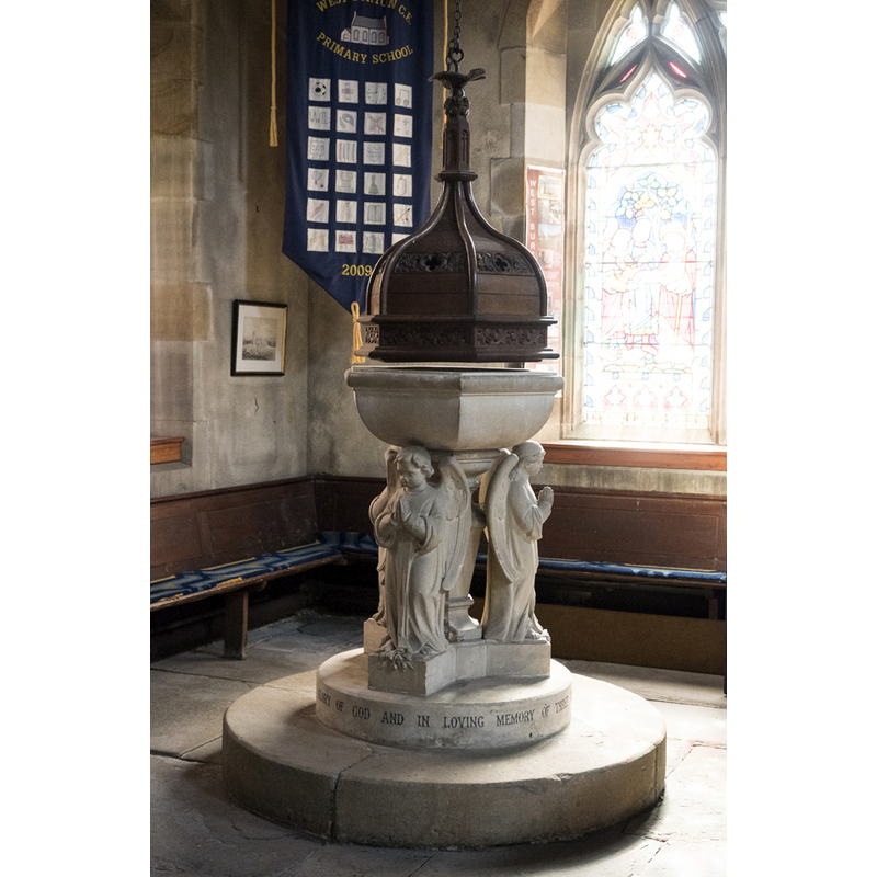
Image copyright © John Salmon, 2018
CC-BY-SA-2.0
Results: 6 records
view of font and cover
Scene Description: the modern font
Copyright Statement: Image copyright © John Salmon, 2018
Image Source: digital photograph taken 9 August 2018 by John Salmon [www.geograph.org.uk/photo/5960309] [accessed 19 November 2019]
Copyright Instructions: CC-BY-SA-2.0
view of church exterior - northwest view
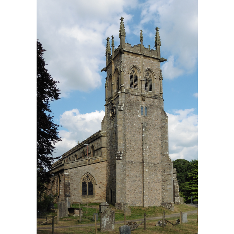
Copyright Statement: Image copyright © Dave Kelly, 2018
Image Source: digital photograph taken 7 July 2018 by Dave Kelly [www.geograph.org.uk/photo/5925651] [accessed 19 November 2019]
Copyright Instructions: CC-BY-SA-2.0
view of church interior - chapel - detail
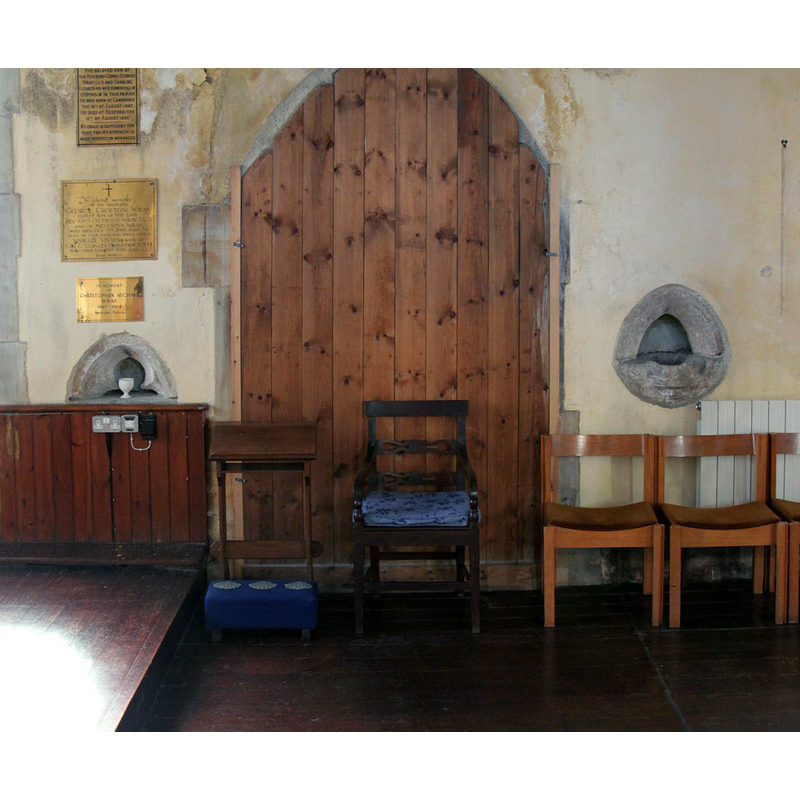
Scene Description: Source caption: "Church of St Andrew, Aysgarth. Two rather mutilated medieval piscinas in the Lady Chapel represent the only medieval stonework in the interior of the church."
Copyright Statement: Image copyright © Alan Murray-Rust, 2017
Image Source: digital photograph taken 13 September 2017 by Alan Murray-Rust [www.geograph.org.uk/photo/5539755] [accessed 19 November 2019]
Copyright Instructions: CC-BY-SA-2.0
view of church interior - rood-screen, choir-screen; iconostasis
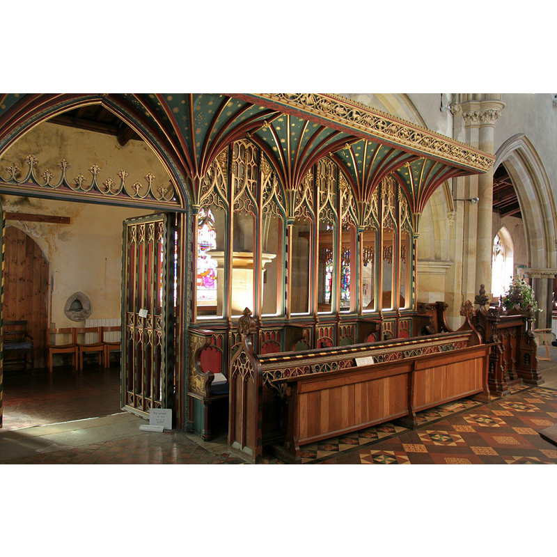
Scene Description: Source caption: "Church of St Andrew, Aysgarth. Part of the 16th century rood screen from Jervaulx Abbey, now installed between the chancel and the Lady Chapel."
Copyright Statement: Image copyright © Alan Murray-Rust, 2017
Image Source: digital photograph taken 13 September 2017 by Alan Murray-Rust [www.geograph.org.uk/photo/5539761] [accessed 19 November 2019]
Copyright Instructions: CC-BY-SA-2.0
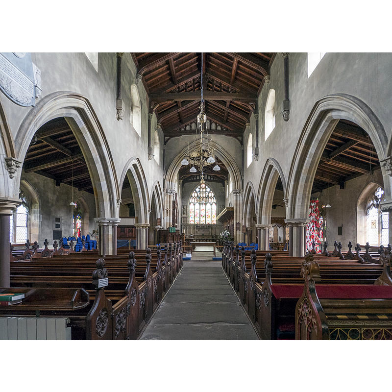
view of church interior - looking west
Copyright Statement: Image copyright © Alan Murray-Rust, 2017
Image Source: digital photograph taken 13 September 2017 by Alan Murray-Rust [www.geograph.org.uk/photo/5539765] [accessed 19 November 2019]
Copyright Instructions: CC-BY-SA-2.0
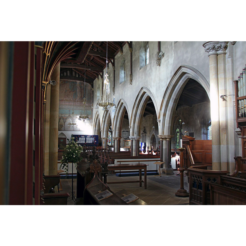
view of church interior - looking east
Copyright Statement: Image copyright © John Salmon, 2018
Image Source: digital photograph taken 9 August 2018 by John Salmon [www.geograph.org.uk/photo/5960304] [accessed 19 November 2019]
Copyright Instructions: CC-BY-SA-2.0
INFORMATION
Font ID: 13590AYS
Object Type: Baptismal Font1?
Font Century and Period/Style: 12th - 13th century, Transitional / Early English
Church / Chapel Name: Parish Church of St. Andrew
Font Location in Church: [cf. FontNotes]
Church Patron Saint(s): St. Andrew
Church Address: Church Ln, Aysgarth, Leyburn DL8 3SR, UK -- Tel.: +44 1969 663097
Site Location: North Yorkshire, Yorkshire and the Humber, England, United Kingdom
Directions to Site: Located N of the A684, on the S bank of the Ure river, 7-8 km W of Leyburn
Ecclesiastic Region: Diocese of Leeds
Historical Region: Hundred of Land of Count Alan
Additional Comments: disappeared font? (the one from the 12th-13thC church here) -- disused font / private hands [cf. FontNotes]
Font Notes:
Click to view
There is an entry for Aysgarth [variant spelling] in the Domesday survey [https://opendomesday.org/place/SE0088/aysgarth/] [accessed 19 November 2019] but it mentions neither cleric nor church in it. The entry for this parish in the Victoria County History (York North Riding, vol. 1, 1914) notes: "The church of Aysgarth was held with the manor by the Burgh family until 1222 [...] With the exception of the west tower, the whole structure was rebuilt in 1866, some details from the former building being re-used [...] The font is modern." There is a note of interest, and perhaps relevance to the old font at Aysgarth in Sheahan & Whellan (1857); after a description of the Church of St. Andrew, they remark: ''There is […] in this locality the site of an ancient Chapel and burial ground, called Chapel House. On the site, which is now occupied by modern cottages, an ancient font was found, which is now in the possession of Mr. Ralph Dobson, of Leyburn'' [cf. Index entry for Aysgarth No. 2 for the later font in Aysgarth]
COORDINATES
UTM: 30U 566191 6016501
Latitude & Longitude (Decimal): 54.292122, -1.983067
Latitude & Longitude (DMS): 54° 17′ 31.64″ N, 1° 58′ 59.04″ W
REFERENCES
- Victoria County History [online], University of London, 1993-. URL: https://www.british-history.ac.uk.
- Whellan & Co., T., History and topography of the city of York and the North Riding of Yorkshire, embracing a […], Beverley: printed for the publishers by John Green, Market Place, 1859, p. 390