Thornton Watlass / Thorneton et Watlous / Thorneton Watloss / Torreton / Torretun / Wadles / Watlows / Wattelaus
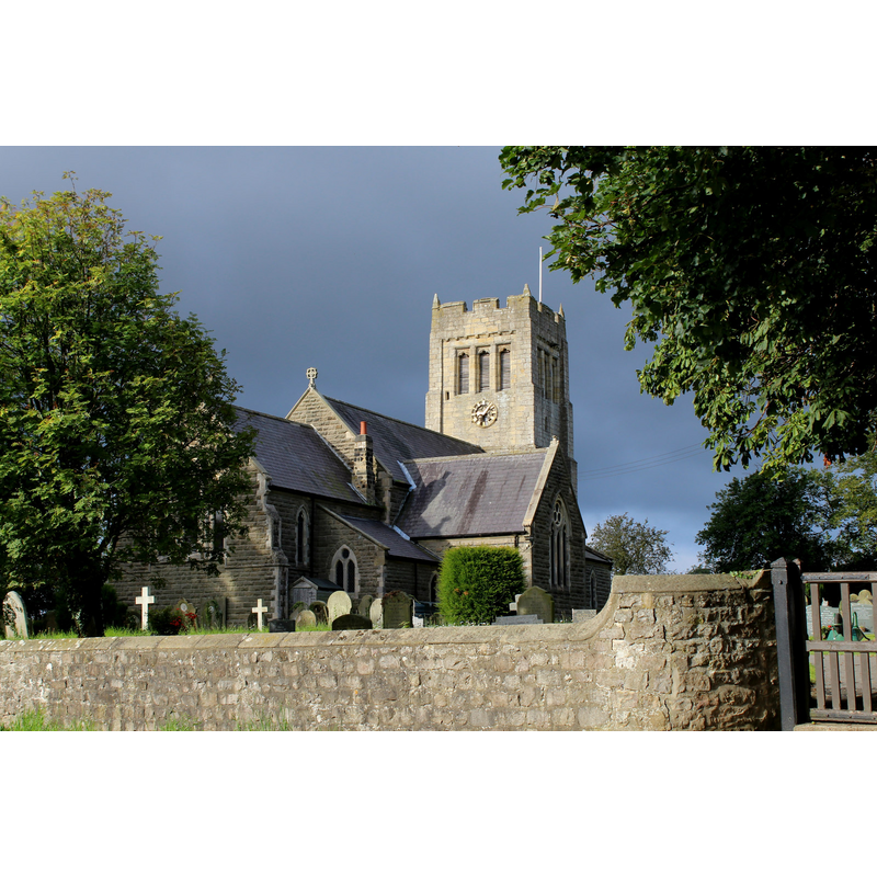
Image copyright © Chris Heaton, 2019
CC-BY-SA-2.0
Results: 2 records
view of church exterior in context - northeast view
Scene Description: Source caption: "St. Mary the Virgin Church, Thornton Watlass. The church stands aloof and alone, several hundred metres from the village it serves. It was completely rebuilt in 1868, with the exception of the tower which is considerably older."
Copyright Statement: Image copyright © Chris Heaton, 2019
Image Source: digital photograph taken 29 August 2015 by Chris Heaton [www.geograph.org.uk/photo/4637337] [accessed 24 October 2019]
Copyright Instructions: CC-BY-SA-2.0
view of church exterior - south view
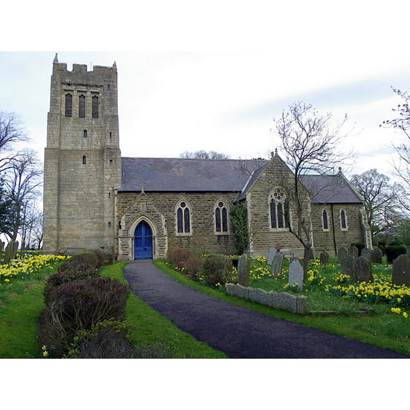
Scene Description: Source caption; "The four stage tower with embattled parapet and pinnacles dates from the 15th century. The rest of the church dates from the 19th century."
Copyright Statement: Image copyright © Maigheach-gheal, 2011
Image Source: digital photograph taken 6 April 2011 by Maigheach-gheal [www.geograph.org.uk/photo/2446079] [accessed 24 Octoer 2019]
Copyright Instructions: CC-BY-SA-2.0
INFORMATION
Font ID: 13589THO
Object Type: Baptismal Font1
Font Century and Period/Style: 13th century, Medieval
Church / Chapel Name: Parish Church of St. Mary
Font Location in Church: Inside the church
Church Patron Saint(s): St. Mary the Virgin
Church Address: Watlass Ln, Thornton Watlass, Ripon HG4 4AJ, UK -- Tel.: +44 677425985
Site Location: North Yorkshire, Yorkshire and the Humber, England, United Kingdom
Directions to Site: Located W of the A1(M), 5 km SW of Bedale, 18 km NNW of Ripon
Ecclesiastic Region: Diocese of Leeds
Historical Region: Hundred of Land of Count Alan
Additional Comments: disappeared font? (the one reported as ancient and dodecagonal in Sheahan & Whellan [cf. FontNotes])
Font Notes:
Click to view
There are two entries for Thornton [Watlass] [variant spelling] in the Domesday survey [https://opendomesday.org/place/SE2385/thornton-watlass/] [accessed 24 October 2019] neither of which mentions cleric or church in it. Sheahan & Whellan (1857) note: ''The font is ancient and plain, with twelve sides''. The entry for this parish in the Victoria County History (York North Riding, vol. 1, 1914) notes: "Mention of the church of 'Wattelaus' occurs in 1263 [...] With the exception of the west tower, which is of the 14th century, the whole building is modern. The piscina in the south wall of the chancel has an old drain. [...] There are two portions of Saxon cross-heads built into the south porch. There is also a fragment of a cross-shaft with loop-work upon the edge, much worn, built into the churchyard wall"; no font mentioned in it. There is no mwention of the font in Pevsner's (1966, 2002) entry for this church.
COORDINATES
UTM: 30U 588578 6013860
Latitude & Longitude (Decimal): 54.265, -1.64
Latitude & Longitude (DMS): 54° 15′ 54″ N, 1° 38′ 24″ W
MEDIUM AND MEASUREMENTS
Material: stone
Font Shape: dodecagonal, mounted
Basin Interior Shape: round
Basin Exterior Shape: dodecgonal
REFERENCES
- Victoria County History [online], University of London, 1993-. URL: https://www.british-history.ac.uk.
- Whellan & Co., T., History and topography of the city of York and the North Riding of Yorkshire, embracing a […], Beverley: printed for the publishers by John Green, Market Place, 1859, p. 383