Ellerton / Elreton / Elretona
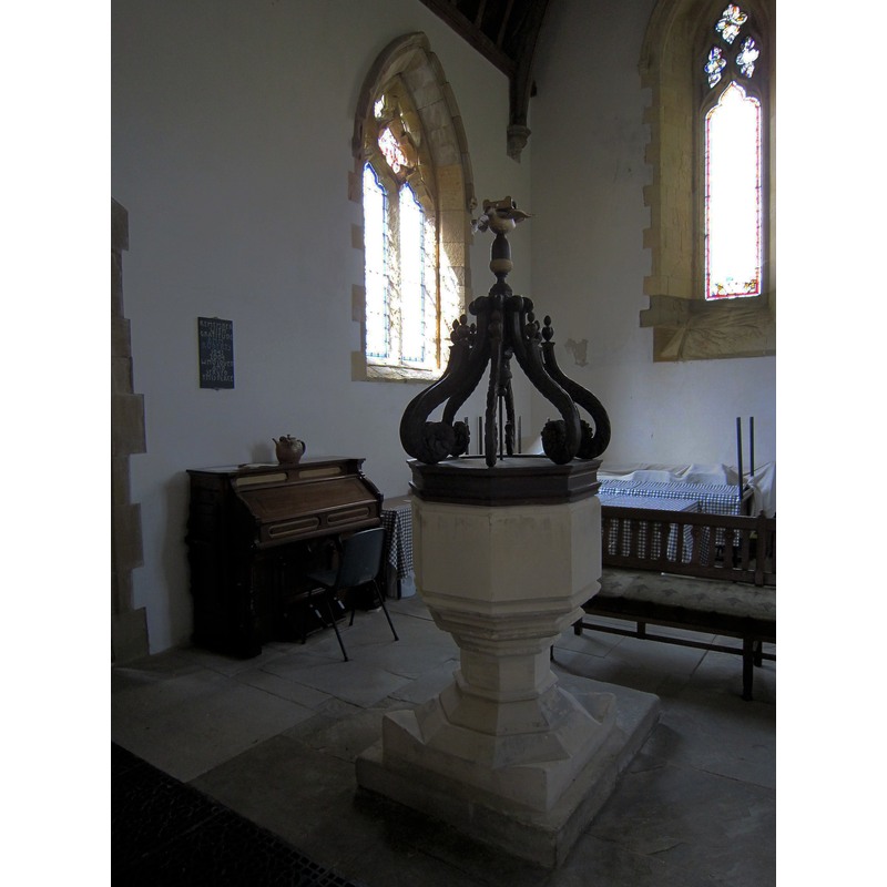
Image copyright © Hazel Pickering, 2015
Permission received from the author (e-mail of 25 November 2018)
Results: 7 records
view of font and cover in context
Scene Description: the modern font and cover in the modern church interior after the 2015 restoration
Copyright Statement: Image copyright © Hazel Pickering, 2015
Image Source: digital photograph taken 12 July 2015 by Hazel Pickering
Copyright Instructions: Permission received from the author (e-mail of 25 November 2018)
view of church exterior in context - south view

Scene Description: Source caption: "Ruins of Ellerton Priory, founded by Warnerus, Lord of Aske in the reign of Henry II (1154-1189) and inhabited by nuns of the austere Cistercian order. The priory was sacked in the reign of Edward III (1327-1377). At the time of its dissolution in 1535 its estate was valued at £15 10s 6d per annum."
Copyright Statement: Image copyright © Hugh Mortimer, 2006
Image Source: digital photograph taken 29 April 2006 by Hugh Mortimer [www.geograph.org.uk/photo/160519] [accessed 25 November 2018]
Copyright Instructions: CC-BY-SA-2.0
view of church exterior in context
Scene Description: Source caption: "The remains of Ellerton Priory. This tower is all that remains of this ancient priory of Cistercian nuns."
Copyright Statement: Image copyright © Martin Dawes, 2012
Image Source: digital photograph taken 24 February 2012 by Martin Dawes [www.geograph.org.uk/photo/2823383] [accessed 25 November 2018]
Copyright Instructions: CC-BY-SA-2.0
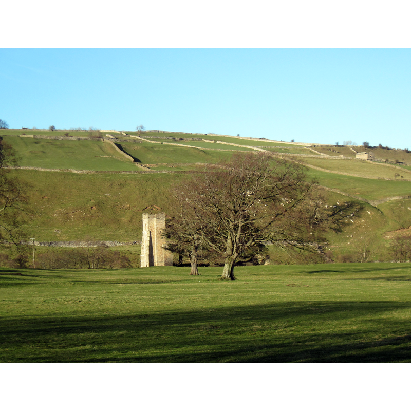
view of church exterior - northwest view

Scene Description: the ruins of Ellerton Priory Church in 1897
Copyright Statement: Image copyright © [in the public domain]
Image Source: digital image of a 1897 illustration by Godfrey Bingley [https://commons.wikimedia.org/wiki/File:Ellerton_Priory,_Godfrey_Bingley_1897.jpg] [accessed 25 November 2018]
Copyright Instructions: CC-PD-Mark / PD Old
view of church exterior - southeast view
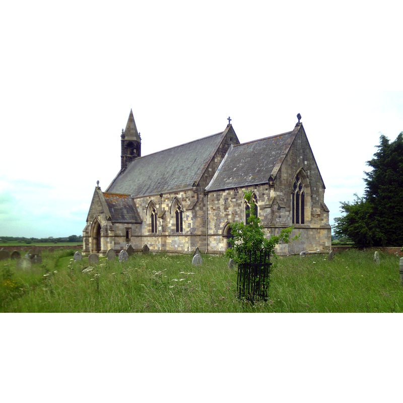
Scene Description: Source caption: "St Mary's, Ellerton, East Riding of Yorkshire, England. A Victorian church standing on the site of a medieval church belonging to the Gilbertine priory of Ellerton which was dissolved in December 1538. Due to the decayed state of the original church, the new building was erected 1846-8 to a design by John Loughborough Pearson at a cost of £1200. It served as the parish church until 1978 when it was closed and gradually fell into disrepair. In 1997 the ownership was transferred to the Ellerton Church Preservation Trust who have restored the building and now maintain it and the graveyard."
Copyright Statement: Image copyright © Gordon Hatton, 2013
Image Source: digital photograph taken 17 June 2013 by Gordon Hatton [https://commons.wikimedia.org/wiki/File:St_Marys_Church_Ellerton_1.jpg] [accessed 25 November 2018]
Copyright Instructions: CC-BY-SA-2.0
view of church interior - chancel and east end
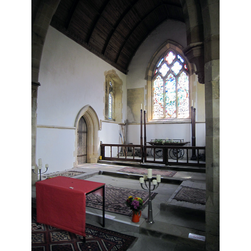
Scene Description: the modern church interior after the 2015 restoration
Copyright Statement: Image copyright © Hazel Pickering, 2015
Image Source: digital photograph taken 12 July 2015 by Hazel Pickering
Copyright Instructions: Permission received from the author (e-mail of 25 November 2018)
view of object
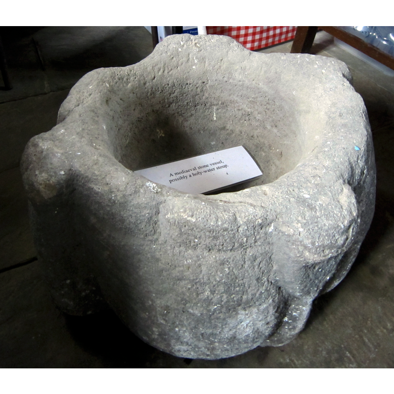
Scene Description: the label inside this object reads: "A mediaeval stone vessel, possibly a holy-water stoup." The shape, however, suggests rather an old mortar.
Copyright Statement: Image copyright © Hazel Pickering, 2018
Image Source: digital photograph taken 12 July 2015 by Hazel Pickering
Copyright Instructions: Permission received from the author (e-mail of 17 December 2018)
INFORMATION
Font ID: 13580ELL
Object Type: Baptismal Font1?
Font Century and Period/Style: 13th century, Medieval
Church / Chapel Name: Parish Church of St. Mary [redundant -- formerly a Priory of Gilbertine Canons]
Church Patron Saint(s): St. Mary the Virgin
Church Address: directions and coordinates are for the priory ruins
Site Location: East Riding of Yorkshire, Yorkshire and the Humber, England, United Kingdom
Directions to Site: Located off (W) the B1228, near Aughton, 13 km NW of Howden, 13 km SW of Pocklington, 18 km ESE of York [NB: the Priory ruins stand close to the Richmond to Reeth road, just a mile downstream from the former Benedictine Priory of Marrick.]
Ecclesiastic Region: Diocese of York
Historical Region: Hundred of Harthill
Additional Comments: disappeared font? (the one from the priory church here)
Font Notes:
Click to view
There is an entry for this Ellerton [variant spelling] in the Domesday survey [https://opendomesday.org/place/SE7039/ellerton/] [accessed 25 November 2018], showing that is was a very small place with only four households, but records "Ernwin the Priest" as its lord in 1066. The entry for this priory in the Victoria County History (York, vol. 3, 1974) notes: "About the middle of the [13th] century Peter, the son of Peter de Mauley, confirmed to the canons all that they had of his fee, including ' totum situm abbathiae in Elretona,' with the church of the same vill. [...] The house was surrendered on 11 December 1538 [...] by John Golding, prior, and four canons." Sheahan & Whellan (1857) note that the ''old church was part of the nave of the ancient conventual church'', part of the ''Priory of Canons of the Order of Sempringham dedicated to the Blessed Virgin and St. Lawrence'' that existed already by 1221, but this source adds that the parish church of St. Mary ''was rebuilt some ten years ago'' [i.e.1846-1847?] and that ''the font is new and octagonal''. Pevsner & Neave (1995) inform: ''The church is now redundant and the interior has been gutted''. The entry for Ellerton St. Mary's in Historic England [Listing NGR: SE7015239848] notes: "Church. 1846-8. By J L Pearson. [...] Derelict at time of resurvey and interior not inspected"; it does not mention a font or the priory church at all. There is stone font in St Mary's now [July 2015], a modern one, probably from the mid-19th century re-building. The modern church was restored in 2015. The entry for the Priory [aka Ellerton Abbey] in Historic England [Listing NGR: SE0795297385] notes: "Priory church. C15 and perhaps earlier. [...] Interior: on ground on north side of nave to east of centre next to wall 2 pieces of an elaborate grave slab, tapering in plan, probably of 1250-1300"; it mentions no font in it. [NB: we have no information on the original font of the old priory church]
Credit and Acknowledgements: We are grateful to Hazel Pickering for her photographs of this church, the modern font and the old mortar labelled as a possible stoup
COORDINATES
UTM: 30U 635812 5968917
Latitude & Longitude (Decimal): 53.850972, -0.935333
Latitude & Longitude (DMS): 53° 51′ 3.5″ N, 0° 56′ 7.2″ W
REFERENCES
- Victoria County History [online], University of London, 1993-. URL: https://www.british-history.ac.uk.
- Pevsner, Nikolaus, Yorkshire: York and the East Riding, London: Penguin, 1995, p. 401
- Sheahan, James Joseph, History and topography of the city of York; the East Riding of Yorkshire and a portion of the West Riding […], Beverley: printed for the publishers by John Green, Market Place, 1857, p. 577