Sutton-under-Brailes / Sudtune
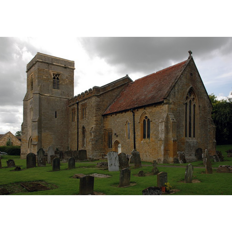
Image copyright © Philip Halling, 2007
CC-BY-SA-2.0
Results: 2 records
view of church exterior - southeast view
Copyright Statement: Image copyright © Philip Halling, 2007
Image Source: digital photograph taken 28 July 2007 by Philip Halling [www.geograph.org.uk/photo/508143] [accessed 13 January 2015]
Copyright Instructions: CC-BY-SA-2.0
view of church interior - nave - looking east
![the modern font and cover in the foreground, right [south] side](/static-50478a99ec6f36a15d6234548c59f63da52304e5/compressed/1150202057_compressed.png)
Scene Description: the modern font and cover in the foreground, right [south] side
Copyright Statement: Image copyright © Philip Halling, 2007
Image Source: digital photograph taken 28 July 2007 by Philip Halling [www.geograph.org.uk/photo/512216] [accessed 13 January 2015]
Copyright Instructions: CC-BY-SA-2.0
INFORMATION
Font ID: 13566SUT
Object Type: Baptismal Font1?
Font Century and Period/Style: 12th century, Norman
Church / Chapel Name: Parish Church of St. Thomas a Becket
Church Patron Saint(s): St. Thomas of Canterbury [aka St. Thomas à Becket]
Church Address: Sutton-under-Brailes, Warwickshire, OX15 5BH
Site Location: Warwickshire, West Midlands, England, United Kingdom
Directions to Site: Located off (E) the A3400, 7 km ESE of Shipston-on-Stour, NE of Cherington
Ecclesiastic Region: Diocese of Coventry
Historical Region: Hundred of Deerhurst [in Domesday] -- Hundred of Kington
Additional Comments: disappeared font? (the one from the 12thC church here)
Font Notes:
Click to view
There is an entry for Sutton[-under-Brailes] [variant spelling] in the Domesday survey [http://domesdaymap.co.uk/place/SP3036/sutton-under-brailes/] [accessed 13 January 2015], but it mentions neither cleric nor church in it. The Victoria County History (Warwick, vol. 5, 1949) notes: "The nave dates from the 12th century, but the only remaining architectural feature is the north doorway, which was re-discovered and opened out in the 19th century […] The font and other furniture are modern" [NB: we have no information on the earlier font of the original church here]
COORDINATES
UTM: 30U 598368 5765843
Latitude & Longitude (Decimal): 52.034477, -1.565987
Latitude & Longitude (DMS): 52° 2′ 4.12″ N, 1° 33′ 57.55″ W
REFERENCES
- Victoria County History [online], University of London, 1993-. URL: https://www.british-history.ac.uk.